


Disclosure: This article contains affiliate links. We may earn a commission from purchases at no extra cost to you, which helps our travel content.
As a researcher accustomed to analyzing ecological transition zones, few places have captivated my scientific curiosity quite like Alamogordo, New Mexico. Here, within a mere 30-mile radius, one can traverse from the pine-scented heights of the Sacramento Mountains to the otherworldly expanse of White Sands National Park—a remarkable compression of ecosystems that would typically span hundreds of miles. During my week-long solo expedition this spring, I documented this dramatic ecological gradient while finding unexpected moments of tranquility and intellectual stimulation in what many travelers overlook as merely a gateway to more prominent destinations.

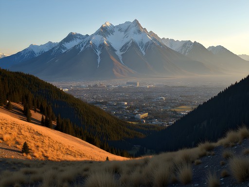
The Sacramento Mountains: Alpine Respite in the Desert State
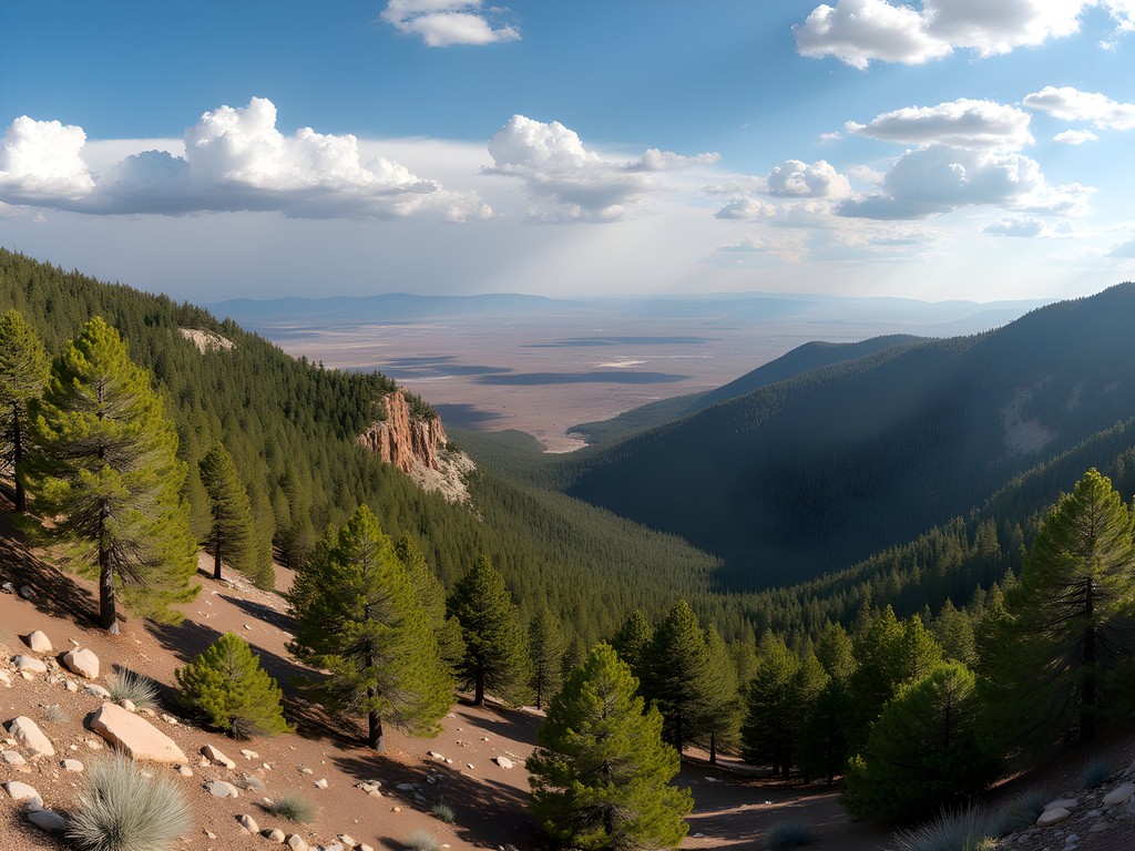
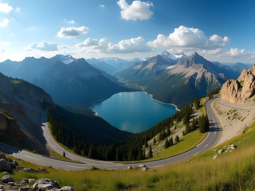
My exploration began in the Sacramento Mountains, where the Lincoln National Forest provides a startling counterpoint to New Mexico's desert reputation. Ascending the winding roads from Alamogordo toward Cloudcroft, I watched my vehicle's thermometer drop nearly 20°F in just 16 miles—a microcosm of what would normally be a multi-state climate transition.
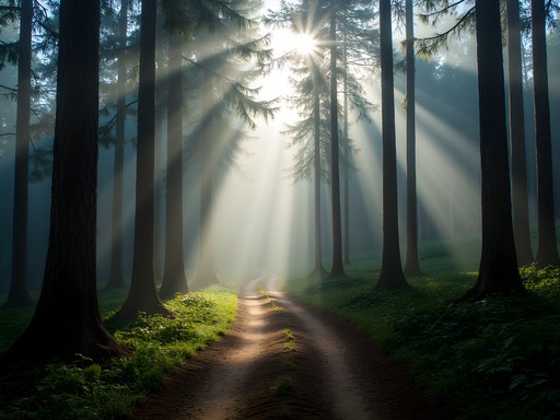
The Mexican spotted owl habitat in these mountains presents a fascinating case study in adaptive ecology. During my three-day backpacking circuit on the Rim Trail, I documented five distinct vegetation zones, each hosting specialized flora adapted to the specific altitude and aspect. For this trek, my trekking poles proved invaluable on the occasionally steep terrain, particularly when navigating the ridge lines where winds can be surprisingly forceful.
At Bluff Springs, I spent an afternoon recording the remarkable diversity of butterfly species—a bioindicator of ecological health that my colleagues at the university would appreciate. The juxtaposition of these delicate creatures against the rugged mountain backdrop provided both scientific data and meditative moments.
💡 Pro Tips
- Start hikes early (before 9am) to avoid afternoon thunderstorms common in spring
- The Rim Trail offers the best ecological diversity but requires intermediate hiking experience
- Cell service is spotty; download offline maps before ascending
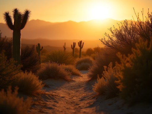
White Sands: Navigating the Gypsum Desert Laboratory
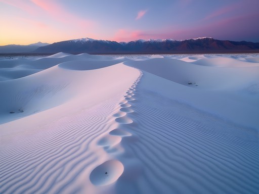
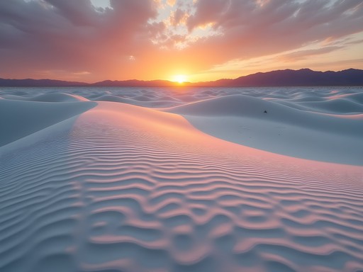
The intellectual centerpiece of my Alamogordo expedition was undoubtedly White Sands National Park—260 square miles of gypsum crystal dunes that constitute the world's largest gypsum dunefield. As a researcher, I approached this landscape with both academic rigor and childlike wonder.
I dedicated two full days to exploring the dune field, with particular attention to the interdunal areas where specialized plant adaptations reveal evolutionary mechanisms worthy of doctoral study. The GPS unit I brought proved essential, as the uniform appearance of the dunes can quickly disorient even experienced navigators. The park's backcountry camping permits (only $3 when I visited) allowed me to document the remarkable temperature fluctuations between day and night.
While the park's established Alkali Flat Trail provides a structured 5-mile loop, I found the most compelling research opportunities in the backcountry areas, where fewer footprints disturb the natural patterns of sand ripples and wildlife tracks. The selenite crystal formations I discovered while hiking off-trail would make excellent specimens for my department's geological collection, though of course I photographed rather than collected them, adhering to Leave No Trace principles.

💡 Pro Tips
- Bring at least 1 gallon of water per person per day—the reflective surface creates extreme dehydration risk
- Use the backcountry markers rather than visual landmarks for navigation
- Visit at sunrise for the most dramatic photography opportunities when the dunes cast long shadows
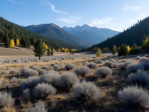
The Transitional Zone: Tularosa Basin's Ecological Gradient
Perhaps the most intellectually stimulating aspect of the Alamogordo region is the transitional zone between mountains and dunes. The Tularosa Basin represents what ecologists call an 'ecotone'—a boundary between distinct ecosystems that often harbors unique biological diversity.
I spent a day at Three Rivers Petroglyph Site, where over 21,000 ancient rock carvings document how previous cultures navigated this transitional landscape. The binoculars I carried allowed me to spot several desert bighorn sheep navigating the rocky terrain—descendants of populations that have adapted to this marginal habitat for millennia.
At Oliver Lee Memorial State Park, I hiked the Dog Canyon Trail, which ascends from desert scrub to pine forest in just 5.5 miles. This compressed ecological gradient offers what I consider the perfect transect for studying adaptational biology. I collected soil samples at 500-foot elevation intervals (with proper permits) to analyze microbial diversity changes—a small side project that complements my primary research.
The field notebook I used throughout the trip proved particularly valuable in this zone, as afternoon rain showers are common in spring but didn't compromise my detailed field notes.

💡 Pro Tips
- The Dog Canyon Trail gains 3,000 feet in elevation—start early and pace yourself
- Bring a camera with a macro lens to document the small transitional zone plant adaptations
- Visit Oliver Lee Memorial State Park visitor center first to understand the geological history of the basin

Solo Travel Logistics: Working Remotely from Alamogordo
As a postdoctoral researcher with flexible work arrangements, I structured my week in Alamogordo to balance field exploration with academic obligations. The town itself, while modest, offers sufficient infrastructure for the digitally-tethered explorer.
I established a productive work routine at Plateau Espresso, where the noise-cancelling headphones I packed created a focused environment for analyzing field data and maintaining correspondence with colleagues. The café's stable Wi-Fi and understanding of the remote worker's needs (ample power outlets and tolerance for three-hour table occupancy) made it my morning base camp before afternoon explorations.
For accommodations, I opted for a small Airbnb with a kitchenette rather than the standard hotel options along White Sands Boulevard. This choice provided both economic efficiency and the space to lay out specimens and notes each evening. The host, a retired geologist, offered invaluable local knowledge about lesser-known geological formations worth investigating.
Renting a vehicle with high clearance proved essential for accessing more remote research sites. While the main attractions are accessible via standard vehicles, my academic curiosity led me to several Forest Service roads where my portable jump starter provided peace of mind in areas with limited cell service.

💡 Pro Tips
- Alamogordo Public Library offers free Wi-Fi and quiet workspace if you need a change of environment from cafés
- The Farmers Market (Saturday mornings) is the best place to stock up on local provisions
- Book accommodations well in advance if visiting during rocket launches at White Sands Missile Range—these events fill the limited lodging options
Final Thoughts
As my week in Alamogordo concluded, I found myself intellectually invigorated by this landscape of extremes. The region represents what I've come to appreciate as a perfect natural laboratory—a compressed transect of ecological zones that would typically require much more extensive travel to experience. For the solo traveler with scientific curiosity, few destinations offer such rich research potential within such a manageable geographic scope.
What began as a straightforward field excursion evolved into a multifaceted investigation of adaptation and resilience—both natural and human. The juxtaposition of ancient petroglyphs against modern missile range technology, of alpine forests against gypsum dunes, creates a temporal and spatial compression that challenges our conventional understanding of landscapes.
I encourage fellow academic travelers to approach Alamogordo not merely as a waypoint between more prominent destinations, but as a worthy research site in its own right. Bring your field notebooks, your curiosity, and your willingness to traverse multiple ecosystems in a single day. The ecological stories unfolding in this transitional zone deserve our scholarly attention—and might just provide the perfect backdrop for your next research breakthrough.
✨ Key Takeaways
- Alamogordo offers an exceptional compressed ecological gradient from alpine to desert environments within a 30-mile radius
- The region is ideal for solo academic travelers who can balance research with exploration
- Spring provides optimal conditions for observing ecological transitions with moderate temperatures and occasional wildflower blooms
- Local infrastructure supports remote work needs despite the town's modest size
📋 Practical Information
Best Time to Visit
March-May (spring)
Budget Estimate
$600-800 for a week (excluding travel to Alamogordo)
Recommended Duration
5-7 days
Difficulty Level
Intermediate

Comments
Sage Dixon
Landon, this really resonates with my experience there! The ecological transition you describe is fascinating - I remember driving up to Cloudcroft and feeling like I'd entered a completely different world. One thing I'd add for anyone planning a visit: the Sunspot Solar Observatory up in the mountains is absolutely worth the detour. It's about 18 miles south of Cloudcroft and the views on the drive are spectacular. The observatory itself has some great exhibits, and standing at 9,200 feet looking out over the Tularosa Basin below really drives home those landscape contrasts you're talking about. Also, if you're working remotely from the area, the coffee shop in Cloudcroft (Mad Jack's) has surprisingly solid wifi and the best green chile I had in the region.
luckybackpacker
oh man wish I'd known about that observatory! adding it to my list for next time
luckybackpacker
YES! White Sands is absolutely mind-blowing. I went last spring and couldn't believe how different it was from anything else I'd seen. The temperature difference between the mountains and the dunes was crazy - we did both in one day and I had to change clothes like three times lol. Did you get to sled down the dunes? That was honestly the most fun I've had in ages. Also the sunset there is unreal, stayed way longer than planned just watching the colors change.
Sage Dixon
The sledding! Yes! I brought a cheap plastic saucer from a hardware store in town and it worked perfectly. The gypsum is so slippery compared to regular sand.
luckybackpacker
exactly! we bought ours at walmart in alamogordo for like $8 and it was totally worth it
Megan Martin
Landon, what camera setup did you use for those stunning White Sands shots? The way you captured both the texture of the sand and the mountain backdrop is impressive. I've tried photographing white sand beaches before and always struggle with the exposure balance. Any specific tips for photography in such high-contrast environments?
adventureninja
Not Landon, but I found polarizing filters really helpful at White Sands! Cuts the glare and brings out those ripple patterns in the dunes.
wavelegend
Just booked my trip for March! So excited after reading this.
skyvibes
Just got back from Alamogordo and can confirm everything in this post! The contrast between the cool pine forests and the blazing white dunes is mind-blowing. Pro tip: hike the Alkali Flat Trail at White Sands early morning - it's a challenging 5-mile loop but gives you the full desert experience. And don't miss the Mexican food in town - Rizo's Restaurant was our favorite local spot. The green chile enchiladas are life-changing!
mountaintime2256
Thanks for the restaurant tip! Adding it to my list.
travelmood
If you're heading to White Sands, try to time your visit during a full moon - they do special night tours and it's MAGICAL! The gypsum glows in the moonlight. Just book way ahead because they fill up fast. Also, don't miss the pistachio farms around Alamogordo. We bought some fresh ones that were incredible!
islandguide
The full moon tours sound amazing! Adding that to my bucket list.
Timothy Jenkins
Landon, your scientific perspective on these transitional zones adds a fascinating dimension to what might otherwise be just another landscape post. I visited the Sacramento Mountains last autumn and was struck by how quickly the ecosystem changes as you ascend. The Mexican spotted owl habitat you mentioned was a highlight for me as well - though I wasn't fortunate enough to spot one! For anyone planning a visit, I'd recommend the Osha Trail near Cloudcroft for a relatively easy hike that showcases these ecological transitions beautifully. The temperature difference between Alamogordo and the mountains caught me off guard - pack layers!
freeguy
Great post! I'm curious about the remote work setup you mentioned. How was the internet connectivity in Alamogordo? I've been thinking about doing something similar but always worry about staying connected for video calls.
Megan Martin
Not the author, but I worked remotely from Alamogordo for two weeks last year. The connectivity in town was surprisingly good! I used my portable hotspot as backup but rarely needed it. Most cafes had decent WiFi too.
adventureninja
I visited White Sands last year and was completely blown away! The contrast between the mountains and the dunes is even more dramatic in person. We rented sleds from the visitor center and spent hours sliding down the dunes - totally worth it even as adults! Did you get a chance to stay for sunset? The way the light hits the gypsum is absolutely magical. Definitely one of the most unique landscapes I've experienced in all my travels.
wavelegend
Did you need special shoes for walking on the sand? Planning to go next spring!
adventureninja
Regular hiking shoes were fine! The sand is surprisingly firm in most places. Just bring lots of water and sunscreen - it gets super bright with all that white reflecting the sun!
islandguide
Those white sands photos are incredible! Looks like another planet.
Venture X
Premium card with 2X miles, $300 travel credit, Priority Pass