

Disclosure: This article contains affiliate links. We may earn a commission from purchases at no extra cost to you, which helps our travel content.
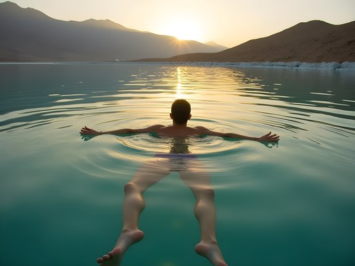
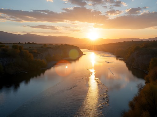
The juxtaposition couldn't be more striking—standing 1,300 feet below sea level while gazing up at mountains that have witnessed millennia of human civilization. Having presided over international cases for decades, I find a different kind of judgment called for here: how to reconcile the harsh, almost lunar landscape of the Dead Sea Basin with its surprising ecological resilience and historical significance. This winter marks my third expedition to these trails, where biblical narratives and geological marvels converge in what I've come to regard as one of Earth's most compelling courtrooms of natural history.

The Legal Brief: Understanding the Geological Jurisdiction
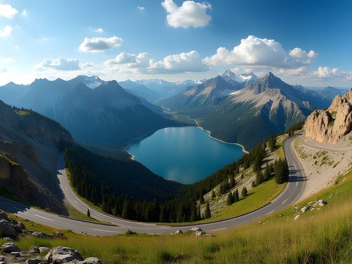
As someone who has spent decades examining evidence in trade disputes, I approach these mountains with the same analytical mindset. The Dead Sea Basin isn't merely a tourist destination—it's a living testament to tectonic forces that created the deepest continental depression on Earth.
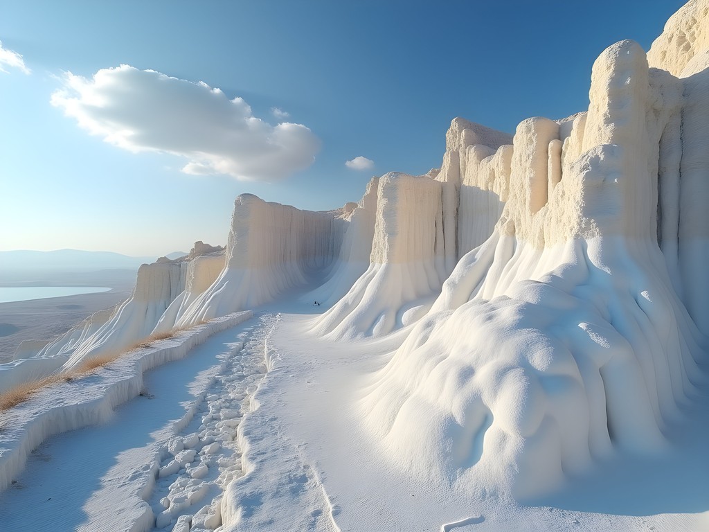
This remarkable landscape sits along the Dead Sea Transform fault system, where the Arabian and African plates have been grinding past each other for millions of years. The evidence is compelling: dramatic escarpments rising over 1,200 meters from the valley floor, salt formations that resemble exhibits in Earth's geological museum, and the hypersaline waters of the Dead Sea itself—a body so dense with minerals that swimming becomes floating.
Winter hiking here presents a particular advantage: temperatures hover between 15-24°C (59-75°F), compared to the sweltering 40°C+ (104°F+) summer heat that would constitute cruel and unusual punishment for any hiker. The clarity of winter air also provides superior visibility for photography and geological observation.
💡 Pro Tips
- Pack microspikes for unexpected icy patches on higher elevations
- Carry at least 3 liters of water per person per day despite cooler temperatures
- Download offline geological maps to identify formations along the trails
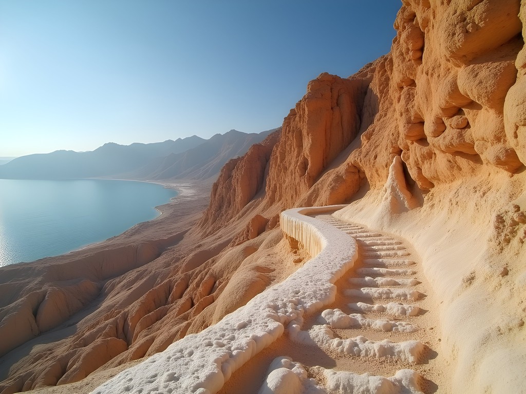
The Mount Sodom Circuit: Walking Through Biblical Precedent
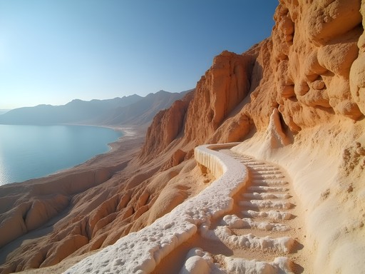
Mount Sodom presents perhaps the most compelling case study in the region's geological jurisprudence. Composed almost entirely of salt (98%), this 3km-long mountain rises 230 meters above the Dead Sea's southwestern shore. The biblical associations with Lot's wife turned to salt add cultural weight to what is already a remarkable natural phenomenon.
The 5km circuit around Mount Sodom requires advanced hiking experience, particularly in winter when flash floods can transform dry wadis into raging torrents with little warning. I've found the eastern face particularly striking at sunrise, when first light illuminates the salt crystals into a shimmering display that no photograph can fully capture.
During my last winter expedition, I navigated the narrow passages between salt pillars with my trekking poles, which proved invaluable on the unstable salt-crystal terrain. The trail requires careful attention to markers, as salt erosion frequently alters the landscape, making previous paths obsolete—not unlike how precedent evolves in legal systems.
💡 Pro Tips
- Start the Mount Sodom circuit before 8 AM to capture the best morning light on salt formations
- Wear closed, ankle-supporting footwear with good grip as salt surfaces can be unexpectedly slippery
- Bring polarizing lens filters for photography to cut glare from salt crystals
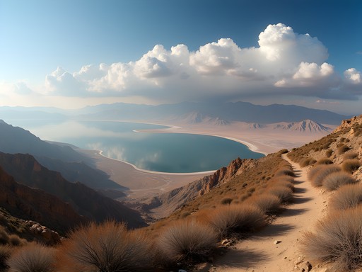
Ein Gedi to Masada: The Ancient Highway
The 15km trail connecting the Ein Gedi Nature Reserve to the fortress of Masada represents what I've come to call 'the ancient highway'—a path that has witnessed the passage of everyone from King David to Roman legions. This advanced route demands proper preparation, especially in winter when daylight hours are limited.
The trail begins in the lush oasis of Ein Gedi, where freshwater springs support remarkable biodiversity in stark contrast to the surrounding desert. The ascent from Ein Gedi follows wadis that can transform dramatically after rainfall. During my December hike last year, I witnessed desert wildflowers emerging from seemingly barren ground—a testament to nature's resilience that reminded me of how communities adapt to challenging circumstances, a parallel to cases I've adjudicated involving resource-stressed regions.
As the path climbs toward Masada, hikers are rewarded with panoramic views of the Dead Sea and Jordan's mountains beyond. I've found my satellite messenger essential on this remote stretch where cell coverage is nonexistent. The device's ability to send emergency messages via satellite provides security without compromising the wilderness experience.
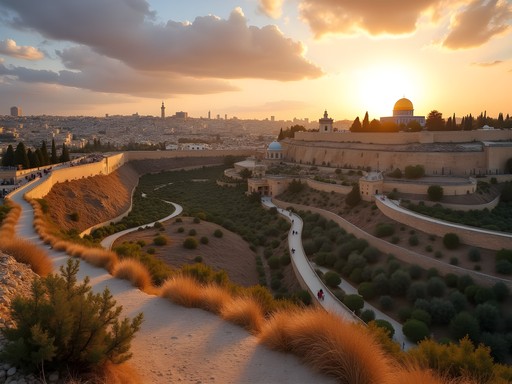
The final approach to Masada, with its stark silhouette against the desert sky, never fails to evoke reflection on the human will to survive against overwhelming odds—a narrative that resonates across civilizations and centuries.

💡 Pro Tips
- Register your hiking plan with Israel Nature and Parks Authority before attempting this trail
- Carry a minimum of 5 liters of water per person for this full-day hike
- Start no later than 7 AM to ensure completion before sunset, especially in winter months

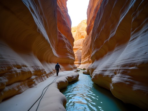
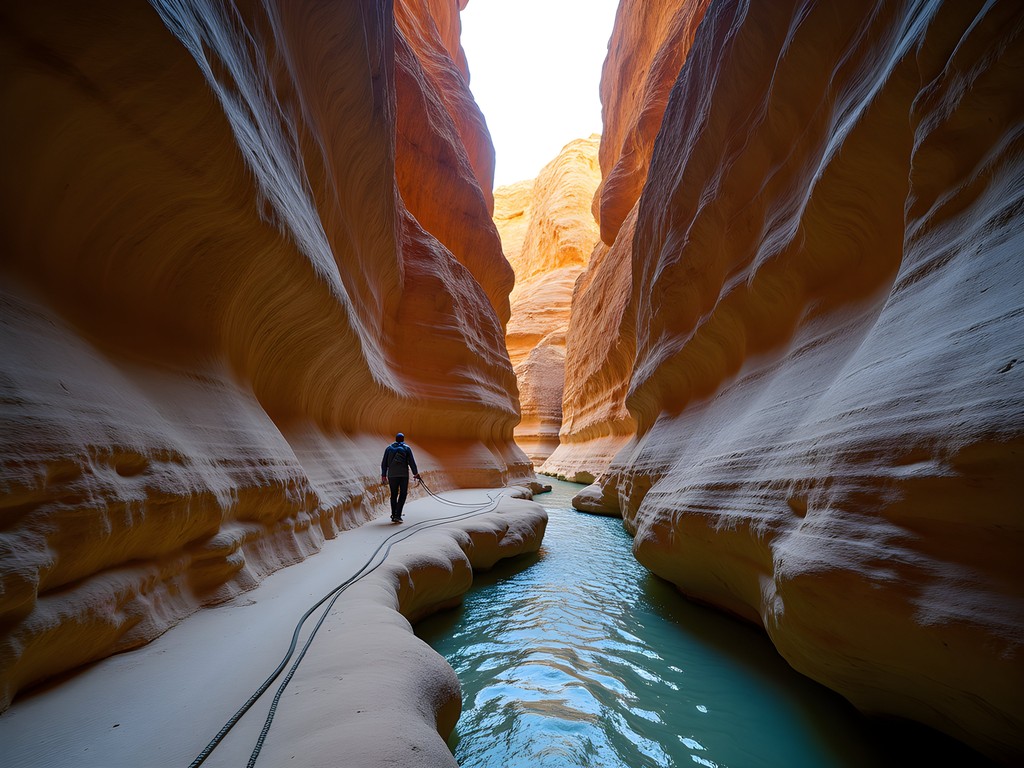
The Darga Canyon: A Test of Physical Jurisprudence
If the Dead Sea region were to present a supreme test of a hiker's abilities, Darga Canyon would be that challenge. This deep limestone gorge cuts through the Judean Desert, creating one of the most technically demanding hikes in Israel—a case where physical laws supersede all others.
The 10km route requires scrambling, navigating narrow passages, and occasional rappelling down waterfalls (particularly after winter rains). Having grown up in San Antonio's semi-arid environment, I've always been fascinated by desert water systems, but nothing prepared me for the dramatic flash flood I witnessed here two winters ago. Within minutes, the dry canyon transformed into a roaring torrent—a visceral reminder of nature's power and unpredictability.
For this challenging route, I rely on my dry bag to keep essential documents and electronics protected during water crossings. The bag has proven its worth multiple times, particularly when negotiating the deep pools that form in the canyon's lower sections during winter.
For navigation, I've found the hiking GPS invaluable, as canyon walls can limit both visibility and satellite phone reception. The ability to mark waypoints at critical junctions has helped me maintain orientation in this complex terrain.
💡 Pro Tips
- Never attempt Darga Canyon if there's any rain forecast in the region, even if it's sunny at your location
- Bring 15 meters of auxiliary rope for assistance on steep sections
- Consider hiring a local guide for first-time attempts, as some sections are not clearly marked
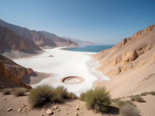
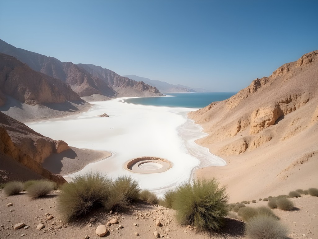
Desert Conservation: The Environmental Verdict
As both a legal professional and environmental advocate, I find the conservation challenges facing the Dead Sea Basin particularly compelling. The sea itself is receding at an alarming rate—over one meter per year—due to water diversion from the Jordan River and mineral extraction operations.
Hiking these trails provides firsthand evidence of this environmental case: newly exposed shorelines, abandoned docks now hundreds of meters from water, and expanding sinkholes that have swallowed sections of roads and buildings. Yet winter brings a temporary reprieve, with seasonal rains feeding ephemeral streams that briefly restore flow to parched wadis.
During my explorations, I've been impressed by Israel's water management technologies being implemented in the region. This portable system, which I now carry on all desert hikes, allows filtration of brackish water sources when necessary—a small-scale version of the massive desalination projects attempting to address the region's water crisis.
The juxtaposition of ancient sustainable practices and modern technological solutions creates a fascinating study in human adaptation. From Nabatean water-harvesting techniques still visible in the landscape to modern drip irrigation systems, the region demonstrates how civilizations past and present have confronted similar resource challenges—a theme that has guided my post-judicial career and writing.
💡 Pro Tips
- Support conservation by staying on marked trails to prevent erosion in fragile desert ecosystems
- Consider volunteering with Dead Sea conservation groups that organize cleanup hikes
- Learn about traditional water harvesting techniques that have sustained desert communities for millennia
Final Thoughts
As I complete my week of winter hiking in this remarkable basin—Earth's lowest terrestrial courtroom—I'm struck by how the legal principles that guided my career find echoes in these ancient landscapes. The mountains surrounding the Dead Sea present their evidence in layers of rock and salt, testifying to forces that have shaped this land since long before human civilization emerged to interpret them. The verdict? This harsh yet magnificent terrain demands our respect, preparation, and conservation efforts if future generations are to experience its power.
For those considering their own expedition to these trails, I urge thorough preparation, respect for local regulations, and a willingness to see beyond the tourist veneer to the complex ecological and historical narratives beneath. Whether you're drawn by biblical connections, geological wonders, or simply the challenge of hiking in one of Earth's most dramatic landscapes, the Dead Sea Basin will render its judgment on your preparedness—and reward the diligent with experiences beyond measure. The gavel falls, but the case of this remarkable region remains perpetually open for further discovery.
✨ Key Takeaways
- Winter offers ideal hiking conditions with moderate temperatures and clearer visibility
- Advanced preparation is essential for the technical challenges and remote nature of these trails
- The region provides unique insights into both geological processes and human history spanning millennia
📋 Practical Information
Best Time to Visit
November through March
Budget Estimate
$600-800 per person for a week (excluding flights)
Recommended Duration
5-7 days
Difficulty Level
Challenging


Comments
oceanbackpacker
Did you do these trails solo or with a guide? Trying to figure out logistics.
Samantha Spencer
I did most solo as they're well-marked, but hired a guide for Darga Canyon which I'd definitely recommend for that one. The navigation is trickier and having local knowledge about weather patterns is crucial.
Timothy Jenkins
The Darga Canyon section particularly resonates with me. I attempted it two years ago and had to turn back due to flash flood warnings - the wadis in this region can transform from bone-dry to torrential in minutes during the rainy season. Always check weather forecasts and local conditions. The geological formations are spectacular though, and the sense of walking through deep time is palpable. Your legal metaphors throughout the piece are quite clever, by the way. The landscape does feel like evidence being presented.
coolace8493
Going there next spring, can't wait!
beachrider
This would be my first desert hike - is it doable for beginners or should I work up to it? Looks amazing but also kind of intimidating!
Timothy Jenkins
I'd recommend starting with some of the shorter trails around Ein Gedi nature reserve first. They're well-marked, have facilities, and will give you a sense of the environment without the commitment of the longer routes. The Dead Sea region is unforgiving if you're unprepared, but absolutely accessible with proper planning.
coollife
Love the photos!
Adam Nichols
Excellent write-up, Samantha. I did the Ein Gedi to Masada hike last spring and the historical context really does add another dimension to the experience. One thing I'd emphasize for readers is the water situation - I went through 5 liters on that trail and wished I'd brought more. The combination of altitude differential and desert heat is deceptive. Also, starting at dawn isn't just romantic advice, it's genuinely necessary for safety. The temperature difference between 6am and 10am is dramatic.
oceanbackpacker
5 liters! Good to know. Did you carry it all or are there refill points?
Adam Nichols
Carried it all. There are no reliable water sources on the trail itself. Ein Gedi has facilities at the start but once you're on the ancient path, you're on your own.
globeperson
How difficult would you say the Mount Sodom circuit is? I'm in decent shape but not like super fit or anything. Also curious about the best time of year to go?
Samantha Spencer
It's moderate difficulty - the elevation changes aren't too extreme but the heat is the real challenge. I went in winter (December-February) which is absolutely the best time. Summer would be brutal and potentially dangerous. Bring way more water than you think you need!
globeperson
Thanks! Winter it is then.
tripfan
This looks absolutely incredible!! Adding to my bucket list right now!
backpackvibes
Going there in March!! So pumped. Quick tip for anyone planning this - start EARLY like 5am early. We made the mistake of starting at 8am and it got brutal by noon. Also the Darga Canyon section is no joke, definitely not for beginners. But totally worth it for the views!
sunsetace
that third photo is stunning
Venture X
Premium card with 2X miles, $300 travel credit, Priority Pass