


Disclosure: This article contains affiliate links. We may earn a commission from purchases at no extra cost to you, which helps our travel content.
The first time my boots hit the rust-colored soil of Gran Canaria, I felt an immediate connection to this island of contrasts. As the warm spring breeze carried distant notes of folk music from a village below, I knew this volcanic paradise would speak to both my Korean heritage's love of mountains and my American upbringing's thirst for exploration. This miniature continent packs an astonishing diversity of landscapes into just 600 square miles – from misty laurel forests to Mars-like calderas, each trail offering its own unique soundtrack of nature. Solo hikers, prepare your playlists and lace up your boots – we're about to explore five trails that showcase the dramatic soul of Gran Canaria's peaks.

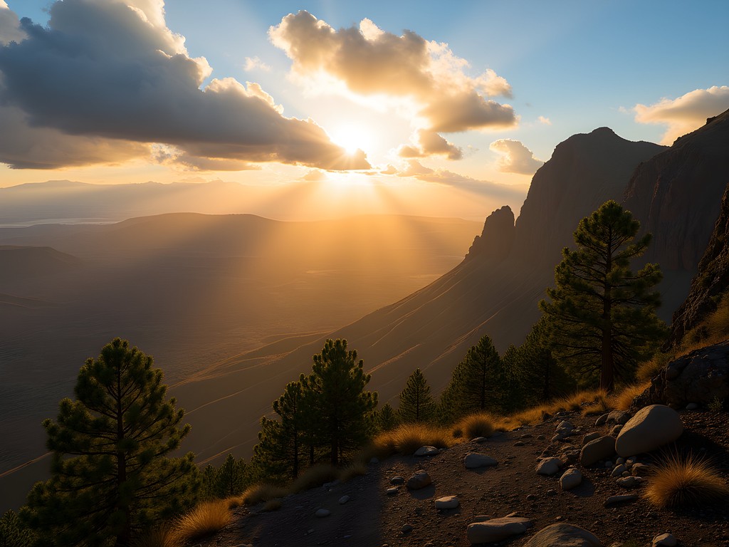
Roque Nublo: Hiking to Gran Canaria's Iconic Rock
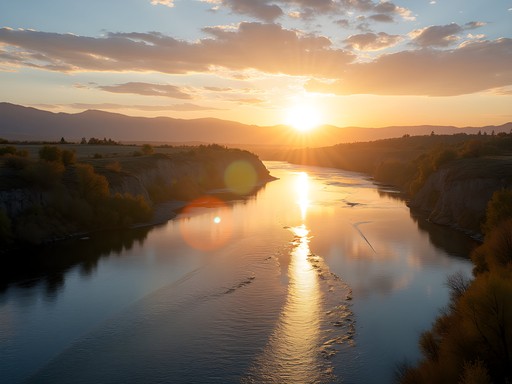
Standing at 80 meters tall against an endless blue sky, Roque Nublo is Gran Canaria's natural monument and spiritual epicenter. The 3.5km roundtrip trail begins at La Goleta car park, winding through fragrant pine forests before emerging onto an otherworldly plateau scattered with volcanic formations.
I arrived at sunrise, when the first light painted the monolith in warm amber tones. The silence was profound – just the whisper of wind through pine needles creating a gentle white noise backdrop. As I set up my portable recording device to capture this natural soundscape, a local shepherd passed with his flock, bells tinkling melodically against the vastness.
What makes this hike special isn't just the imposing rock formation but the 360° panorama from the plateau. On clear days, you can see Teide volcano on neighboring Tenerife rising above the clouds – a sight that literally took my breath away. The trail's gradual ascent makes it accessible for most fitness levels, though the final section requires some light scrambling over volcanic rocks.
💡 Pro Tips
- Start early (before 9am) to avoid crowds and catch the best light for photos
- Bring at least 1.5 liters of water – the exposed sections can be surprisingly hot even in spring
- Pack a windbreaker for the summit area where gusts can be strong
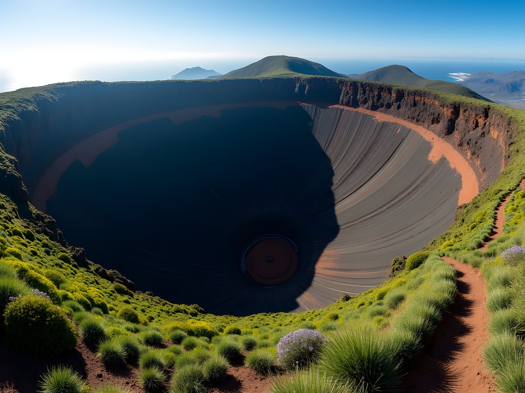
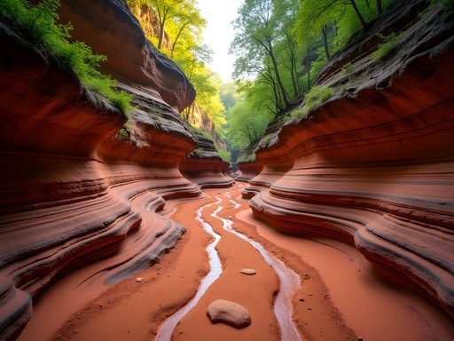
Caldera de Bandama: A Volcanic Symphony
Just 15 minutes from Las Palmas lies one of the island's most accessible natural wonders – the perfectly preserved Caldera de Bandama. This circular volcanic crater measures 1,000 meters in diameter and plunges 200 meters deep, offering a hike that's equal parts geological marvel and botanical treasure hunt.
The trail spirals down into the crater along a narrow path that seems to play with acoustics – each footstep echoes slightly, creating what locals call 'the whispers of the volcano.' I found myself constantly pausing to record these subtle sound variations with my clip-on microphone that connects directly to my phone – perfect for capturing environmental audio without carrying bulky equipment.
What fascinated me most was the microclimate within the caldera – noticeably cooler and more humid than the rim. Endemic plants that exist nowhere else thrive here, creating a lush oasis within this volcanic bowl. The descent takes about 30 minutes, with the complete loop requiring 2-3 hours depending on how often you stop to admire the unique flora or capture the perfect shot of the dramatic caldera walls.
💡 Pro Tips
- Wear proper hiking shoes with good grip – the descent can be slippery
- Visit in late February or March when wildflowers carpet the caldera floor
- Pack a headlamp if hiking late afternoon – the crater gets dark before the surrounding areas
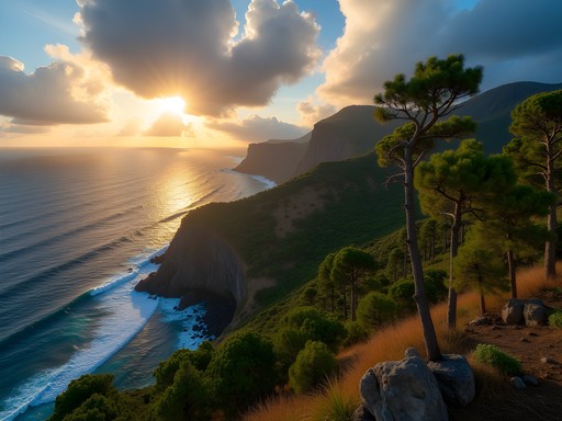
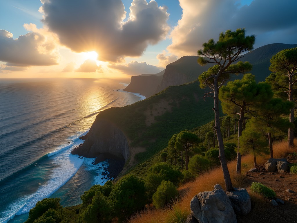
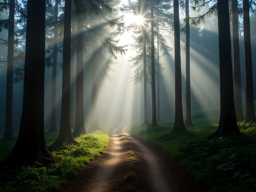
Tamadaba Natural Park: Ancient Pine Forests and Ocean Views
The northwestern corner of Gran Canaria houses my favorite hiking area on the entire island – Tamadaba Natural Park. This pristine pine forest clings to dramatic cliffs that plunge directly into the Atlantic Ocean, creating a landscape that feels more Pacific Northwest than Canary Islands.
I spent two full days exploring the network of trails here, basing myself at the simple but charming mountain refuge that kept me cozy in the surprisingly cool mountain nights. The signature hike connects the viewpoints of Mirador del Balcón and Mirador de la Paloma, a moderate 7km route that weaves through Canarian pine forests whose needles create a natural carpet that muffles footsteps into whispers.
What makes Tamadaba truly special is its soundscape – the constant interplay between ocean waves crashing 600 meters below and wind singing through pine boughs above creates what I can only describe as nature's perfect stereo mix. As a music producer, I found myself constantly stopping to close my eyes and just listen, the natural reverb of the landscape transforming ordinary sounds into something magical.
The park's isolation means you'll encounter few other hikers, especially if you visit midweek. I spent an entire afternoon perched on a cliff edge watching ravens perform aerial acrobatics against the backdrop of Tenerife's silhouette, not seeing another soul for hours – pure mountain magic for the solo traveler.
💡 Pro Tips
- Fill up water bottles at the park entrance – there are no reliable water sources on the trails
- Download offline maps as cell service is spotty throughout the park
- Pack layers – the temperature difference between sunny and shaded sections can be 10°C

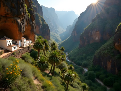
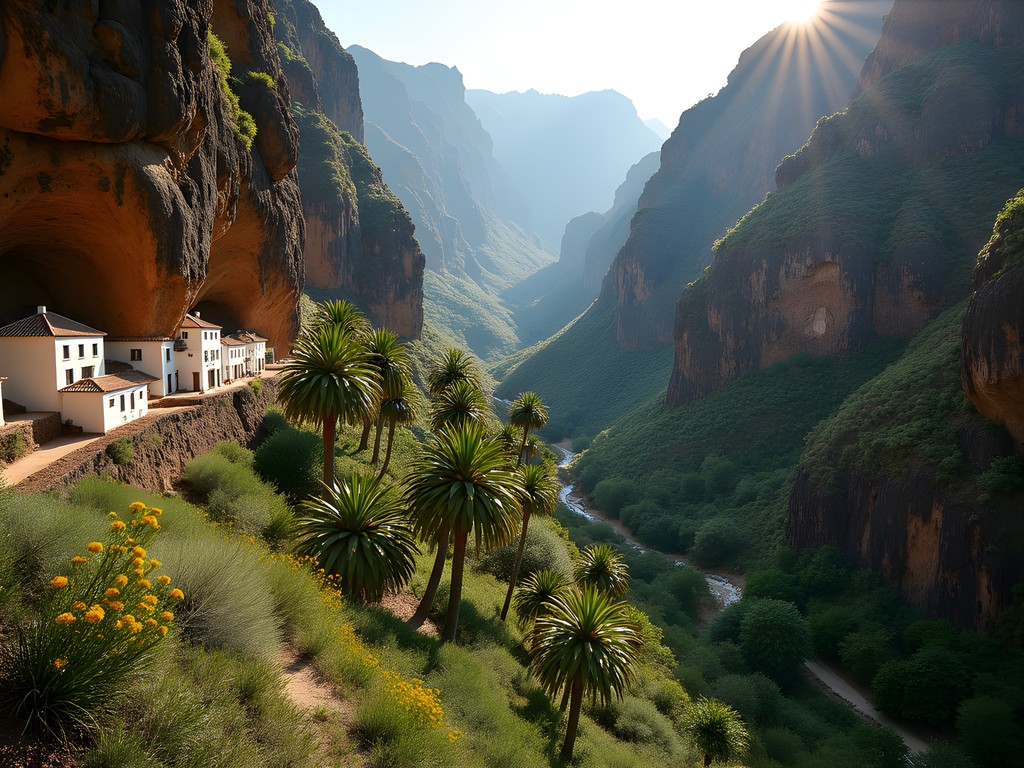
Barranco de Guayadeque: Canyon Hiking with Cave Dwellings
Some landscapes tell stories more clearly than others. Barranco de Guayadeque, a lush ravine cutting through Gran Canaria's eastern mountains, speaks volumes about the island's indigenous history. This verdant canyon was home to the native Guanches, whose cave dwellings are still visible – and in some cases still inhabited – throughout the steep walls.
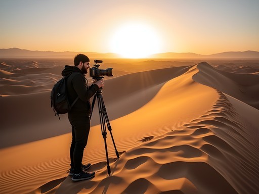
The 8km trail follows an ancient path used by the Guanches, starting near the village of Agüimes and gradually climbing deeper into the canyon. What struck me immediately was the acoustic quality of the ravine – it naturally amplifies sounds, carrying birdsong and distant conversations with surprising clarity. I captured these unique acoustics using my wind protection system which was essential for clean recordings in this breezy corridor.
Midway through the hike, I discovered what became my favorite lunch spot on the island – Tagoror Cave Restaurant, where traditional Canarian dishes are served inside an actual cave dwelling. Their vegetable sancocho (a local stew) perfectly fueled the remainder of my hike while giving me a literal taste of history.
The upper sections of the canyon reveal surprising biodiversity, with over 80 endemic plant species creating a microclimate that feels almost tropical compared to the arid surroundings. Keep an eye out for the bright blue Canarian lizards that dart between rocks – they're surprisingly photogenic if you're patient enough.
💡 Pro Tips
- Visit the small ethnographic museum at the canyon entrance to understand the historical context
- Bring a headlamp to explore some of the accessible cave entrances safely
- Reserve a table at Tagoror Cave Restaurant a day ahead if hiking on weekends
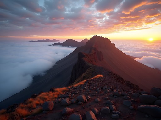
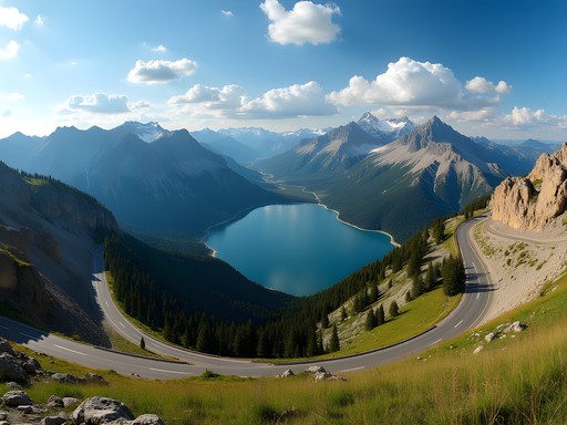
Pico de las Nieves: The Roof of Gran Canaria
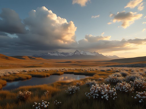
At 1,949 meters above sea level, Pico de las Nieves represents Gran Canaria's highest accessible point – a place where the island's diverse ecosystems converge into one breathtaking panorama. While you can drive quite close to the summit, the true experience comes from hiking the network of trails that radiate from this central peak.
I tackled the challenging 12km circular route that connects Pico de las Nieves with Roque Nublo, a trail that traverses several climate zones in a single day. Setting out before dawn with my rechargeable headlamp lighting the way, I witnessed a sunrise that transformed the surrounding peaks into islands floating in a sea of clouds – a phenomenon locals call 'mar de nubes' (sea of clouds).
The trail's elevation means you'll experience significant temperature swings throughout the day. My convertible hiking pants proved invaluable, starting as full-length protection against the morning chill and converting to shorts as the day warmed.
What makes this hike particularly special is the perspective it offers – on clear days, you can see not only the entirety of Gran Canaria but also neighboring Canary Islands floating on the horizon. The silence at the summit has a weight to it, broken only by the whistle of wind around ancient rock formations and the occasional call of a Kestrel riding thermals above.
Be prepared for some technical sections with loose scree and moderate scrambling, particularly on the northern face. The effort is rewarded with views that literally span an entire island – from the white dunes of Maspalomas to the green northern valleys in a single sweeping panorama.

💡 Pro Tips
- Start no later than 7am to maximize your chance of seeing the 'sea of clouds' effect
- Pack multiple layers – temperature can vary by 15°C from start to finish
- Bring trekking poles for the steep descent sections to save your knees
Final Thoughts
As I sit at Las Palmas airport, my hiking boots still dusted with Gran Canaria's distinctive red soil, I'm scrolling through recordings of wind whistling through Tamadaba pines and the distant echo of goat bells in Guayadeque Canyon. These sonic souvenirs capture what makes this island a paradise for mountain lovers – landscapes that engage all senses, not just sight. For solo travelers seeking connection with both nature and self, Gran Canaria's network of trails offers something rare: accessibility without sacrificing authenticity. Whether you're chasing the perfect sunrise above a sea of clouds or exploring ancient cave dwellings carved into canyon walls, these five trails showcase the island's remarkable diversity. Pack light, bring plenty of water, and prepare to discover a mountain playground where African, European, and uniquely Canarian elements blend into something magical. As they say in the local dialect, 'La montaña te llama' – the mountain calls you. When it does, make sure you answer with your boots already laced.
✨ Key Takeaways
- Gran Canaria offers exceptional hiking diversity within a small area – from volcanic craters to ancient forests
- Spring (March-May) provides the perfect balance of comfortable temperatures and blooming landscapes
- Solo hikers will find well-marked trails and safe conditions throughout the island's protected natural areas
- Early morning starts are essential for the best experiences, especially to witness the 'sea of clouds' phenomenon
- The island's unique acoustics and soundscapes add an extra dimension to the hiking experience
📋 Practical Information
Best Time to Visit
March to May (spring) for moderate temperatures and wildflowers
Budget Estimate
€450-600 for a week including accommodation, food, and transportation
Recommended Duration
5-7 days to explore all major hiking regions
Difficulty Level
Moderate – Most Trails Require Reasonable Fitness But Don't Demand Technical Skills

Comments
hikingperson
Going there in June!! So excited after reading this 🙌
Bryce Diaz
The Caldera de Bandama trail brought back memories! I did that hike solo on a misty morning and it felt like walking into another world. The descent into the crater is steeper than it looks from above - my legs were shaking by the time I reached the bottom. But standing there surrounded by those volcanic walls with the clouds rolling overhead... absolutely worth it. Pro tip: the trail can be slippery after rain, so check the weather. I learned that the hard way!
hikingperson
The misty morning vibes sound incredible! Adding this to my list
globemaster
We hiked Barranco de Guayadeque last winter and it was one of the highlights of our trip! Those cave dwellings are wild - some of them are still restaurants and homes. We had lunch in one of the cave restaurants and the food was incredible. The hike itself is pretty moderate but wear good shoes because it gets rocky. Also the views down the canyon are just epic.
moondiver
Your photos are stunning! Really captured the vibe
wanderlustbackpacker
Love the photos!
journeylover
Did you rent a car or is it possible to reach these trails with public transport? Planning a trip in May and trying to figure out logistics.
Bryce Diaz
Not Savannah, but I did these trails last year. You'll really want a car for most of them. The bus system is decent for getting to Las Palmas or the coast, but the mountain trails are much harder to access. Renting was affordable and gave me so much freedom to explore at my own pace.
Jean Wells
Your description of the volcanic landscapes resonates deeply. I spent three weeks solo hiking in Gran Canaria last autumn and found the geological diversity remarkable for such a compact island. The contrast between the green north and arid south creates distinct microclimates that reward slow, observant travel. One practical note: I found my trail map invaluable for finding lesser-known paths branching off these main routes. The offline maps worked perfectly in areas with spotty coverage. Also recommend staying in Tejeda village as a base - authentic, affordable, and centrally located for the interior trails.
Timothy Jenkins
Excellent write-up, Savannah! I visited Gran Canaria last autumn and was similarly blown away by the diversity of landscapes. The Tamadaba pine forests are absolutely spectacular - that combination of ancient trees and ocean vistas is truly unique. One tip I'd add: if you're doing Roque Nublo, try to time it for late afternoon. The golden hour light on those rock formations is absolutely magical for photography. The crowds thin out considerably after 4pm as well.
moondiver
Great tip about the timing! Definitely noting that down
freestar
How hard are these trails for someone who doesn't hike much? The Roque Nublo one looks incredible but I'm a total beginner!
hikingperson
Roque Nublo is actually pretty doable! It's steep in parts but not too long. Just take your time and bring water.
freestar
Thanks!! That makes me feel better about trying it
wandermood
This is amazing!! Adding to my bucket list right now 🏔️
Venture X
Premium card with 2X miles, $300 travel credit, Priority Pass