


Disclosure: This article contains affiliate links. We may earn a commission from purchases at no extra cost to you, which helps our travel content.
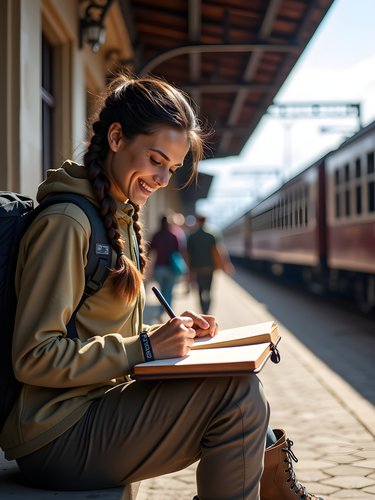
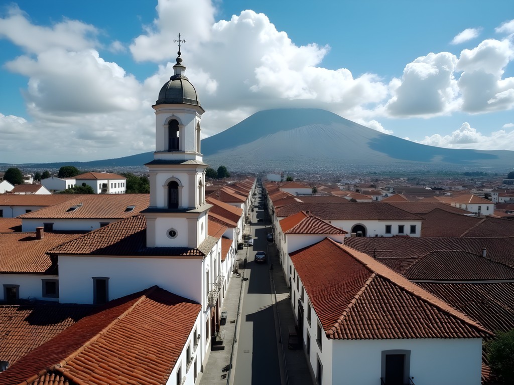
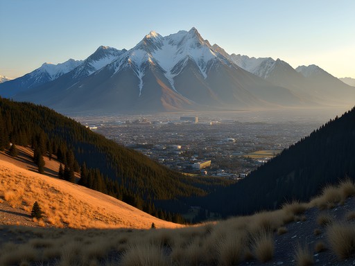
Standing at 9,350 feet in Quito's historic center, I felt the familiar thinness of plateau air filling my lungs—a sensation my body has grown accustomed to through years of high-elevation fieldwork. But Ecuador's capital was merely my gateway to the legendary Avenue of Volcanoes, a 200-mile stretch of the Andes containing eight of Ecuador's ten highest peaks. As an archaeologist specializing in plateau regions, I've long been fascinated by how these volcanic landscapes shaped pre-Columbian civilizations. This expedition would combine my scientific interests with some serious mountaineering challenges—a perfect solo adventure for my summer research break from Bangalore.

Preparing for Ecuador's Altitude Challenge
Quito demands respect at 9,350 feet (2,850m), but it's merely the appetizer for Ecuador's volcanic main course. Having experienced altitude sickness during my first expedition to the Tibetan Plateau years ago, I've become methodical about acclimatization. I spent three full days in Quito before attempting any significant elevation gain, hydrating religiously with my insulated water bottle that keeps water cold despite the equatorial sun.
My accommodation strategy centered on gradually increasing elevation. I began at Hotel Casa Gardenia in Quito's historic center, then moved to the higher Papallacta hot springs (3,300m) for two nights before attempting my first summit bid. The thermal pools there provide perfect muscle recovery while your body adjusts to the thin air.
For summit days, I relied heavily on my high-altitude gear which reduced knee strain on steep descents by nearly 25% according to my fitness tracker. The investment in quality equipment becomes apparent when you're navigating loose volcanic scree at 15,000+ feet with depleted oxygen levels.
💡 Pro Tips
- Schedule at least 2-3 acclimatization days in Quito before attempting high-altitude hikes
- Drink coca tea to help with altitude symptoms, widely available at local markets
- Consider a prescription for Diamox if you're particularly sensitive to altitude
Cotopaxi: The Iconic Stratovolcano Challenge
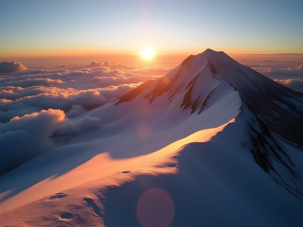
At 19,347 feet (5,897m), Cotopaxi stands as Ecuador's second-highest peak and one of the world's tallest active volcanoes. Its perfectly symmetrical cone has become emblematic of the Ecuadorian Andes, but its beauty belies serious climbing challenges. After two reconnaissance days exploring the national park's lower elevations and archaeological sites, I committed to the summit attempt.
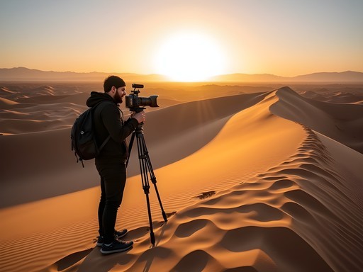
The standard route begins at the parking area (15,000 feet), where I met my certified guide, Fernando. While I've summited peaks independently in North America, local regulations and safety considerations make guides mandatory on Ecuador's major volcanoes—a requirement I fully support given their active status and glaciated terrain.
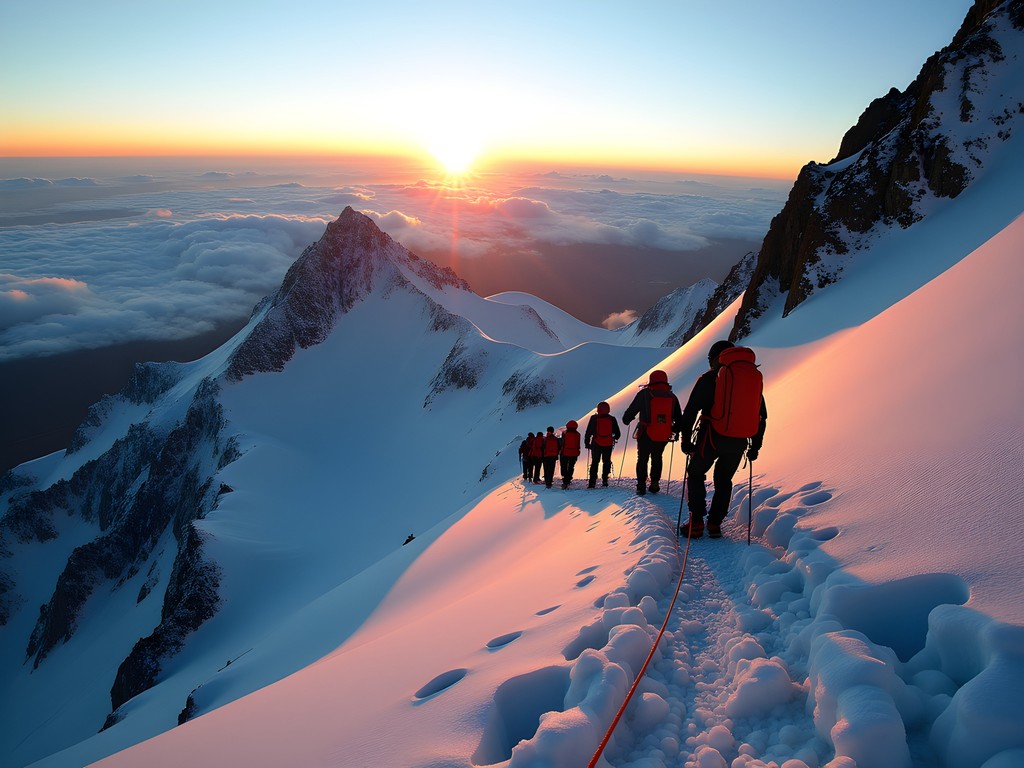
Our ascent began at midnight under a blanket of stars so bright they seemed artificially enhanced by the thin atmosphere. Wearing my expedition headlamp with its 450-lumen output, we navigated the initial rocky terrain before transitioning to crampons at the glacier's edge. The beam's red night-vision setting proved invaluable for checking my altimeter without destroying my night adaptation.
The final 1,000 feet tested every ounce of my physical conditioning. Each step required deliberate focus as we traversed 45-degree ice slopes with thousand-foot drops below. The predawn summit arrival rewarded us with what mountaineers call the 'mountain shadow'—Cotopaxi's perfect triangular shadow projected onto the clouds below as the sun crested the Amazon basin to the east.
💡 Pro Tips
- Book your certified guide at least 2-3 weeks in advance during high season
- The summit attempt starts around midnight to ensure firm snow conditions
- Practice with crampons and ice axe before attempting Cotopaxi if you're new to glaciated climbs
Chimborazo: The Farthest Point from Earth's Center
Despite Everest's reputation as Earth's highest peak, Ecuador's Chimborazo (20,549 feet/6,263m) holds a fascinating geological distinction: due to Earth's equatorial bulge, its summit is actually the farthest point from our planet's center. As an archaeologist fascinated by how ancient cultures interpreted their landscapes, I was drawn to this mountain that the indigenous Puruhá people considered sacred.
Chimborazo demands serious preparation. I spent a week progressively tackling smaller peaks—Rucu Pichincha (15,413 feet) and Illiniza Norte (16,818 feet)—before attempting this behemoth. The night before my climb, I carefully organized my expedition pack which balances minimal weight with sufficient capacity for emergency gear, extra layers, and my research equipment.
The climb itself traverses multiple ecological zones, from high desert scrubland through alpine tundra to the permanent ice cap. What makes Chimborazo particularly challenging is its final approach—nearly 5,000 feet of elevation gain on summit day across highly variable terrain. My mountaineering boots with their rigid soles and excellent insulation proved essential when temperatures plummeted to -10°C (14°F) near the summit.
During our brief summit celebration, my guide shared that pre-Columbian peoples harvested ice from Chimborazo's glaciers, transporting it to coastal regions as a luxury good. This intersection of cultural history and natural landscape epitomizes why I'm drawn to high-elevation archaeology—the extreme environments that both challenge and sustain human adaptation.
💡 Pro Tips
- Consider Chimborazo only after acclimatizing on at least two other significant peaks
- The Whymper Route is technically easiest but still requires glacier travel experience
- Pack emergency electrolytes like Nuun tablets to combat dehydration at extreme altitude

Archaeological Treasures Along the Avenue of Volcanoes
Between summit attempts, I dedicated time to exploring the rich archaeological landscape of Ecuador's highlands. The volcanic soil here supported intensive agriculture that sustained complex pre-Columbian societies, creating a fascinating parallel to my research on the Deccan Plateau in India.
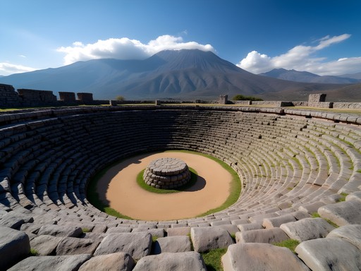
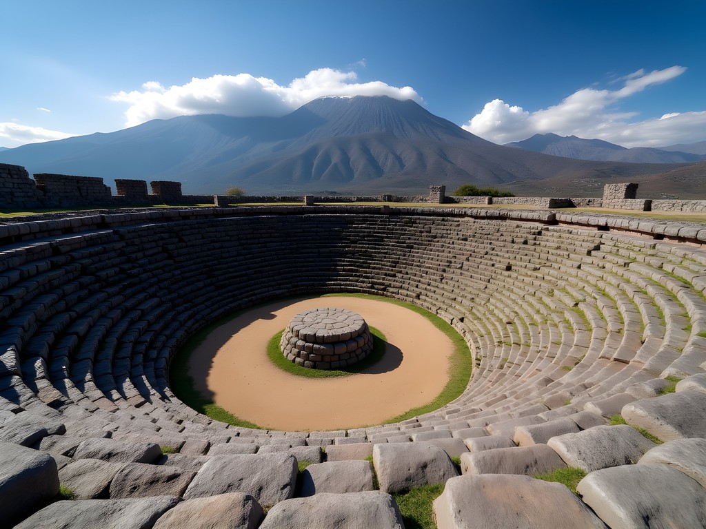
The Ingapirca ruins, Ecuador's most significant Inca site, reveal how these master builders incorporated astronomical alignments into their architecture. Using my archaeological compass with its clinometer function, I verified the summer solstice alignment of the site's elliptical temple—a feature I've documented at plateau sites across four continents.
The lesser-known site of Rumipamba on Quito's outskirts provided fascinating insights into how the local Quitu-Cara culture adapted to volcanic hazards. Excavations reveal multiple occupation layers separated by ash deposits, demonstrating remarkable cultural resilience in the face of environmental catastrophe.
Perhaps most moving was my visit to the indigenous market at Otavalo, where contemporary Kichwa artisans maintain weaving traditions dating back centuries. I documented textile patterns using my field notebook with its water-resistant pages—essential when afternoon downpours are common. These patterns contain encoded knowledge about agricultural cycles and mountain deities that continue to shape indigenous relationships with the volcanic landscape.
💡 Pro Tips
- Visit Ingapirca on weekdays to avoid crowds and get better photographs
- Hire a knowledgeable indigenous guide at archaeological sites for cultural context beyond the standard signage
- Bring small denominations of US dollars (Ecuador's official currency) for purchasing crafts directly from artisans
Indigenous Knowledge and Mountain Survival
My training as an archaeologist has taught me to value indigenous ecological knowledge—something that proved invaluable in Ecuador's mountains. While modern equipment certainly enhances safety, understanding local weather patterns and plant resources adds crucial dimensions to mountain survival.
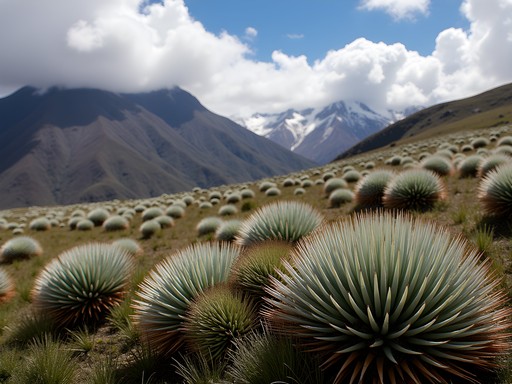
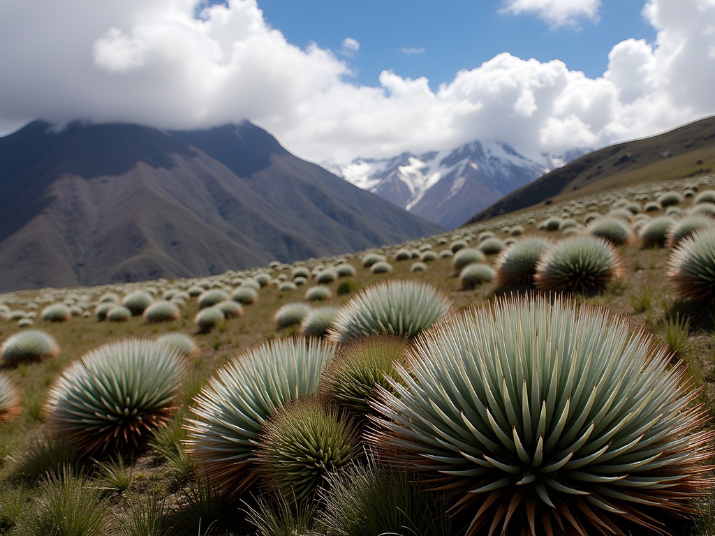
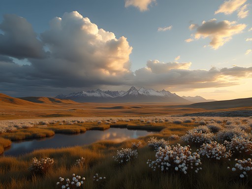
In the páramo ecosystem—the high-altitude grasslands between forest line and permanent snow—I documented medicinal plants still used by indigenous guides. The sunfo plant (Clinopodium nubigenum), when brewed as tea, effectively counters altitude-induced nausea. I carry a portable herb press to preserve samples for my ethnobotanical research database.
Indigenous weather prediction also proved remarkably accurate. My guide on Illiniza Norte pointed to a particular formation of cirrus clouds that indigenous communities call 'horses' tails'—a reliable indicator of approaching storms within 24 hours. This knowledge prompted us to begin our descent earlier than planned, avoiding an afternoon electrical storm that would have made the exposed ridgeline extremely dangerous.
Perhaps most fascinating was learning about traditional navigation techniques. When dense fog enveloped us on Rucu Pichincha, my guide demonstrated how to identify north using subtle differences in moss growth patterns on rock faces—a technique I've since incorporated into my field methods. I documented these observations using my weatherproof camera which handles extreme conditions far better than smartphone cameras.
💡 Pro Tips
- Learn basic Kichwa phrases to show respect when interacting with indigenous guides
- Ask permission before photographing indigenous people or their ceremonial sites
- Consider hiring indigenous guides specifically for their knowledge of local plants and weather patterns
Final Thoughts
As my two weeks in Ecuador's Avenue of Volcanoes drew to a close, I found myself standing once more in Quito's historic center, gazing up at the surrounding peaks with new perspective. These mountains had challenged me physically while enriching my understanding of how ancient civilizations adapted to extreme environments—knowledge that directly informs my ongoing research in India's Deccan Plateau.
The volcanic highlands of Ecuador offer a rare combination of world-class mountaineering, archaeological significance, and living indigenous traditions. For the solo traveler willing to invest in proper acclimatization and preparation, these peaks provide not just adventure but profound insights into human resilience across millennia.
As I prepare to return to my research in Bangalore, I carry with me not just field notes and photographs but a deeper appreciation for how volcanic landscapes shape both geological and cultural histories. Whether you're an experienced mountaineer seeking new summits or an archaeologist like me exploring human adaptation to extreme environments, Ecuador's Avenue of Volcanoes offers transformative experiences that will reshape your understanding of our planet's most dramatic landscapes.
✨ Key Takeaways
- Proper acclimatization is non-negotiable—spend at least 2-3 days in Quito before attempting higher elevations
- Combine summit attempts with archaeological explorations for a richer understanding of the landscape
- Indigenous knowledge enhances both safety and cultural appreciation in Ecuador's mountains
📋 Practical Information
Best Time to Visit
June-August (dry season) and December-January (secondary dry season)
Budget Estimate
$2,000-3,500 for two weeks excluding international flights
Recommended Duration
Minimum 14 days for proper acclimatization and multiple summit attempts
Difficulty Level
Challenging

Comments
EcuadorFan
Those photos of Cotopaxi are stunning! The perfect cone shape is unreal.
Megan Martin
Harper, your post brought back amazing memories of my expedition along the Avenue of Volcanoes last year! Chimborazo was definitely the highlight for me too - there's something profound about standing at the farthest point from Earth's center. One tip for anyone planning this journey: the temperature changes are dramatic between day and night. I found my insulated jacket essential for those pre-dawn summit attempts. Also, the archaeological sites you mentioned deserve more attention - Ingapirca was a revelation and much less crowded than Machu Picchu. Did you get a chance to visit the hot springs in Baños after your climbs? Perfect recovery spot!
MountainLover456
Did either of you attempt Antisana? I've heard it's technically more challenging than Cotopaxi but with fewer crowds.
Megan Martin
I didn't do Antisana, but met climbers who did. They confirmed it's more technical and less crowded. Apparently the glacier approach requires more experience, but the views are incredible!
adventurenomad
This looks incredible! How much time would you recommend for acclimatizing before attempting Cotopaxi? Planning a trip there next spring and wondering about altitude sickness.
Megan Martin
I spent 3 days in Quito before attempting Cotopaxi and that worked well for me. Some people need more time though. The key is to do some moderate hikes at progressively higher elevations before tackling the big one. Rucu Pichincha is perfect for this!
adventurenomad
Thanks Megan! That's really helpful. Did you take any medication for altitude?
Megan Martin
I took Diamox (acetazolamide) as a precaution, starting the day before arriving in Quito. Also, drink coca tea when you're there - the locals swear by it!
luckylife
LOVED THIS POST!! Ecuador is seriously underrated. The photos of Cotopaxi at sunrise gave me chills. Already planning my return trip to tackle Chimborazo. Thanks for the inspiration Harper!
springnomad
What time of year did you go? Is there a best season for climbing?
luckylife
June to September is the dry season and best for climbing! I went in July and conditions were perfect
Bryce Diaz
Man, this brings back memories. I summited Chimborazo solo in 2024 and it remains one of the most challenging things I've ever done. That final push from Whymper refuge in the dark, headlamp cutting through the thin air, ice crunching under crampons—pure magic. Your description of standing at the farthest point from Earth's center really captures that surreal feeling. The Avenue of Volcanoes is truly special. For anyone reading this: don't rush it. Take the time to acclimatize properly.
sunsetking
How much did the guided climbs cost? Trying to budget for this trip
Bryce Diaz
Not Harper, but I did Cotopaxi last year for around $200-250 with a guide from Quito. Chimborazo was closer to $300. Worth every penny for the safety factor at those altitudes.
Timothy Jenkins
Excellent write-up, Harper. I attempted Cotopaxi back in 2023 and the weather turned us back at 5,200m. Your point about the archaeological sites along the avenue is spot on—so many climbers miss the Inca ruins at Pumapungo and the markets in Latacunga. The cultural dimension really enriches the whole experience beyond just bagging peaks. Did you manage to visit any of the highland communities around Chimborazo?
Harper McDonald
Yes! Spent a day with a community near Riobamba. The vicuña conservation work they're doing is incredible. Definitely worth the detour.
starwalker
Cotopaxi is on my bucket list!
starmood
This looks amazing but I'm kinda worried about the altitude. Did you feel sick at all? I've never been above like 5000 feet and wondering if I need to do anything special to prepare.
Harper McDonald
Great question! Definitely spend at least 2-3 days in Quito before attempting any climbs. Stay hydrated, take it slow, and listen to your body. Coca tea helps too!
luckylife
I took altitude pills and they were a lifesaver!! Also the coca tea Harper mentioned is everywhere and actually works
Venture X
Premium card with 2X miles, $300 travel credit, Priority Pass