


Disclosure: This article contains affiliate links. We may earn a commission from purchases at no extra cost to you, which helps our travel content.
After navigating buses through Liverpool's narrow streets and Sydney's busy highways for over three decades, I've spent the last nine years exploring mountain trails across five continents. But crikey, nothing quite prepared me for the raw, untamed beauty of Argentina's northwestern province. Salta isn't your typical tourist trap – it's a proper hiker's playground with trails that'll make your legs burn and your heart soar. I've just returned from a two-week expedition through these magnificent Andean landscapes, and I'm itching to share what I've learned. From navigating local colectivos (that's buses to you and me) to finding trails where you'll meet more condors than people, this guide is for serious hikers who don't mind getting their boots properly dirty. Leave your fancy gear and pretensions at home – we're going into real mountain country.

Getting Your Bearings: Salta City as Your Base Camp
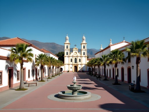
Salta City is where you'll want to plant your flag before venturing into the wilderness. It's a proper city with colonial architecture that reminds me a bit of those Spanish towns I visited years back, but with a distinctly South American flavor. The main plaza – Plaza 9 de Julio – is where everything happens, and it's where you'll find tourist information that's actually useful.
I spent my first two days here getting acclimated to the altitude (Salta sits at about 1,200 meters) before heading higher. The city's organized in a grid pattern that even this old bus driver could navigate without getting lost. Most hiking outfitters and tour companies cluster around Balcarce Street, though I'd recommend comparing prices before committing.
The local transport system is surprisingly efficient. The city buses (colectivos) run frequently and cost pennies compared to taxis. They're not as punctual as my old Number 75 route in Liverpool, mind you, but they'll get you where you need to go. I picked up a SAETA card (like an Opal card in Sydney) from a kiosk near the main plaza, which saved me fumbling for change.
Before heading out on any major treks, I'd recommend visiting the MAAM museum to understand the cultural significance of these mountains to the indigenous peoples. Those mummified children discovered on mountaintops are a sobering reminder that these peaks have witnessed centuries of human history – they're not just pretty views for our Instagram accounts.

💡 Pro Tips
- Get a SAETA card for city buses if staying more than a few days
- Visit the tourist office on Plaza 9 de Julio for updated trail conditions and weather reports
- Acclimatize in Salta for at least 48 hours before attempting high-altitude hikes
Trail #1: The Quebrada de San Lorenzo - Your Warm-Up Act
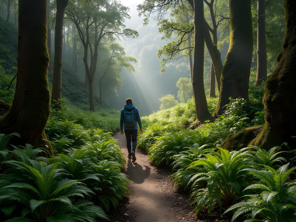
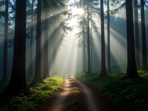
Just 10km from Salta city lies what I call the perfect warm-up hike. The Quebrada de San Lorenzo isn't going to test your limits, but it's a proper introduction to the region's flora and fauna without killing your legs before the main event.
I caught the local bus #115 from Salta's bus terminal (ask for 'San Lorenzo' and the driver will let you know where to hop off). The trail begins at the end of the village and is well-marked – a rarity in these parts! The path winds through a cloud forest that reminded me of parts of New Zealand, though with distinctly South American vegetation.
The full circuit takes about 3-4 hours at a leisurely pace, climbing to viewpoints that offer spectacular vistas back toward Salta. I spotted several condors circling overhead – magnificent beasts with wingspans that make you feel properly insignificant.
This is where I first tested my hiking poles, which proved invaluable on the steeper sections. My old knees aren't what they used to be after decades behind the wheel, and these adjustable poles saved me from what could have been a nasty tumble on some loose scree.
Bring plenty of water – I underestimated how quickly the sun would dry me out, even in springtime. There's a small canteen at the trailhead, but nothing once you're on the path. The trail gets busy with locals on weekends, so aim for a weekday visit if possible.
💡 Pro Tips
- Take bus #115 from Salta terminal to San Lorenzo village
- Start early (around 8am) to avoid afternoon heat and crowds
- Pack at least 2 liters of water per person - there are no refill points on the trail
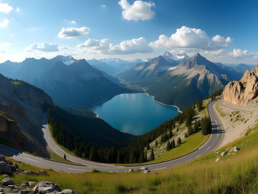
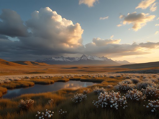
Trail #2: Cachi and the Calchaquí Valley - Where the Real Challenge Begins
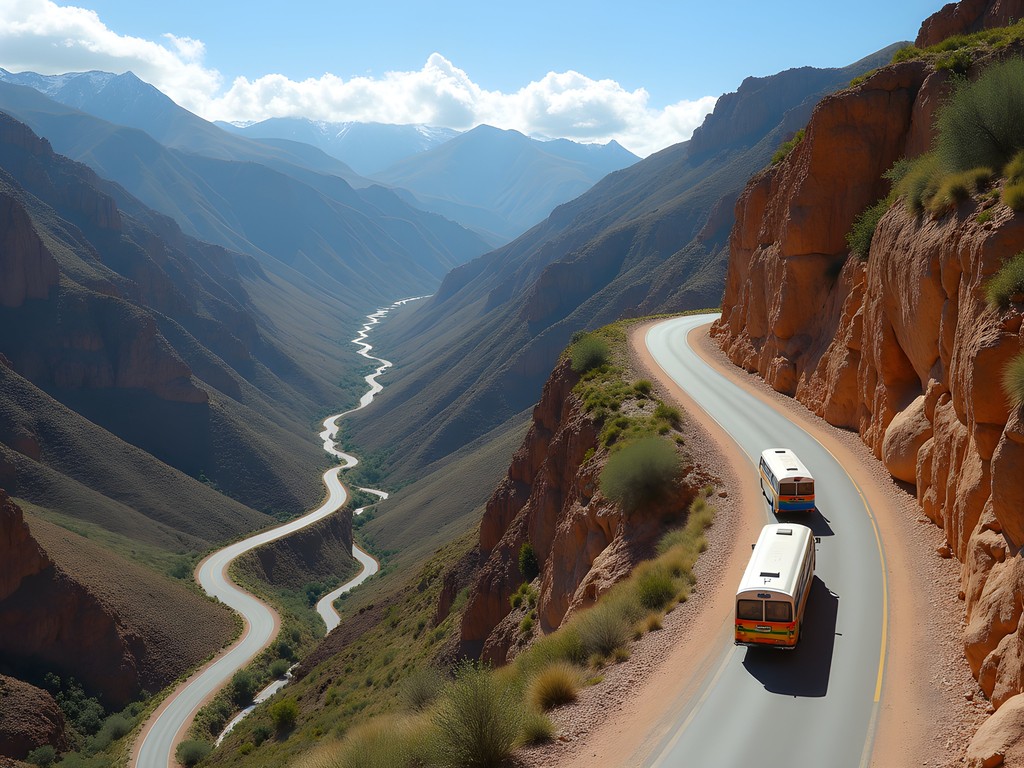
Now we're talking proper hiking. The trails around Cachi and through the Calchaquí Valley separate the casual walkers from the serious mountain folk. To get there, I took a bus from Salta's main terminal to Cachi (about 4 hours) along what locals call the 'Cuesta del Obispo' – a road with 40+ switchbacks that would make even this veteran bus driver a bit queasy. If you're prone to motion sickness, take your meds before this journey!
Cachi itself sits at 2,280 meters above sea level, so you'll feel the altitude. I spent a night in a basic but clean hospedaje (around 20 USD) to acclimatize before tackling the trails. The town has a lovely colonial center with white-washed buildings and a church that dates back to the 1600s.
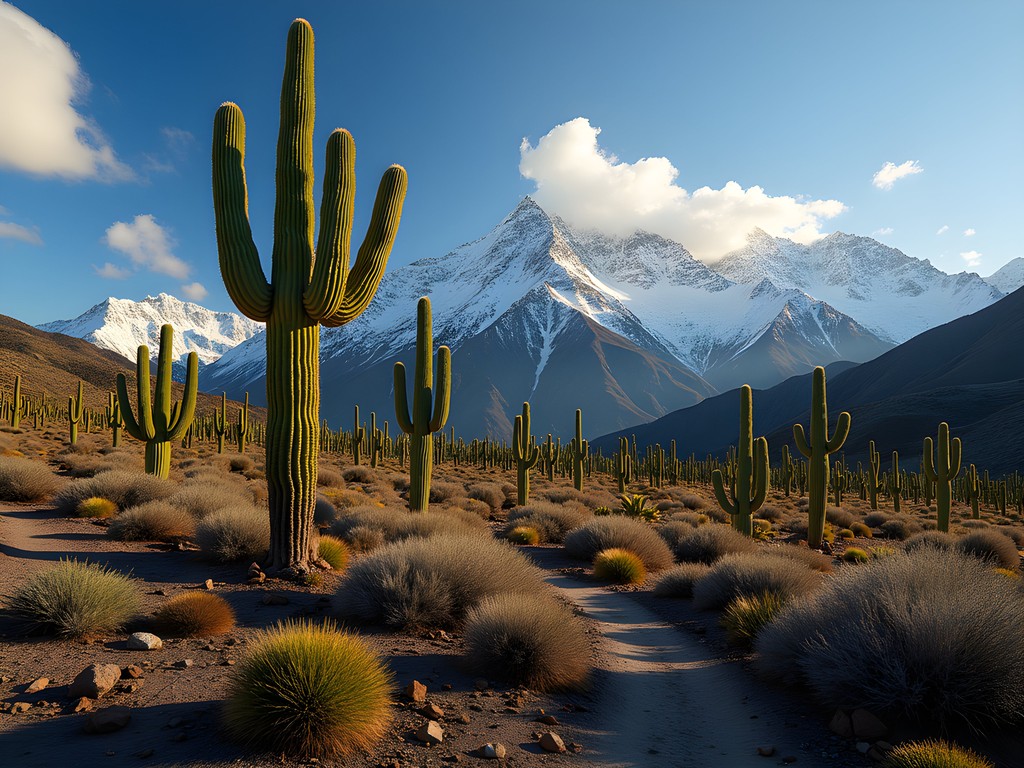
From Cachi, I arranged with a local guide (ask at the municipal tourism office) to drop me at the trailhead for the Los Cardones circuit. This full-day trek takes you through a forest of giant cacti – some over 300 years old – against a backdrop of snow-capped Andean peaks. The contrast between the desert-like foreground and the alpine background creates photos that look almost surreal.
The trail isn't well-marked in places, which is why I'd recommend either hiring a guide (about 40 USD for the day) or downloading maps to your phone beforehand. My hiking GPS proved invaluable here, especially when a sudden afternoon fog rolled in and obscured the trail markers.
The elevation gain is substantial – about 800 meters over the course of the day – and the terrain varies from sandy paths to rocky scrambles. My sturdy hiking boots earned their keep that day, I'll tell you that much. Pack plenty of food, as there's nowhere to restock along the way, and the dry mountain air will have you burning calories faster than you might expect.
💡 Pro Tips
- Take altitude sickness prevention seriously - hydrate well and consider medication if you're sensitive
- Hire a local guide from Cachi for the Los Cardones circuit (around 40 USD)
- Layer your clothing - mornings start near freezing but afternoons can be surprisingly warm

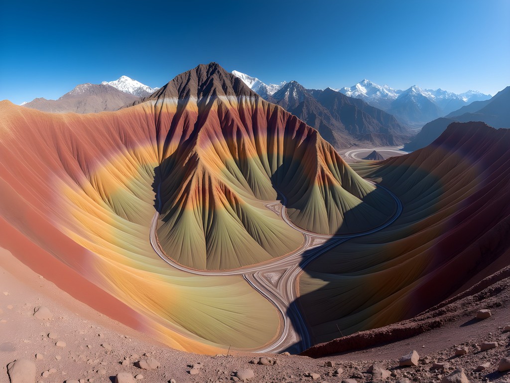
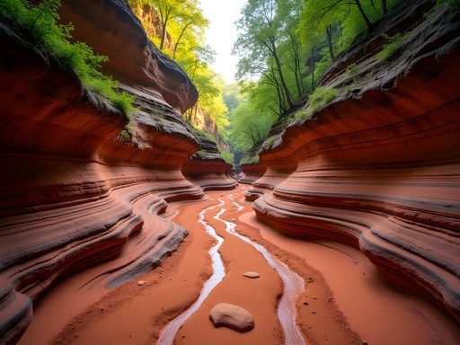
Trail #3: Trekking the Quebrada de Humahuaca - The Crown Jewel
If you're after the full Andean experience, the multi-day trek through parts of the Quebrada de Humahuaca will test your mettle and reward you with landscapes that look like they've been painted by a mad artist. This UNESCO World Heritage site features mountains in shades of red, purple, green, and orange that have to be seen to be believed.
I based myself in the town of Tilcara, about 4 hours by bus from Salta. From here, I arranged a three-day trek with a local outfit that included basic camping equipment and food. It wasn't cheap at 200 USD, but attempting this independently without local knowledge would be foolish for all but the most experienced mountaineers.
The route took us through the Garganta del Diablo (Devil's Throat) canyon, past pre-Columbian ruins, and up to viewpoints where you can see the famous Hornocal (Mountain of Seven Colors). We camped in basic conditions, with temperatures dropping well below freezing at night despite it being spring.
My old bus driver's back complained bitterly about the sleeping arrangements, but my sleeping pad made the experience tolerable. It packs down smaller than my thermos but provides enough insulation to keep the cold ground at bay. Worth every penny when you're trying to rest at 3,500 meters altitude.
The highlight was reaching a remote plateau where we could see condors nesting on inaccessible cliff faces. Through my binoculars, I watched these magnificent birds with their 3-meter wingspans riding the thermal currents with barely a wing flap. Made me think about all those years I spent wrestling with a steering wheel when these creatures navigate the skies with such effortless grace.
The trek reaches altitudes of over 4,000 meters, so altitude sickness is a real concern. Our guide carried an oxygen canister for emergencies, and we were advised to chew coca leaves (perfectly legal and normal here) to help with the effects. I found they helped a bit, though the taste takes some getting used to – like strong tea leaves mixed with grass clippings.
💡 Pro Tips
- Book your multi-day trek at least 2 days in advance in Tilcara
- Pack thermal layers even in spring - nighttime temperatures drop below freezing
- Bring good quality sunscreen and lip balm - the high altitude sun is merciless
Getting Around: A Bus Driver's Perspective on Local Transport
Now, as someone who's spent most of his life behind the wheel of buses, I feel qualified to give you the lowdown on getting around Salta province. The good news is that public transport exists to most major towns. The bad news? It's infrequent, sometimes unreliable, and rarely goes directly to trailheads.
Long-distance buses in Argentina are surprisingly comfortable – a far cry from the rattling boneshakers I used to drive in Liverpool. Companies like Balut and Flecha Bus operate services from Salta to Cachi, Cafayate, and Humahuaca. Expect to pay about 10-15 USD for a 3-4 hour journey. The buses have toilets, air conditioning, and sometimes even serve coffee and alfajores (local sweet treats).
The challenge comes when trying to reach actual trailheads. For this, you have three options:
-
Local colectivos: These small buses run to villages near popular hiking areas but operate on schedules that seem to exist only in the driver's head. Ask locals about times and be prepared to wait.
-
Shared taxis (remises): More expensive than buses but can be split between hikers. From Cafayate to some trailheads, expect to pay about 20-30 USD one way.
-
Hitchhiking: Common practice among locals and budget travelers. I thumbed a few rides with farmers heading up into the mountains. Always offer a few pesos for fuel as a courtesy.
For multi-day treks, the transport logistics can be the most challenging part. This is where I found my travel backpack invaluable – with 65 liters of capacity, I could carry enough supplies for 3-4 days of independent hiking, allowing me to reach areas where public transport simply doesn't go.
One final tip from an old bus driver: always, ALWAYS confirm your return transport before setting off on a day hike. Nothing worse than completing an exhausting trek only to find the last bus left an hour ago, leaving you stranded in a village with more goats than people.
💡 Pro Tips
- Download the offline map of the region on apps like Maps.me before heading out
- Learn basic Spanish transport phrases - many drivers speak no English
- Always carry small bills (pesos) for bus fares - drivers rarely have change for large notes
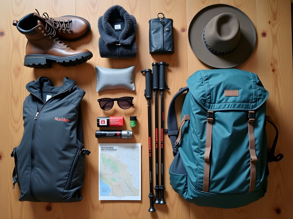
Essential Gear for Salta's Mountain Trails
After decades of mountain hiking across five continents, I've learned to pack smart rather than heavy. Salta's trails demand specific gear considerations due to the extreme temperature fluctuations, high altitude, and remote nature of the hikes.
First, let's talk boots. The terrain here ranges from dusty paths to sharp volcanic rock, with the occasional stream crossing thrown in for good measure. I wore my trusty leather mid-ankle boots with Vibram soles that have seen me through Nepal and New Zealand. If you're buying new, break them in thoroughly before arriving – these trails are no place to be nursing blisters.
Layering is critical in the Andes. Mornings can start near freezing, while midday sun at altitude can feel scorching. I typically wore: - Base layer: Moisture-wicking long-sleeve shirt - Mid layer: Lightweight fleece - Outer layer: Wind/waterproof jacket
For lower body, I swear by convertible hiking trousers – the ones that zip off at the knee. Might not win any fashion contests, but when the temperature climbs 20 degrees between breakfast and lunch, you'll be grateful.
Water purification is essential on multi-day treks. My water filter saved me from carrying excessive water weight and let me safely refill from mountain streams. It's smaller than a can of beans but filters out 99.9% of all bacteria and protozoa – a literal lifesaver when you're days from civilization.
Sun protection isn't optional – it's mandatory. The combination of high altitude and clear air means UV exposure is significantly higher than at sea level. A wide-brimmed hat, high SPF sunscreen, and proper sunglasses are non-negotiable items.
Finally, don't underestimate the value of a good first aid kit. Mine includes blister treatment, altitude sickness medication, broad-spectrum antibiotics (prescribed by my doctor before travel), and basic painkillers. When you're a day's walk from the nearest road, being self-sufficient can make the difference between a minor inconvenience and a major emergency.
💡 Pro Tips
- Bring twice as many pairs of socks as you think you'll need - wet feet are miserable feet
- Pack a headlamp with spare batteries - even day hikes can unexpectedly extend into dusk
- Consider renting specialized equipment in Salta city rather than bringing everything from home
Final Thoughts
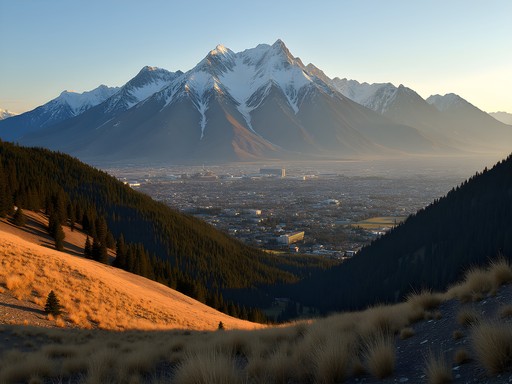
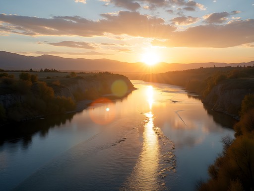
As I watched the sun set behind the Andes on my final evening in Salta, painting those multicolored mountains in even more spectacular hues, I couldn't help but reflect on how these trails had challenged and rewarded me. These mountains don't give up their treasures easily – you earn every vista with sweat, aching muscles, and occasionally a bit of fear. But crikey, are they worth it. Salta remains one of the few places where you can experience world-class mountain trekking without world-class crowds or prices. The combination of ancient cultures, otherworldly landscapes, and genuine adventure makes this corner of Argentina special for serious hikers. So lace up your boots, pack your sense of adventure, and prepare for trails that will test your limits while filling your camera and your soul. Just remember what this old bus driver always says: the journey is as important as the destination – especially when that journey involves conquering the mighty Andes.
✨ Key Takeaways
- Acclimatize properly - spend 2-3 days adjusting to altitude before attempting serious treks
- Local transport requires flexibility and patience - always have a backup plan
- The best trails (Los Cardones and Quebrada de Humahuaca) require guides for safety and navigation
- Spring (September-November) offers the ideal balance of moderate temperatures and minimal rainfall
📋 Practical Information
Best Time to Visit
Spring (September to November)
Budget Estimate
$40-60 USD per day excluding multi-day guided treks
Recommended Duration
Minimum 10 days, ideally 14 days
Difficulty Level
Moderate To Challenging

Comments
Gregory Boyd
Excellent breakdown, Hunter. I did Humahuaca last year and completely agree it's the standout trek. One thing I'd add for readers: the weather can shift dramatically within hours at those altitudes. I got caught in a hailstorm in May that came out of nowhere. Pack layers and waterproofs regardless of the forecast. The Calchaquí Valley section is also worth spending an extra day or two - the archaeological sites around there don't get enough attention in most guides. Did you make it to the Pucará ruins near Tilcara?
Hunter Bernard
Yes! The Pucará was brilliant. Should've mentioned that actually. And spot on about the weather - learned that lesson the hard way on my first day out there. Nearly got hypothermia in March!
starclimber
Wait so even in summer you need warm gear?
Gregory Boyd
Absolutely. Temperature drops fast once the sun goes down, and storms can roll in any time of year at elevation. I always carry my lightweight down jacket on Andean treks - weighs nothing but has saved me multiple times.
starclimber
Those photos are incredible!! Adding this to my bucket list
winterlife
How long did you spend acclimatizing in Salta city? Planning to go in August and worried about the altitude!
Hunter Bernard
Good question! I gave myself 3 full days in Salta city before tackling the higher trails. Take it slow, drink loads of water, and maybe do the San Lorenzo trail first since it's lower elevation. Coca tea helps too - locals swear by it!
winterlife
Thanks! Really helpful
ArgentinaFan
Just got back from Salta last week and followed your guide - it was spot on! The Quebrada de Humahuaca was even more spectacular than your photos show. We stayed in a small homestay in Tilcara where the family cooked us traditional meals each night. One tip for others: the temperature drops DRAMATICALLY at night, even in summer. Bring layers! Also, the local markets in Humahuaca town have beautiful handwoven textiles that make perfect souvenirs and support local artisans.
Douglas Bradley
So true about the temperature drops! I remember being in a t-shirt during the day and needing my heavy down jacket by sunset. Classic high desert climate.
hikergirl45
How's the cell reception on these trails? Wondering if I need to download offline maps.
Hunter Bernard
Definitely download offline maps! Cell reception is spotty at best once you're on the trails, especially in the valleys. Better safe than sorry!
mountain_wanderer
Those sunset photos are incredible! Added to my bucket list!
Douglas Bradley
Hunter, your post brings back such vivid memories of my time in Salta last year! The Quebrada de San Lorenzo really is the perfect warm-up trail as you mentioned. I'd add that the local empanada shops at the trailhead make for the perfect post-hike reward. One thing I found helpful in the Calchaquí Valley section was bringing proper ankle support boots - those loose stone sections can be treacherous. I tracked everything with my hiking GPS which was invaluable when the trail markers became sparse near Cachi. For anyone planning this trip, I'd recommend adding an extra day in Humahuaca itself - the pre-Columbian ruins nearby deserve more time than most guides suggest. The cultural context makes the hiking experience so much richer.
redseeker
Those empanadas sound amazing! Any specific shop you'd recommend?
Douglas Bradley
Definitely try 'Doña Clara's' - small place with a blue door about 200m from the trailhead. The beef and corn ones are traditional and absolutely delicious!
redseeker
This looks amazing! How difficult would you rate the Quebrada de Humahuaca trail for someone who's only done day hikes before?
Hunter Bernard
Thanks for asking! Quebrada de Humahuaca has options for all levels. If you stick to the main paths near Purmamarca and Tilcara, you'll be fine as a day hiker. Just start early, pack plenty of water, and take it slow with the altitude. The full multi-day trek definitely needs more experience though!
redseeker
That's perfect - thanks! Definitely sticking to the day sections then. Can't wait!
nomadmaster
Those sunset pics are INCREDIBLE! Adding Salta to my bucket list right now!
freeblogger
Hunter - your bus driving experience shows in how well you explained getting around! We just got back from Salta and your guide was spot on. The local collectivos are such a fun way to get to the trailheads. We met this amazing older lady on the bus to Cachi who insisted on sharing her mate tea with us and then proceeded to tell us about a hidden viewpoint that wasn't in any guidebook. The temperature swings are wild though - freezing in the morning and roasting by midday. Layers are essential! The multicolored mountains in Humahuaca seriously look photoshopped in real life. No filter needed for those Instagram posts!
Venture X
Premium card with 2X miles, $300 travel credit, Priority Pass