

Disclosure: This article contains affiliate links. We may earn a commission from purchases at no extra cost to you, which helps our travel content.
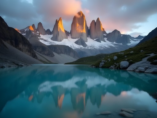
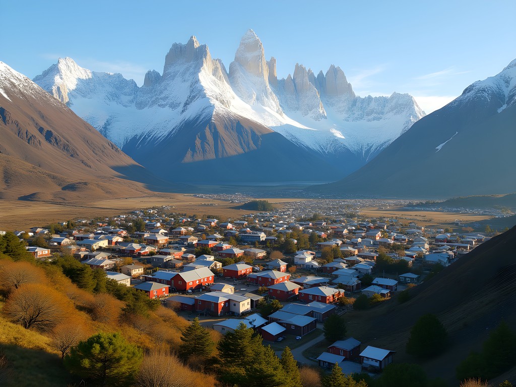
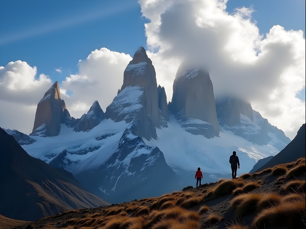
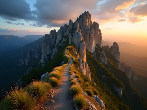
The first time I laid eyes on the jagged spires of Mount Fitz Roy emerging through swirling clouds, I understood why El Chalten has earned its reputation as Argentina's trekking capital. As an economist who's studied the impact of scientific tourism across five continents, I've developed a particular fondness for mountains that offer both natural splendor and educational value. El Chalten delivers this perfect combination in spades. Nestled within Los Glaciares National Park in Argentine Patagonia, this frontier town provides unparalleled access to some of South America's most spectacular hiking trails, all while maintaining a refreshingly unpretentious atmosphere. During my week-long exploration last summer, I discovered why this remote outpost attracts everyone from casual day-hikers to serious mountaineers. Whether you're planning your first Patagonian adventure or returning for deeper exploration, this guide distills my analytical observations and practical experience into the essential information you need for an unforgettable El Chalten expedition.

Understanding El Chalten: Location and Logistics
El Chalten sits at the northern edge of Los Glaciares National Park, approximately 220 kilometers north of El Calafate (the nearest airport town). As an economist who's studied tourism infrastructure development, I find El Chalten particularly fascinating—it was essentially built from scratch in 1985 to solidify Argentina's territorial claims in the border region with Chile. Today, this purpose-built hiking hub serves as the gateway to Patagonia's most iconic peaks.
Reaching El Chalten requires some planning. Most international travelers fly into El Calafate's airport (FTE) and then take a 3-hour bus ride north. The journey itself is part of the experience—the transition from Patagonian steppe to dramatic mountain landscape provides a visual introduction to the region's remarkable geography.
Despite its remote location, El Chalten offers surprisingly robust services for a town of under 2,000 permanent residents. You'll find accommodations ranging from backpacker hostels to comfortable mid-range hotels, though nothing approaching luxury. For my stay, I selected a family-run guesthouse with mountain views and packed my own sleeping bag liner for added comfort and hygiene—a habit I developed during research trips to remote scientific stations.
Cell service and WiFi exist but remain notably unreliable. I recommend downloading offline maps, trail guides, and any important documents before arrival. The town has several ATMs, but they frequently run out of cash during peak season, so bring sufficient Argentine pesos from El Calafate.
💡 Pro Tips
- Download offline maps and trail guides before arrival as WiFi is unreliable
- Bring enough Argentine pesos from El Calafate as ATMs in El Chalten often run out of cash
- Book accommodations well in advance for January-February peak season
Classic Day Hikes: Laguna de los Tres and Laguna Torre
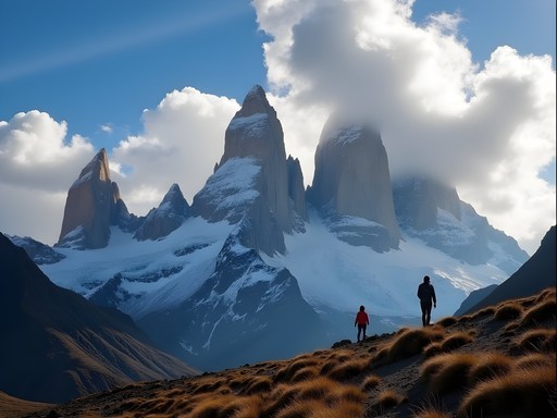
El Chalten's reputation centers on two spectacular day hikes that showcase Patagonia's quintessential landscapes: the trek to Laguna de los Tres (Mount Fitz Roy) and the journey to Laguna Torre (Cerro Torre). Both trails begin directly from town, eliminating the need for transportation to trailheads—an efficiency that the economist in me appreciates.
Laguna de los Tres (20-22km round-trip, 8-10 hours)
This iconic trail delivers hikers to the base of Mount Fitz Roy, culminating at a glacial lake that reflects the mountain's imposing granite face. The trail begins with a moderately steep climb before leveling through lenga forests and open valleys. The final kilometer ascends steeply over rocky terrain, gaining approximately 400 meters in elevation—challenging but manageable for most intermediate hikers with proper preparation.
What makes this trail special is its progression through distinct ecological zones. As an educator at heart, I found myself explaining to fellow hikers how the vegetation changes with altitude and exposure. The payoff at Laguna de los Tres is nothing short of spectacular—Fitz Roy's granite spires tower overhead, often catching the first light of dawn in brilliant orange hues.
Laguna Torre (18km round-trip, 6-7 hours)
Slightly less demanding but equally rewarding, the trail to Laguna Torre leads to the base of the needle-like Cerro Torre. The path follows the Fitz Roy River valley through forests and meadows before opening to views of the spectacular spire. The lagoon itself often contains small icebergs calved from the glacier, creating an otherworldly landscape.
For both hikes, I strongly recommend an early start (7-8am) to avoid afternoon winds and crowds. My trekking poles proved invaluable on these trails, providing stability on rocky descents and reducing strain during the steeper sections. As someone who's hiked at various elevations worldwide, I've found quality trekking poles to be one of the most worthwhile investments for mountain terrain.

💡 Pro Tips
- Start hiking by 7-8am to avoid afternoon winds and crowds
- Pack layers as weather can change rapidly, even in summer
- Bring at least 2 liters of water per person—there are streams for refilling but purification is recommended
Off the Beaten Path: Lesser-Known Trails
While most visitors focus exclusively on the trails to Fitz Roy and Cerro Torre, El Chalten offers several less-trafficked routes that deserve attention. These alternatives provide unique perspectives on the region's geography and often deliver solitude rarely found on the main trails—a valuable commodity during peak season.
Loma del Pliegue Tumbado (18km round-trip, 6-8 hours)
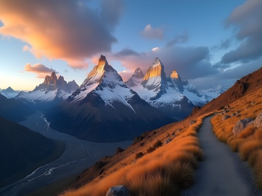
This moderate trail offers perhaps the best panoramic views in the entire region. Unlike the routes that lead to the base of individual peaks, Pliegue Tumbado climbs to a ridge that provides a sweeping vista encompassing both Fitz Roy and Cerro Torre simultaneously. The trail passes through diverse ecosystems, including fascinating southern beech forests and high alpine zones with hardy vegetation adapted to Patagonia's harsh conditions.
What makes this hike particularly special is the perspective it offers on the region's geological formation. As someone who's spent years connecting scientific education with tourism, I found this trail especially valuable for understanding how tectonic forces shaped Patagonia's dramatic landscape.
Huemul Circuit (4 days, 64km)
For experienced trekkers seeking a genuine wilderness adventure, the Huemul Circuit represents El Chalten's ultimate challenge. This four-day loop requires river crossings, glacier travel, and navigation skills. The reward is access to the remote Southern Patagonian Ice Field and views few tourists ever witness.
Before attempting this route, you must register with park rangers and demonstrate appropriate equipment. Having studied the economic impacts of adventure tourism across multiple mountain regions, I've observed that these permit requirements effectively balance access with conservation.
Piedra del Fraile and Río Eléctrico Valley (15km round-trip, 5-6 hours)
This gentler option follows the Río Eléctrico valley to a rustic refugio (mountain hut), offering alternative views of Fitz Roy's north face. The trail passes through beautiful lenga forests with significantly fewer hikers than the main routes.
For any of these less-traveled paths, I recommend bringing a detailed topographic map and a reliable GPS device. While most trails are well-marked, Patagonian weather can change rapidly, reducing visibility. Having accurate navigation tools provides essential security in remote terrain.

💡 Pro Tips
- Register with park rangers before attempting the Huemul Circuit and bring required safety equipment
- Carry a detailed topographic map even for day hikes—weather changes can reduce visibility dramatically
- Consider hiring a local guide for lesser-known trails to enhance both safety and educational value

Practical Considerations: Weather, Gear, and Preparation
Patagonia's weather deserves its legendary reputation for unpredictability. Even during the summer hiking season (December-March), conditions can rapidly shift from pleasant sunshine to driving rain, powerful winds, or even snow. As someone who's studied mountain tourism across multiple continents, I've observed that weather-related preparedness is often the key differentiator between enjoyable and miserable experiences.
Weather Patterns and Planning
El Chalten's location east of the Southern Patagonian Ice Field creates unique meteorological conditions. The massive ice sheet influences local weather patterns, generating strong winds and rapid changes in conditions. During my week in El Chalten, I experienced temperatures ranging from freezing to 70°F (21°C) within a single day.
The most reliable weather forecasts come from the park rangers' office in town, not smartphone apps. I recommend checking with them each evening to plan the following day's activities. If a clear morning is predicted for Fitz Roy views, prioritize the Laguna de los Tres hike immediately.
Essential Gear
Proper layering is critical in Patagonia. My typical hiking outfit included:
- Moisture-wicking base layer
- Insulating mid-layer (fleece or down)
- Waterproof and windproof outer shell
- Hiking pants (preferably quick-dry)
- Sturdy hiking boots with ankle support
- Warm hat and gloves (even in summer)
One item I consider non-negotiable in Patagonia is a truly waterproof and breathable rain jacket. After testing numerous options through years of mountain travel, I've found that investing in premium rain protection pays dividends in comfort and safety. Lesser jackets often fail in Patagonia's driving rain and wind combination.
Physical Preparation
While El Chalten's trails don't reach extreme altitudes, they involve significant elevation gain (600-1000m) and often challenging terrain. Before my trip, I incorporated stair climbing and loaded backpack hikes into my regular fitness routine. This preparation made a noticeable difference in my enjoyment of the longer trails.
As an economist who's studied tourism demographics, I've observed that hikers across all age groups can enjoy El Chalten's trails with appropriate preparation. During my visit, I met several hikers in their 70s successfully completing the Laguna de los Tres trek—inspiring evidence that with proper training and pacing, these experiences remain accessible throughout life.
💡 Pro Tips
- Layer clothing appropriately—Patagonian weather can deliver four seasons in a single day
- Check weather forecasts at the rangers' office each evening, not on smartphone apps
- Break in hiking boots thoroughly before your trip to prevent blisters on long trails
Family-Friendly Options and Educational Opportunities
While El Chalten is renowned for challenging treks, it also offers accessible options for families and educational experiences that align perfectly with my passion for scientific tourism. Having introduced many reluctant family members to mountain environments over the years, I've developed strategies for making these experiences engaging across generations.
Shorter Family-Friendly Hikes
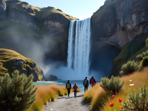
The Chorrillo del Salto trail (5km round-trip, 1-2 hours) leads to a picturesque waterfall through relatively flat terrain, making it ideal for children or those new to hiking. The Los Cóndores and Las Águilas viewpoints (2-3km round-trip, 1 hour) offer spectacular panoramas of the valley and mountains with minimal elevation gain—perfect for sunset viewing after a day of rest.
For families with older children or teens who can handle moderate hiking, the first section of the Laguna Torre trail (to the first viewpoint) provides a taste of Patagonia's grandeur without committing to the full day trek.
Educational Value
El Chalten's trails offer natural classrooms for learning about geology, glaciology, and ecology. The visible retreat of glaciers provides tangible evidence of climate change, while the region's unique flora demonstrates remarkable adaptation to extreme conditions.
The small but informative visitors center in town offers educational displays about the region's natural and cultural history. I recommend visiting on your first day to provide context for what you'll observe on the trails.
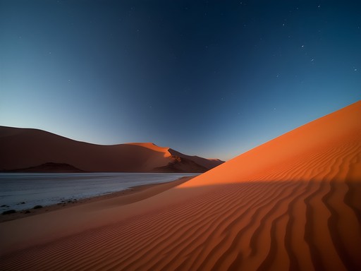
Night Sky Observation
As someone with a particular passion for astronomical tourism, I was delighted by El Chalten's exceptional stargazing opportunities. The town's remote location and minimal light pollution create ideal conditions for observing the southern celestial hemisphere.
During summer (December-February), true darkness arrives late (after 11pm), but reveals spectacular views of the Milky Way and southern constellations not visible from northern latitudes. I packed my compact binoculars specifically for stargazing and wasn't disappointed—they revealed details of the Magellanic Clouds (satellite galaxies visible only from the southern hemisphere) that amazed everyone who took a look.
For families, I suggest bringing a simple star chart of the southern hemisphere and planning at least one evening of stargazing away from town lights. These shared moments of wonder often become children's most vivid memories of Patagonia, connecting scientific learning with emotional experience in precisely the way that inspired my career transition from academic publishing to educational travel content.

💡 Pro Tips
- Visit the Los Cóndores viewpoint for sunset on your first day to orient yourself to the landscape
- Pick up the free educational pamphlet about local flora and fauna at the rangers' office
- Plan stargazing sessions for after 11pm when summer skies are darkest
Final Thoughts
As I watched the alpenglow illuminate Fitz Roy's granite spires on my final evening in El Chalten, I reflected on how this remote Patagonian outpost exemplifies the perfect synthesis of adventure, education, and accessibility. While the iconic peaks and challenging trails rightfully draw serious trekkers from around the world, the region offers meaningful experiences for visitors across the spectrum of ages, abilities, and interests. What makes El Chalten truly special is not just its spectacular geography, but the way it democratizes access to world-class mountain landscapes without requiring technical climbing skills or extreme fitness. As both an economist who has studied mountain tourism and an advocate for scientific literacy through travel, I believe El Chalten represents a model destination—one that balances conservation with access, challenge with inclusivity, and natural wonder with educational opportunity. Whether you come seeking photographic trophies, physical challenges, family adventures, or simply connection with one of our planet's most dramatic landscapes, these trails will leave you forever changed.
✨ Key Takeaways
- El Chalten offers world-class hiking for various experience levels, from challenging full-day treks to family-friendly short trails
- Weather preparation is essential—pack proper layers and rain gear regardless of forecasts
- Less-traveled trails like Pliegue Tumbado often provide superior experiences during peak season
- The region offers exceptional educational opportunities in geology, glaciology, and astronomy
📋 Practical Information
Best Time to Visit
December through March (Patagonian summer)
Budget Estimate
$75-150 USD per day (mid-range)
Recommended Duration
5-7 days
Difficulty Level
Moderate


Comments
luckyvibes
OMG I just booked my flights to Argentina for March!!! This guide is PERFECT timing! Can't wait to see those mountains in person! Did you find the trails well-marked? I'm a bit nervous about getting lost.
bluefan
Don't worry about getting lost! I hiked there solo last year and the main trails are super well-marked with frequent signposts. Just download the offline maps.me app before you go as backup. Have an amazing time!
redmaster
Those Fitz Roy photos are insane! Adding this to my bucket list right now.
Megan Martin
Excellent guide, Maria! I visited El Chalten last November while extending a business trip to Buenos Aires. For those trying to plan, I'd emphasize the importance of flexibility in your itinerary. I scheduled 4 days and ended up with only 2 good weather days for hiking. If you're serious about photography or seeing the peaks clearly, build in buffer days. Also, the town has surprisingly good Wi-Fi in most accommodations, making it feasible to work remotely if needed. My Osprey Talon 22 daypack was perfect for these day hikes - enough space for layers, food, and camera gear without being bulky.
redseeker
I'm a beginner hiker but really want to see Fitz Roy. Are any of these trails doable for someone with limited experience? Or should I just stick to the viewpoints near town?
Sage Dixon
The Mirador Los Cóndores trail is perfect for beginners! It's only about 2 hours round trip from town with minimal elevation gain, and you still get amazing views of both Fitz Roy and Cerro Torre. Start with that, and if you're feeling good, try Laguna Capri (first section of the Laguna de los Tres trail) - it's beautiful and you can turn back whenever you want.
redseeker
That's super helpful, thanks! Mirador Los Cóndores sounds perfect for my first day.
Sage Dixon
Maria, this brought back so many memories! I hiked to Laguna de los Tres last year and made the rookie mistake of not bringing layers. The Patagonian weather changed in minutes - I started in sunshine and ended in sleet! For anyone heading there, I'd add that the Huemul Circuit is worth considering if you have 3-4 days and some technical experience. It's less crowded and the views of the Southern Patagonian Ice Field are absolutely mind-blowing. Just make sure you're prepared for river crossings with a harness system.
moonphotographer
Great post! I'm planning to visit El Chalten in February. How crowded do the main trails get during that time? Would you recommend starting the Laguna de los Tres hike super early?
Maria Moreau
February is high season, so definitely start the Laguna de los Tres hike at sunrise! You'll beat the crowds and get the best light for photos of Fitz Roy.
moonphotographer
Thanks Maria! Sunrise it is then. Can't wait to capture those morning colors!
wandernomad
Going in February! Any recommendations for good hostels or budget places to stay? Also is the tap water safe to drink?
Maria Moreau
Yes, tap water is safe! For hostels, Rancho Grande and Condor de los Andes are popular budget options. Book soon though - February is peak season!
sunsetphotographer
Your photos are incredible!! What camera do you use?
Ana Robinson
We brought our two kids (ages 8 and 11) to El Chalten last March and it was magical! The Laguna Torre trail was perfect for them - relatively flat and the views kept them motivated. We didn't attempt Fitz Roy with the kids though. One tip for families: the Chorrillo del Salto waterfall is an easy 4km roundtrip that kids love, and there's a great spot for picnics. Also, the town has surprisingly good ice cream shops which became our post-hike ritual. My kids still talk about watching condors soar over the valley.
wandernomad
This is so helpful! Did you need to book accommodation way in advance?
Ana Robinson
Yes! We booked 4 months ahead for March (shoulder season). High season (Dec-Feb) fills up even faster. The town is small with limited options.
greenbackpacker
Is it possible to do both Laguna de los Tres and Laguna Torre in one day or is that crazy? Trying to plan my itinerary and only have 3 days there.
Maria Moreau
Technically possible but you'd be hiking for 12+ hours. I'd recommend doing them separately to actually enjoy the views! With 3 days, you could do Fitz Roy, Torre, and one of the shorter trails I mentioned.
Venture X
Premium card with 2X miles, $300 travel credit, Priority Pass