


Disclosure: This article contains affiliate links. We may earn a commission from purchases at no extra cost to you, which helps our travel content.
Standing at the base of Arizona's highest peaks, I couldn't help but view the San Francisco Peaks through both my climber's and anthropologist's lenses. These volcanic mountains aren't just a playground for outdoor enthusiasts—they're sacred to at least 13 Indigenous tribes, including the Navajo, who know them as Dookʼoʼoosłííd, one of their four sacred mountains. As a researcher who's studied ritual landscapes across three continents, I found myself drawn to Flagstaff not just for the vertical challenge but for the cultural palimpsest etched into every switchback and summit. Join me for a weekend exploration of seven trails that offer both physical exhilaration and cultural significance—all accessible on a researcher's modest stipend.

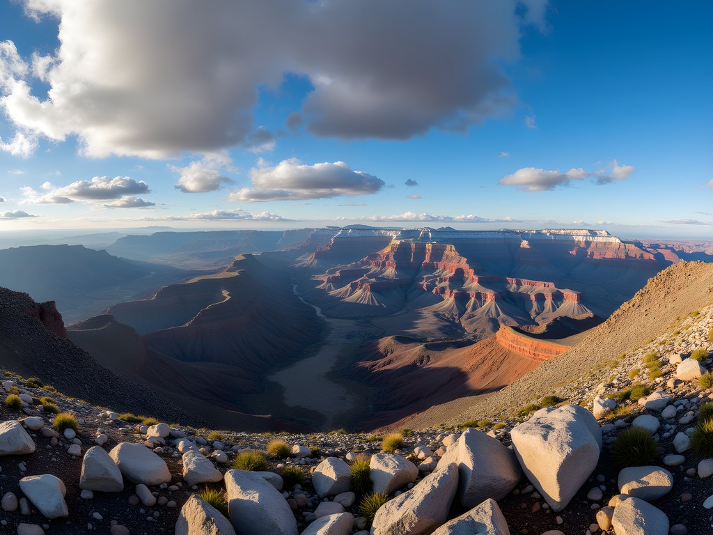
Humphreys Peak Trail: A Summit Stage Worth the Spotlight
If hiking trails were theatrical productions, Humphreys Peak would be the headlining Broadway show—demanding, spectacular, and leaving you breathless in more ways than one. At 12,633 feet, Arizona's highest point offers what theater folks might call the ultimate 'reveal'—a 360-degree panorama stretching from the Grand Canyon to the Painted Desert.
As someone who's summited peaks across three continents, I can tell you Humphreys presents unique challenges. The 10.7-mile round trip begins deceptively gentle at Arizona Snowbowl but quickly transforms into a steep, rocky third act with some light scrambling above treeline. The final mile—what I've come to call 'the denouement'—tests both quadriceps and will as the thin air (about 35% less oxygen than at sea level) makes each step a deliberate choice.
I started early, around 6 AM, with my trusty trekking poles proving invaluable for the steep descent. When the afternoon thunderstorms rolled in precisely at 1 PM (nature's punctual as a German theater director), I was already below treeline, watching the meteorological drama unfold from a safe distance.
💡 Pro Tips
- Start by 7 AM to avoid afternoon thunderstorms, which typically develop like clockwork after 12 PM
- Pack at least 3 liters of water—the dry air dehydrates you faster than you realize
- The temperature difference between trailhead and summit can exceed 30°F; dress in adaptable layers
Weatherford Trail: The Character Actor of Flagstaff Hikes
While Humphreys Trail gets the spotlight, the Weatherford Trail is the character actor of Flagstaff hikes—less famous but arguably delivering the more nuanced performance. This 18-mile round-trip route to Humphreys Peak offers a gentler grade but greater distance, making it my preferred approach when I have time to savor the journey.
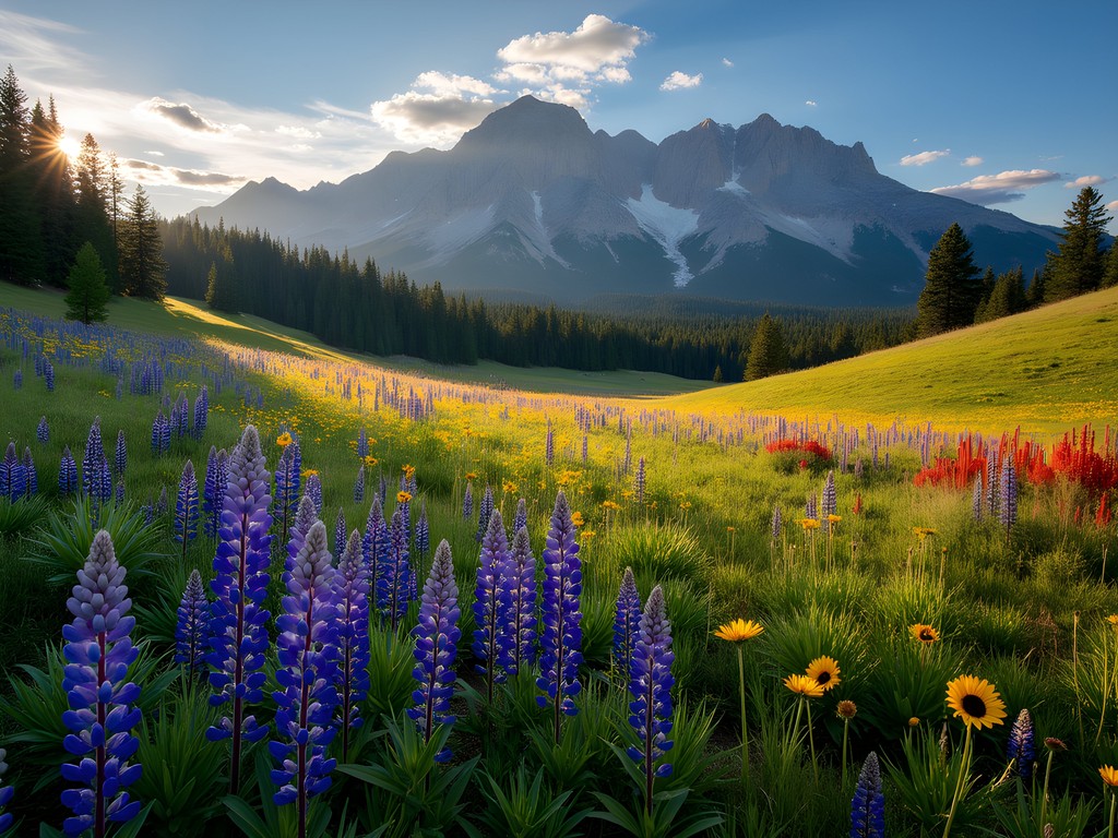
What makes Weatherford exceptional is its theatrical set changes—beginning in ponderosa pine forests, traversing ancient lava flows, and eventually opening to breathtaking meadows that burst with wildflowers in July and August. The trail passes through what ecologists call the 'Inner Basin,' a natural amphitheater formed by the collapsed caldera of the ancient stratovolcano.
During my research visit last summer, I documented how the trail crosses multiple ecological zones, creating what anthropologists call 'liminal spaces'—thresholds between distinct environments that often hold ritual significance in indigenous cosmologies. My compact binoculars proved invaluable for spotting both wildlife and distant geological features relevant to my fieldnotes.
💡 Pro Tips
- The trailhead at Schultz Pass Road is easy to miss; look for the small parking area 2 miles up from Highway 180
- The exposed sections above treeline can be brutally windy—bring a windbreaker even on warm days
- This trail sees about 80% fewer hikers than Humphreys Trail—perfect for those seeking solitude
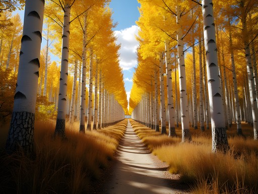
Kachina Trail: The Perfect Second Act
If you're familiar with three-act structure in theater, consider Kachina Trail your perfect second act—challenging enough to create tension but accessible enough for intermediate hikers. This 10-mile out-and-back route traverses the southern face of the peaks, offering consistent views without the quad-crushing elevation gain of summit trails.
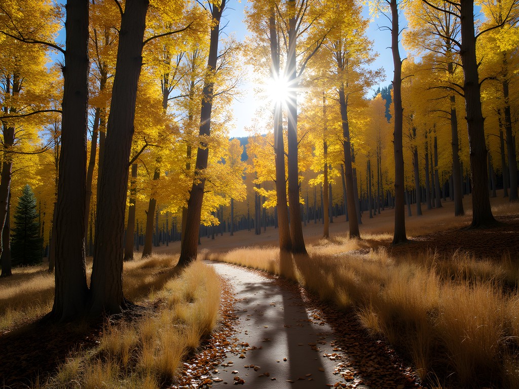
Named for the Hopi spirit beings believed to reside in the mountains, Kachina Trail holds cultural significance that resonates with my anthropological research. The trail weaves through aspen groves that, come September, transform into a golden spectacle that would make any Broadway set designer envious. The aspens' trembling leaves create a natural soundtrack—what the Navajo poetically describe as the 'whispering ones.'
During my research trip, I documented how the trail's numerous ecological microenvironments support different traditional medicinal plants used by indigenous communities. I packed my field notebook and found myself filling pages with observations on how the mountain's southern exposure creates unique growing conditions.
The relatively moderate elevation gain (about 800 feet) makes this trail accessible without sacrificing scenery—a rare combination in mountain environments. For the budget-conscious academic like myself, it offers maximum visual and cultural return on minimal investment of time and energy.
💡 Pro Tips
- The trail can be muddy after rain; waterproof hiking shoes are essential in monsoon season (July-September)
- Look for the remains of an old ski area about 2 miles in—a fascinating glimpse into the region's recreational history
- Bring a light jacket even in summer; the dense forest sections can be surprisingly cool

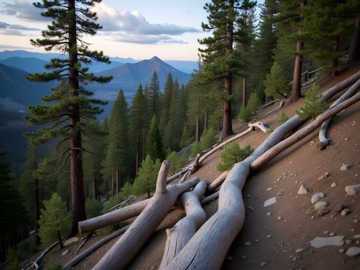
Abineau-Bear Jaw Loop: The Experimental Theater of Flagstaff Hikes
Some trails follow predictable narratives—Abineau-Bear Jaw Loop is not one of them. This 7-mile circuit on the northern slope of the peaks reminds me of experimental theater: challenging conventional expectations and delivering unexpected turns. It's the trail I recommend to experienced hikers looking to escape crowds and experience the mountain's wilder character.
The loop combines two distinct trails—Bear Jaw's gradual ascent through dense mixed-conifer forest and Abineau's steep descent alongside a dramatic canyon. The connecting segment along an old service road offers rare north-facing views of the peaks that few visitors ever witness.
What fascinates me as a researcher is how this trail reveals the mountain's geological autobiography. The Abineau portion follows an avalanche scar from a 2005 event that cleared a swath of forest, creating what ecologists call a 'disturbance regime'—nature's way of refreshing ecosystems. My hiking daypack proved perfect for this route, with enough capacity for extra layers needed in the surprisingly cool microclimate of the north face.
When I hiked this loop last summer, I encountered only four other hikers during six hours on trail—a stark contrast to the parade of humanity on Humphreys Trail. The solitude allowed me to document how differently snowmelt patterns affect vegetation on north versus south aspects of the mountain—field observations that later informed my department presentation on microclimate adaptation.

💡 Pro Tips
- The trailhead is remote; download offline maps as cell service disappears about 3 miles before arrival
- Hike the loop clockwise (Bear Jaw up, Abineau down) to save your knees on the steep descent
- The north face holds snow longer; check trail conditions through late June
Inner Basin Trail: The Hidden Gem with Cultural Depth
Some trails are geological journeys—Inner Basin is both that and a cultural pilgrimage. This 7-mile round-trip hike leads into the heart of the ancient volcano, accessing what the Hopi call the 'womb of the mountain.' As someone who's researched sacred landscapes across multiple continents, I found the Inner Basin particularly compelling for how it combines natural splendor with deep cultural significance.
The trail begins at Lockett Meadow (a destination in its own right) before climbing steadily through what might be the most photogenic aspen forest in Arizona. These aren't just any trees—they're what botanists call a 'clonal colony,' meaning they share a single root system and are essentially one massive organism. In autumn, this creates a synchronized color display that had me filling my memory card within the first mile.
What makes this trail special from an anthropological perspective is its connection to Flagstaff's water supply. The Inner Basin has been the city's watershed since 1884, with historic pipeline remnants still visible along the route. This creates what environmental anthropologists call a 'resource narrative'—how communities conceptualize their relationship with natural resources over time.
While researching Indigenous relationships with mountain landscapes, I spent three consecutive mornings on this trail, documenting how the light quality changes the perception of space within the basin—an element frequently referenced in Hopi and Navajo oral traditions about the peaks.

💡 Pro Tips
- The access road to Lockett Meadow is narrow, unpaved, and intimidating for some drivers; consider carpooling with someone comfortable on mountain roads
- This is Flagstaff's most popular fall color destination; visit weekdays in late September to avoid crowds
- The parking area fills by 8 AM on summer and fall weekends; arrive early or prepare for disappointment
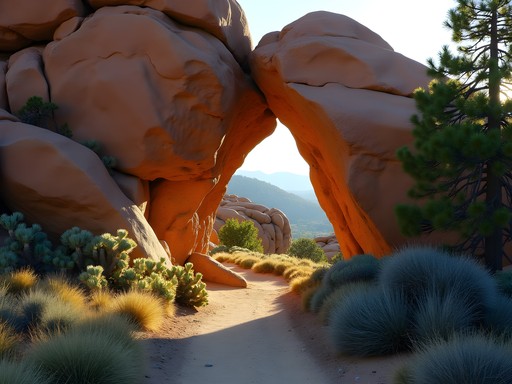
Fatman's Loop: The Perfect Prologue
Despite its unfortunate name (a relic of less body-positive times), Fatman's Loop serves as the perfect introduction to Flagstaff hiking—what theater folks would call the prologue that sets the stage for greater adventures. This accessible 2.4-mile loop offers surprising diversity in a compact package, making it ideal for acclimatization or time-constrained visitors.
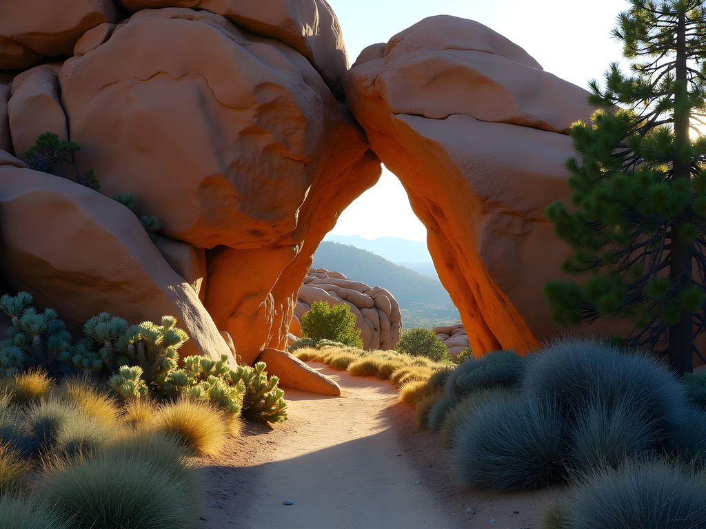
The trail circles the eastern base of Mount Elden, a separate volcanic formation adjacent to the San Francisco Peaks. What makes it fascinating from a geological perspective are the massive volcanic boulders that create natural gateways along the route—including the narrow passage that gave the trail its name.
During my field research on how recreational trails serve as cultural interfaces, I observed how Fatman's Loop functions as what sociologists call a 'third place'—neither home nor work, but a community gathering space where locals and visitors interact. On a typical summer evening, I documented conversations between university professors, tourists, and local Indigenous youth all sharing the same path.
The trail's moderate difficulty makes it perfect for testing gear before more ambitious hikes. I broke in my new hiking boots here before tackling Humphreys, appreciating the varied terrain that included both smooth paths and rocky sections requiring careful footing.
💡 Pro Tips
- This trail gets hot—temperatures on the exposed eastern section can be 15°F higher than official Flagstaff readings
- The northern half offers better views; hike counterclockwise for a more gradual buildup to the scenic payoff
- Parking can be challenging after 9 AM on weekends; consider the Buffalo Park alternative access point
Elden Lookout Trail: The Method Actor's Challenge
If Humphreys Peak is Flagstaff's headlining trail, Elden Lookout is its method actor—intense, demanding, and uncompromising in its approach. This 5-mile round-trip route gains over 2,400 feet of elevation to reach the fire lookout atop Mount Elden, delivering what mountaineers call 'maximum vertical relief'—the greatest elevation gain in the shortest distance.
What makes this trail anthropologically interesting is its function as what performance theorists call a 'proving ground'—a space where local hikers establish their credentials through physical achievement. During my research interviews with Flagstaff outdoor community members, Elden Lookout frequently emerged as the benchmark trail against which hiking abilities were measured.
The trail begins deceptively, winding through ponderosa pine forest before revealing its true character—a relentlessly steep ascent up exposed switchbacks with minimal shade. My hydration reservoir proved essential here, as the combination of elevation gain and exposure can lead to rapid dehydration.
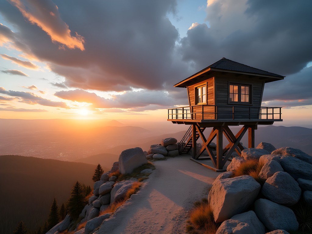
The summit reward is multifaceted: access to a working fire lookout tower (staffed seasonally), panoramic views of Flagstaff and the San Francisco Peaks, and the satisfaction of completing what locals consider their most challenging day hike. As a researcher interested in how physical landscapes shape community identity, I found the summit register entries particularly revealing—filled with expressions of both triumph and humility in the face of the mountain's demands.
💡 Pro Tips
- Start early to avoid both heat and afternoon thunderstorms; the exposed upper sections are lightning prone
- The final mile averages 25% grade—trekking poles can save your knees on the descent
- Sign the summit register! It's part of a long tradition and provides fascinating data for researchers like myself
Final Thoughts
As I packed away my field notes and laced up my boots for one final morning hike before catching my flight back to Cleveland, I found myself reflecting on what makes the San Francisco Peaks so compelling. These trails aren't merely paths through scenic terrain—they're narratives etched into the landscape, simultaneously telling geological, ecological, cultural, and personal stories.
For the budget-conscious traveler with intellectual curiosity, Flagstaff offers an unparalleled opportunity to experience environmental diversity without breaking the bank. A $5 Red Rock Pass (or America the Beautiful annual pass) grants access to most trailheads, while affordable camping options and university-adjacent hostels provide lodging for less than what you'd pay for airport parking in most major cities.
Like any good anthropological fieldwork, hiking these trails reveals layers of meaning—from the physical challenge that reminds us of our bodies' capabilities to the cultural significance that connects us to both ancient traditions and contemporary communities. Whether you're seeking the triumphant summit panorama or the contemplative forest immersion, the San Francisco Peaks offer a stage where we can, however briefly, play a role in a performance much greater than ourselves.
✨ Key Takeaways
- Start early for all hikes to avoid afternoon thunderstorms, especially in monsoon season (July-September)
- The diversity of trails allows hikers of all abilities to experience the mountain's unique environments
- Remember these mountains are sacred to Indigenous peoples—practice respectful hiking and leave no trace
📋 Practical Information
Best Time to Visit
June-October, with fall colors peaking late September
Budget Estimate
$50-100/day including lodging, food, and transportation
Recommended Duration
3-4 days minimum to experience multiple trails
Difficulty Level
Moderate To Challenging
Comments
Casey Andersson
Sofia, I absolutely love how you wove the anthropological perspective into this! The San Francisco Peaks have such profound spiritual significance to multiple Indigenous nations, and it's refreshing to see that acknowledged alongside the hiking info. When I was there, I stayed at the Little America Hotel and their concierge actually gave me some great context about respecting the sacred nature of the peaks. The Weatherford Trail became my favorite too - there's something about those long, contemplative stretches through the aspen groves that just centers you. Did you get a chance to explore any of the trails in autumn? I imagine the aspen colors would be absolutely stunning.
coolexplorer
Wait, when's the best time to see the aspens?
Casey Andersson
Usually late September to early October! It's peak season though, so trails get busy. Worth it for the golden views.
escapelife
Love the photos! Adding this to my list
coolexplorer
This looks amazing! Quick question though - how bad is the altitude? I'm coming from sea level and kinda worried about getting sick on Humphreys Peak. Should I do one of the lower trails first to adjust?
Casey Andersson
Great question! I did Humphreys on a trip through Arizona last year and the altitude definitely hit me harder than expected. Started at 9,300 feet and climbed to 12,600. I'd recommend spending at least a day in Flagstaff (7,000 ft) before attempting it, and maybe do Kachina Trail first - it stays around 9,000 feet so you can gauge how you're feeling. Drink SO much water, seriously more than you think you need.
coolexplorer
Thanks! That's super helpful, I'll definitely do a lower one first
freehero
Just got back from doing Humphreys Peak last weekend and WOW!!! Your post inspired us to go for it! That final mile to the summit nearly broke me but the views were INSANE!!! Definitely bring layers - we started in t-shirts and ended up in puffy jackets at the top. My hiking poles were lifesavers on the way down. Has anyone done the Weatherford Trail? Thinking about trying that one next time.
beachmaster
Congrats on making it to the top! How long did the whole hike take you?
freehero
About 7 hours round trip with lots of photo stops and a long break at the summit. We're in decent shape but not hardcore hikers or anything.
Amit Sullivan
Weatherford is less crowded than Humphreys but longer. Beautiful traverse if you have the time. The meadows in early summer are absolutely stunning with wildflowers.
Amit Sullivan
Sofia, your anthropological perspective on these trails adds such a rich dimension! I hiked the Abineau-Bear Jaw Loop last spring while visiting from Wellington and was completely mesmerized by the ecological transitions. The aspen groves reminded me of certain South Island forests back home, but with their own distinct character. Your description of it as 'experimental theater' is spot on - every turn reveals something unexpected. I'd add that the elevation gain can be challenging for those not acclimated to altitude. I spent three days in Flagstaff before attempting it, which I'd recommend to fellow sea-level dwellers.
Sofia Franklin
Thanks so much, Amit! That's a great point about acclimatization - I should have emphasized that more. The comparison to South Island forests is fascinating!
citybackpacker
Just did the Weatherford Trail last weekend and your description is perfect - it really is the character actor of Flagstaff hikes! Less crowded than Humphreys but equally stunning. We started early (6am) and the morning light on the mountain was incredible for photos. One tip for others: the temperature drop can be dramatic as you climb, even in summer. I was surprised how chilly it got near the top even though Flagstaff was warm. Layers are essential!
journeybackpacker
Thanks for the tip about the temperature changes! Adding extra layers to my packing list now.
citybackpacker
No problem! Also worth noting that afternoon thunderstorms are common in summer. Best to be heading down by noon if possible.
Claire Hawkins
Sofia, this brought back so many memories! My family and I hiked Humphreys last summer with our kids (10 and 12) and it was challenging but absolutely worth it. The Kachina Trail was actually our favorite - perfect for the little ones with those gorgeous aspen groves. We spent a week in a cabin near Snowbowl and did a different hike each morning. The way you described the theatrical nature of each trail is spot on - each has its own personality! We used our trekking poles which were lifesavers on the steeper sections, especially for the kids. Your anthropological perspective adds such a rich dimension to the experience!
Sofia Franklin
Claire! So wonderful to hear from you. I'm impressed your kids tackled Humphreys - what troopers! The Kachina Trail is magical with kids, isn't it? Those aspen groves feel like walking through a fairy tale. Would love to hear which cabin you stayed in for my next visit!
journeybackpacker
Great post! How difficult would you say the Humphreys Peak Trail is for someone who's in decent shape but not a regular hiker? Planning a trip in October.
Sofia Franklin
Thanks for reading! Humphreys is challenging but doable if you're in decent shape. The altitude is the biggest factor - make sure to acclimate for a day in Flagstaff first. October is perfect timing with cooler weather and fewer crowds. Take it slow and bring plenty of water!
journeybackpacker
Thanks so much for the advice! Will definitely plan for that extra acclimation day.
beachmaster
Awesome post! I'm planning to visit Flagstaff in November. Would Humphreys Peak still be doable that time of year or should I stick to the lower elevation trails?
Amit Sullivan
November can be tricky - I hiked Humphreys last October and encountered snow near the summit. If you're going in November, definitely check weather conditions and bring microspikes just in case. Kachina Trail would be a safer bet that time of year.
beachmaster
Thanks for the advice! Kachina sounds like a good backup plan.
Sofia Franklin
Beachmaster, Amit is spot on. November can be hit or miss for Humphreys. The Weatherford Trail is also beautiful that time of year and slightly less exposed if conditions aren't ideal for the summit.
journeymood
That shot of the aspen trees along Kachina Trail is gorgeous! What time of year was that taken? Hoping to catch them in their golden glory!
Venture X
Premium card with 2X miles, $300 travel credit, Priority Pass