

Disclosure: This article contains affiliate links. We may earn a commission from purchases at no extra cost to you, which helps our travel content.
When most people think of Nevada, they picture casinos and neon lights. But as someone who's explored valleys from the Pantanal to the Alaskan wilderness, I can tell you that Reno holds secrets that rival any ecological wonder I've witnessed. Nestled between the Sierra Nevada and the high desert, this underrated destination offers solo travelers like us a chance to reconnect with nature without the crowds—or the hefty price tag. This spring, I discovered ten hidden trails that transformed my understanding of Nevada's diverse ecosystems, and I'm excited to share these gems with you.

1. Hunter Creek Trail: Your Gateway to Sierra Solitude
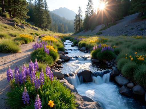
Just fifteen minutes from downtown Reno, Hunter Creek Trail feels like stepping into another world entirely. This 8-mile out-and-back trail follows a rushing creek through a narrow canyon, where wildflowers explode in color every spring. I hiked this trail solo on a Tuesday morning in April and encountered maybe three other people—a rare gift in today's crowded outdoor spaces.
The trail gains about 1,400 feet, making it perfect for intermediate hikers looking to build stamina without overwhelming themselves. What struck me most was the ecological transition: you start in high desert scrubland and gradually ascend into pine forests, witnessing Nevada's biodiversity in real-time. Bring your water filter because the creek water is pristine and you'll want to refill along the way rather than carrying extra weight.
💡 Pro Tips
- Park at the Hunter Creek Trailhead on Woodchuck Circle—it's free and rarely full on weekdays
- Start early in spring to catch the waterfall at its peak flow from snowmelt
- Watch for wild horses in the lower canyon sections during morning hours
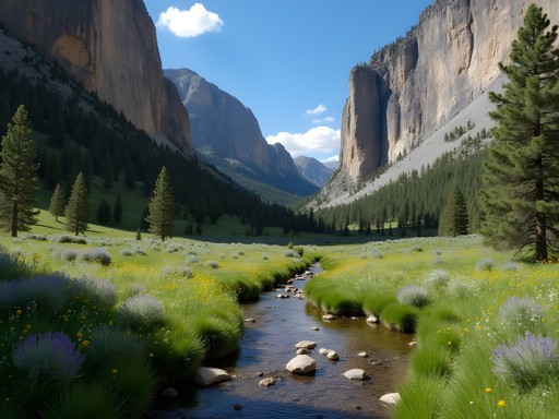
2. Whites Creek Trail: The Secret Canyon Nobody Talks About
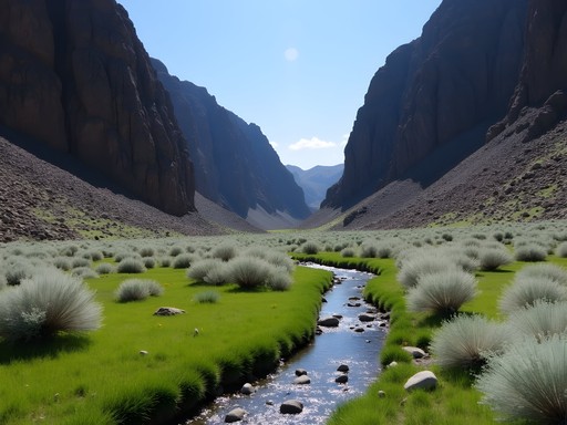
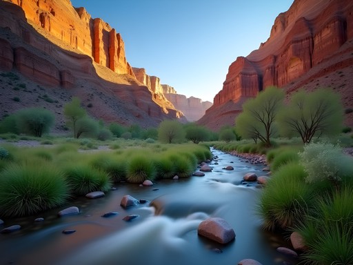
Here's a trail that even locals overlook. Whites Creek Trail is a 6-mile loop that takes you through a hidden canyon system with year-round water—a rarity in Nevada. The trail features several creek crossings (nothing technical, but waterproof boots help) and leads to a stunning meadow surrounded by volcanic rock formations.
What makes this trail special for solo travelers is its meditative quality. The sound of water accompanies you the entire hike, creating what I call a natural sound bath. As a life coach, I often recommend this trail to clients seeking clarity—there's something about the rhythm of moving water that helps untangle complicated thoughts. The conservation value here is significant too: this riparian corridor supports over 150 bird species during migration season.
💡 Pro Tips
- Access via Whites Creek Lane off Pyramid Highway—the trailhead is unmarked, so download offline maps
- Bring a trekking poles for the creek crossings and rocky sections
- Visit in early May for the best wildflower displays and comfortable temperatures
3. Jones Creek Trail to Whites Creek Loop: The Ultimate Spring Challenge
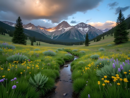
For those ready to level up, this 12-mile loop combines two creek systems into one spectacular day hike. I tackled this trail solo last April and it remains one of my top Nevada experiences. The elevation gain is about 2,000 feet, but it's distributed gradually enough that you can maintain a steady pace.
The ecological diversity here is remarkable. You'll pass through four distinct zones: high desert, riparian corridor, mixed conifer forest, and alpine meadows. Each ecosystem tells a different story of adaptation and resilience—themes that resonate deeply with my conservation work. Pack plenty of snacks because this is an all-day adventure. I rely on my energy bars for sustained energy without the sugar crash.

💡 Pro Tips
- Start at the Jones Creek Trailhead before 7 AM to complete the loop with daylight to spare
- Carry at least 3 liters of water even though there are creek sources—spring weather is unpredictable
- Download the AllTrails map offline as cell service is nonexistent

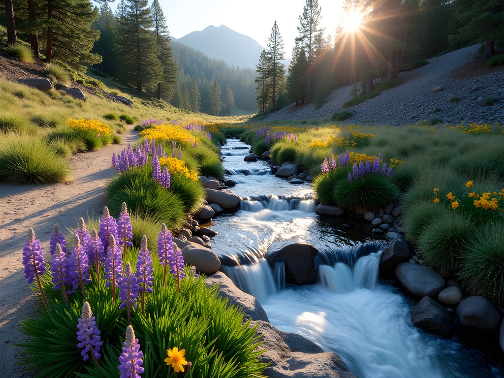
4. Galena Creek Trail: Where Desert Meets Forest
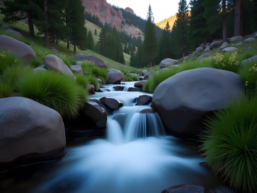
Galena Creek offers something special: accessibility without sacrificing beauty. This 5-mile trail is perfect for solo travelers who want a half-day adventure with maximum reward. The trail follows Galena Creek through a dramatic canyon, passing several small waterfalls that rage during spring snowmelt.
What I love about this trail is how it demonstrates Nevada's ecological transition zones. Within a few miles, you witness the shift from sagebrush steppe to montane forest—a living laboratory of climate adaptation. The trail is well-maintained but not overly developed, striking that perfect balance between wilderness and accessibility. I always bring my plant identification guide on this hike because the botanical diversity is outstanding.

💡 Pro Tips
- Park at Galena Creek Regional Park and follow signs to the backcountry trailhead
- The first mile is popular with families, but crowds thin dramatically after the second creek crossing
- Spring afternoons can bring sudden weather changes—pack a lightweight rain shell
5. Thomas Creek Trail: The Photographer's Paradise
Thomas Creek Trail is a 7-mile out-and-back that climbs through aspen groves and pine forests to a high meadow with panoramic views of the Truckee Meadows. While fall is famous for aspen colors, spring offers something equally magical: the aspens leaf out in brilliant lime green, creating an almost luminescent quality in the forest.
This trail is ideal for solo travelers who want solitude with spectacular views. The elevation gain is about 1,600 feet, challenging enough to feel accomplished but manageable for intermediate hikers. I've returned to this trail multiple times because each season reveals something new. The conservation story here involves watershed protection—Thomas Creek feeds directly into the Truckee River system, making it critical habitat for Lahontan cutthroat trout.
💡 Pro Tips
- Access via Mount Rose Highway—look for the small pullout at mile marker 12
- The trail can be muddy in early spring, so waterproof boots are essential
- Afternoon thunderstorms are common in May, plan to summit before 2 PM
6. Ophir Creek Trail: Hidden Valley Serenity
Ophir Creek Trail is my secret weapon for when I need complete solitude. This 6-mile trail sees maybe a dozen hikers per week, even during peak season. The trail follows Ophir Creek through a narrow valley flanked by granite walls, eventually opening into a meadow that feels like your own private sanctuary.
The intermediate difficulty comes from several steep sections and loose rock, but the reward is worth every careful step. I've encountered deer, wild turkeys, and once, a bobcat on this trail. For solo travelers concerned about safety, the wildlife here is abundant but not threatening—just practice good trail etiquette and make noise in blind corners. Consider bringing a bear spray for peace of mind, though bear encounters are rare in this area.

💡 Pro Tips
- Trailhead is at the end of Ophir Creek Road in Washoe Valley
- Bring cash for the small parking fee—it's an honor system box
- The meadow at mile 3 is perfect for a long lunch break and meditation
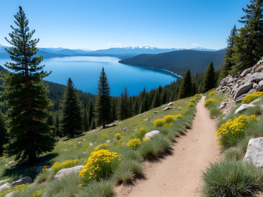
7. Incline Flume Trail: History Meets Nature
The Incline Flume Trail combines natural beauty with fascinating history. This 6-mile trail follows the route of an old logging flume that once transported timber from the mountains to the valley below. The trail offers constant views of Lake Tahoe while winding through forests and across exposed ridges.
What makes this trail special is the interpretive aspect—you can still see remnants of the flume system, creating a tangible connection to Nevada's resource extraction history. As someone passionate about conservation, I find these historical trails valuable for understanding how our relationship with land has evolved. The trail requires good balance and comfort with exposure, as some sections have significant drop-offs. My hiking gloves provided excellent grip on the rocky sections while protecting my hands from the intense spring sun at this elevation.
💡 Pro Tips
- Start at the Tunnel Creek Trailhead off Mount Rose Highway
- This trail gets afternoon sun exposure—start early and bring sun protection
- The views are spectacular but watch your footing, especially on loose gravel sections
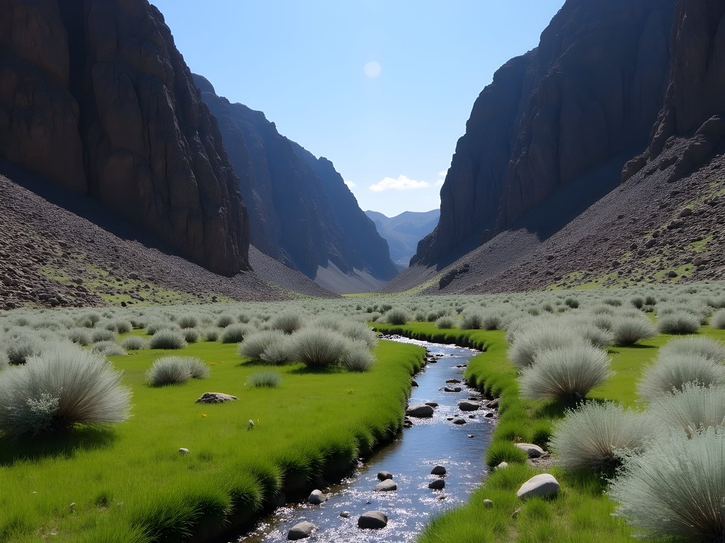
8. Dry Pond Trail: High Desert Ecosystem Showcase
Don't let the name fool you—Dry Pond Trail is anything but boring. This 8-mile loop showcases Nevada's high desert ecosystem at its finest. Spring is the only time I recommend this trail because summer temperatures can be brutal and winter brings heavy snow. But in April and May, this trail comes alive with wildflowers, birds, and perfect hiking temperatures.
The trail circles a seasonal pond that attracts incredible wildlife during spring. I've seen sandhill cranes, great blue herons, and countless songbirds here. The elevation is moderate, around 6,500 feet, and the trail is relatively flat, making it accessible for hikers who want distance without extreme climbing. This is prime conservation territory—the seasonal wetland supports species that depend on these increasingly rare habitats.
💡 Pro Tips
- Access via Geiger Grade Road, park at the informal pullout near mile marker 8
- Bring a field guide because the bird diversity is exceptional
- Visit in early morning for best wildlife viewing and cooler temperatures
9. Steamboat Ditch Trail: The Urban-Wilderness Connector
Steamboat Ditch Trail offers something unique: an easy entry point into Reno's wild side without driving far from town. This 10-mile trail follows a historic irrigation ditch through diverse terrain, from sagebrush valleys to pine forests. The beauty of this trail for solo travelers is its flexibility—you can hike as much or as little as you want and turn around at any point.
The ecological story here fascinates me. The ditch, built in the 1870s, created an artificial riparian corridor that now supports wildlife you wouldn't typically find in this dry landscape. It's a perfect example of how human infrastructure can sometimes benefit conservation when managed thoughtfully. The trail is mostly flat with gentle elevation changes, making it ideal for a contemplative solo hike where you can set your own pace.
💡 Pro Tips
- Multiple access points exist—I recommend starting at the Whites Creek intersection for the most scenic section
- This trail is popular with mountain bikers, so stay alert and step aside when you hear them approaching
- Pack a light lunch and make it a leisurely all-day adventure rather than rushing
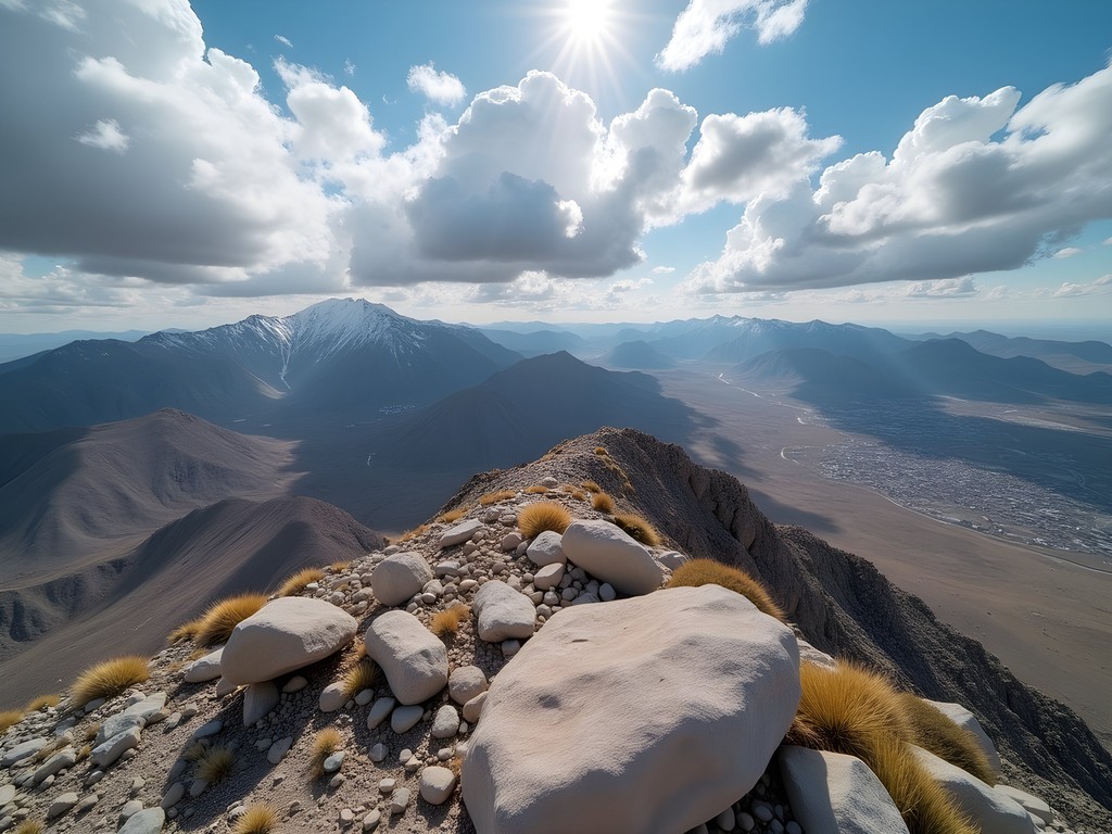
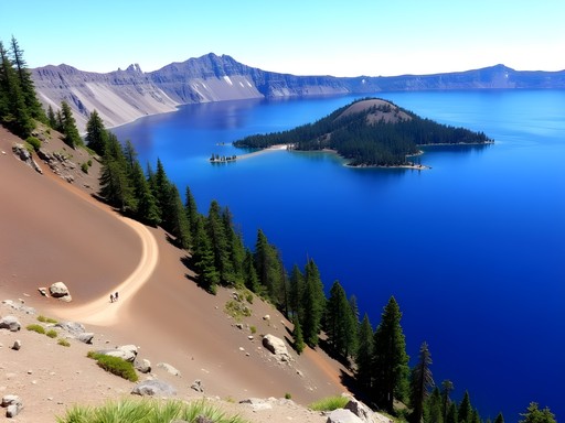
10. Peavine Peak Trail: Summit Success for Solo Adventurers
Peavine Peak deserves its spot as the grand finale of this list. At 8,266 feet, the summit offers 360-degree views of Reno, the Sierra Nevada, and the high desert beyond. The trail is about 9 miles round trip with 2,000 feet of elevation gain—a solid intermediate challenge that feels like a real accomplishment.
I hiked Peavine solo on a clear May morning and it remains one of my most memorable Nevada experiences. The trail passes through multiple ecosystems, each with distinct character and wildlife. The summit itself is expansive and flat, perfect for a long break to soak in the views. What I love about this trail is how it puts Reno in perspective—you can see the entire valley spread below, reminding you that even urban areas are surrounded by wild spaces worth protecting. My insulated water bottle kept my water cold for the entire hike despite the warming temperatures at lower elevations.
💡 Pro Tips
- Start from the Peavine Peak Trailhead off Wedge Parkway in northwest Reno
- The final push to the summit is exposed with loose rock—take your time
- Summit weather can be 15-20 degrees cooler than the trailhead, bring an extra layer
Final Thoughts
These ten trails have taught me that Nevada's greatest treasures aren't found in casinos—they're hidden in canyons, valleys, and peaks waiting for solo adventurers willing to explore. As someone who grew up exploring Brazil's Pantanal and now calls Alaska home, I can honestly say Reno's trail network rivals any destination I've experienced for accessibility, diversity, and sheer beauty.
What makes these trails special isn't just their scenery—it's the opportunity they provide for mindful connection with nature. Solo hiking allows you to move at your own pace, to pause when something catches your eye, to sit in silence and truly absorb your surroundings. These trails offer that gift without requiring expensive permits, long drives, or advanced technical skills.
This spring, challenge yourself to explore at least three of these hidden gems. Bring your curiosity, respect the land, and practice Leave No Trace principles. Nevada's wild spaces need advocates who understand their value beyond resource extraction. Every hiker who falls in love with these trails becomes another voice for their protection. Now get out there and discover why Reno might just be the most underrated hiking destination in the American West.
✨ Key Takeaways
- Spring (April-May) offers ideal conditions for these trails with wildflowers, flowing creeks, and comfortable temperatures
- Most trails are accessible within 30 minutes of downtown Reno, making them perfect for budget-conscious solo travelers
- These hidden trails provide solitude and ecological diversity without the crowds of more famous Nevada destinations
📋 Practical Information
Best Time to Visit
April through early June for optimal spring conditions, wildflowers, and creek flow
Budget Estimate
$50-150 for a weekend including gas, parking fees, food, and basic supplies
Recommended Duration
2-3 days to experience 4-5 trails without rushing
Difficulty Level
Intermediate—requires Moderate Fitness And Some Trail Experience


Comments
Savannah Walker
Amy, this post brought back memories! I did the Galena Creek trail last spring and was blown away by how the landscape transitions from high desert to pine forest in just a couple miles. That ecological shift is something you don't see in many places. For anyone planning to visit, I'd add that early summer (June) is perfect timing - the snowmelt creates these beautiful cascades, and the temps are still comfortable for longer hikes. I actually met a local ranger who mentioned that the area around Whites Creek has some ancient petroglyphs if you know where to look. Definitely adding the rest of these to my Nevada bucket list!
starmate
are these trails ok for dogs? planning a trip with my pup
skyfan
YES!! Finally someone writing about Whites Creek! I've been going there for years and it's like my secret spot. The wildflowers in May are absolutely insane. Amy you nailed it with this list - these trails are so underrated compared to Tahoe. Galena Creek is my go-to for a quick morning hike before work. Can't wait to try the ones I haven't done yet!
sunsetphotographer
Hunter Creek is absolutely stunning for golden hour shots! I went last fall and the way the light hits those canyon walls is incredible. Pro tip: if you go in late afternoon, you'll have the trail almost to yourself and the shadows create amazing contrast. The creek crossing can be tricky with camera gear though, so I'd recommend waterproof bags. Also saw a ton of wildlife around dusk - deer, rabbits, even caught a glimpse of what might have been a bobcat.
starmate
what time would you say is best to start for golden hour?
sunsetphotographer
I'd say get there around 4pm in summer, maybe 3pm in fall/winter. Gives you time to hike in and find your spot
smartninja
how hard is the Jones Creek loop? im not super experienced but want to try something new
skyfan
It's pretty moderate! Just start early in spring because it gets hot. The elevation gain is real but totally doable if you take your time
smartninja
thanks! gonna try it in march
Venture X
Premium card with 2X miles, $300 travel credit, Priority Pass