

Disclosure: This article contains affiliate links. We may earn a commission from purchases at no extra cost to you, which helps our travel content.
Standing on the banks of the Elizabeth River, watching sailboats glide beneath the South Norfolk Jordan Bridge, I couldn't help but appreciate how waterways have shaped this region's identity just as profoundly as its roadways. As an engineer with a passion for how infrastructure connects communities, Chesapeake fascinates me with its intricate network of transportation options. This coastal Virginia gem offers a unique blend of maritime charm and modern convenience that makes it surprisingly navigable for solo travelers—if you know how to approach it.

Understanding Chesapeake's Unique Geography
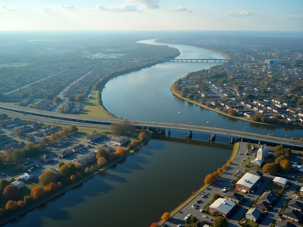
Chesapeake presents a fascinating engineering challenge: a city where land and water engage in constant conversation. With over 485 square miles of territory intersected by the Intracoastal Waterway, Elizabeth River, and numerous tributaries, this isn't your typical grid-based urban area. The city is actually a collection of distinct communities—South Norfolk, Great Bridge, Deep Creek, Western Branch, and others—each with their own character and connectivity challenges.
During my week exploring the area, I quickly realized that understanding this geography is essential for efficient navigation. The waterways that once served as the primary transportation arteries still influence modern movement patterns. Major roads often follow historical water routes, and bridges become critical connection points.
Perhaps most surprising to visitors is how the city's layout creates what locals call the "Chesapeake Paradox"—places that appear close on a map might require significant detours around waterways, while seemingly distant locations can be surprisingly accessible via direct routes. My engineering background had me fascinated by how the Great Bridge Lock system manages water levels between different waterways, a perfect example of infrastructure adapting to natural conditions rather than forcing nature to conform to human designs.
💡 Pro Tips
- Download the Waze app for real-time traffic updates about bridge openings and closures
- Consider the time of day when planning routes—morning and evening rush hours can add 15-20 minutes to cross-city travel
- Familiarize yourself with the major waterways on a map before arrival to understand the city's natural boundaries
Renting a Car: Your Best Option for Freedom
Let me be direct with you: if you're planning to explore Chesapeake properly as a solo traveler, renting a car isn't just convenient—it's practically essential. Unlike more densely populated urban areas, Chesapeake's sprawling layout makes comprehensive public transit coverage challenging.
During my visit, I opted for a fuel-efficient compact from car rental service at Norfolk International Airport, which served me perfectly for the week. The airport is just a 15-minute drive from northern Chesapeake, making it an ideal starting point. If you're flying in, I'd recommend booking your rental in advance, especially during the popular spring season when rates tend to climb.
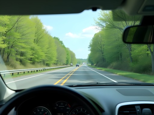
Chesapeake's road network is generally well-maintained, with Interstate 64 serving as the primary east-west corridor and Route 168 (Chesapeake Expressway) connecting to the Outer Banks of North Carolina. Navigation apps work reliably throughout the region, though I found having a phone mount essential for safe, hands-free directions.
One engineering quirk I appreciated: the city's stormwater management systems along major roadways are quite impressive, meaning roads drain relatively quickly after the spring showers that frequently pass through. Just be prepared for occasional slowdowns when drawbridges open to allow boat traffic—a charming reminder of the region's maritime priorities.

💡 Pro Tips
- Reserve your rental car at least two weeks in advance during spring for better rates
- Keep loose change handy for the Chesapeake Expressway toll if heading to the Outer Banks
- Download offline Google Maps of the area in case you encounter cellular dead zones near some of the more remote waterways
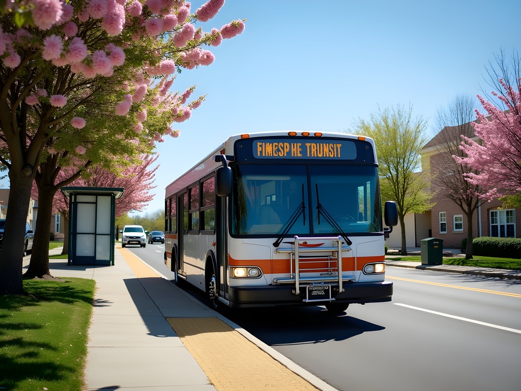
Navigating Chesapeake's Limited Public Transit
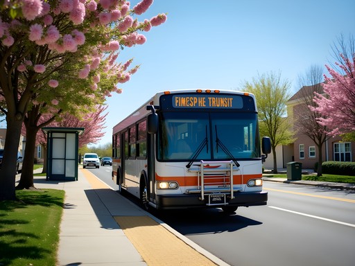
While a personal vehicle offers the most flexibility, Hampton Roads Transit (HRT) does provide bus service throughout portions of Chesapeake. As someone who values sustainable transportation options, I made a point to test these services during my stay.
The Route 15 bus connects Greenbrier area to downtown Norfolk, while Routes 13 and 44 serve South Norfolk and other communities. However, be prepared for limited frequency—most routes run hourly at best—and service that ends relatively early in the evening. For real-time tracking, I found the transit app more reliable than HRT's official app, which sometimes displayed outdated information.
One pleasant surprise was the efficiency of the Tide light rail system if you're heading to Norfolk. While it doesn't extend into Chesapeake proper, you can park at the Newtown Road station just across the city line and ride into downtown Norfolk, avoiding parking hassles and traffic.
As an engineer, I couldn't help but notice the infrastructure challenges that have limited public transit development in this region. The numerous waterways require expensive bridges for any rail expansion, and the relatively low population density makes frequent service economically challenging. This is a common issue in many American communities where historical development patterns prioritized personal vehicles.
💡 Pro Tips
- Purchase a GoPass card if you'll be using HRT buses frequently during your stay
- Allow extra time when relying on buses—they occasionally run behind schedule
- Consider ride-sharing services like Uber or Lyft for evening transportation when buses stop running

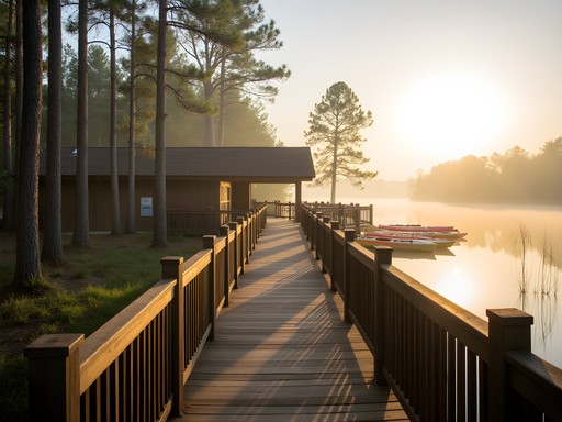
Exploring by Water: Chesapeake's Maritime Roots
For a truly authentic Chesapeake experience, don't overlook the waterways themselves as transportation options. While not practical for daily commuting as a visitor, exploring by boat offers perspectives you simply can't get from land.
During my stay, I spent a memorable day with Chesapeake Boat Tours exploring the historic Dismal Swamp Canal—the oldest continually operating artificial waterway in America. As an engineer, I was fascinated by how this 18th-century infrastructure project continues to function effectively, connecting the Chesapeake Bay to Albemarle Sound in North Carolina.
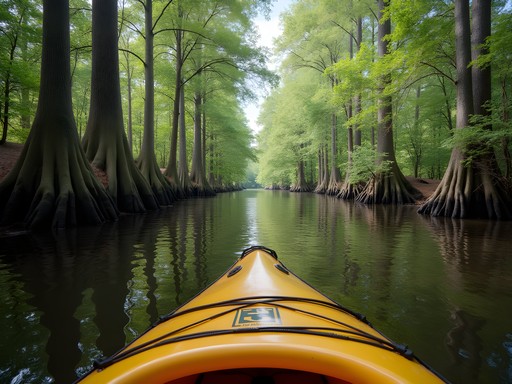
For solo travelers interested in self-guided exploration, kayak and paddleboard rentals are widely available. I rented a stable recreational kayak from Wild River Outfitters to explore the protected waters of the Northwest River. The waterproof phone case I brought proved essential for keeping my navigation tools and camera dry while capturing the abundant wildlife and cypress trees along the shoreline.
For those interested in maritime history and engineering, I highly recommend timing your visit to witness the Great Bridge Lock in operation. This fascinating piece of infrastructure manages the water level difference between the Elizabeth River and the Albemarle and Chesapeake Canal. The lock tender's house contains historical information, and watching vessels transit through is a reminder of how engineering solutions have facilitated commerce and travel for generations.

💡 Pro Tips
- Reserve boat tours at least 48 hours in advance during spring season
- Bring polarized sunglasses to reduce glare when on the water—the polarized sunglasses are perfect for water activities
- Visit the Great Bridge Lock around midday when boat traffic is typically highest
Biking Chesapeake: An Emerging Option
While Chesapeake isn't traditionally known as a cycling destination, recent infrastructure improvements have made biking a viable option for exploring certain areas. As someone who appreciates both the engineering of good cycling infrastructure and the sustainability of human-powered transportation, I was eager to test these routes.
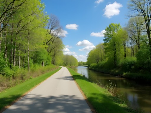
The Dismal Swamp Canal Trail stands out as the crown jewel for cyclists. This 8.5-mile paved path follows the historic waterway, offering a flat, car-free route perfect for casual riders. I rented a comfortable hybrid bike from Bike Norfolk and spent a delightful morning pedaling alongside the canal, spotting turtles sunning themselves on logs and herons stalking the shallows.
The Great Bridge Battlefield area also offers some bike-friendly pathways, though these are more limited in scope. For serious cyclists, the roads of southern Chesapeake become progressively more rural and suitable for road biking, with decreasing traffic as you head toward the North Carolina border.
Before setting out, I made sure to pack my bike multi-tool for any quick adjustments and a insulated water bottle to stay hydrated in the spring sunshine. One engineering observation: the drainage systems along the Dismal Swamp Canal Trail are particularly well-designed, meaning the path dries quickly after rain—a thoughtful detail that extends the usability of this recreational infrastructure.

💡 Pro Tips
- The Dismal Swamp Canal Trail has limited shade—apply sunscreen generously even in spring
- Download the TrailLink app for offline access to bike path maps
- Bring insect repellent for early morning or evening rides when bugs are most active
Final Thoughts
Navigating Chesapeake requires adapting to its unique geography—where water and land create a transportation puzzle that's been centuries in the solving. As an engineer, I found myself admiring how both historical and modern infrastructure have responded to these natural challenges. For solo travelers, the freedom of a rental car offers the most comprehensive experience, but don't miss the opportunity to explore by water and discover the maritime heritage that gives this region its character.
What struck me most was how the transportation networks here tell the story of the community—from colonial canal builders to modern highway engineers, each generation has found ways to connect these disparate lands divided by water. The next time you find yourself waiting at a drawbridge as a sailboat passes beneath, remember that you're witnessing the delicate balance between land and water transportation that has defined Chesapeake for centuries. ¡Buen viaje, amigos! May your journeys through this fascinating coastal Virginia city be as rewarding as mine.
✨ Key Takeaways
- Renting a car provides the most flexibility for exploring Chesapeake's widespread attractions
- Public transit exists but is limited—plan accordingly if not driving
- Water-based transportation offers unique perspectives unavailable by road
- Spring is ideal for exploring both land and water routes with comfortable temperatures
- Understanding the city's waterway-divided geography is essential for efficient navigation
📋 Practical Information
Best Time to Visit
Mid-April to early June
Budget Estimate
$800-1200 for a week including car rental
Recommended Duration
5-7 days
Difficulty Level
Moderate


Comments
explorezone
If you're visiting during warmer months, don't miss the Chesapeake Jubilee! We stumbled upon it last year - great local food, music and you can reach it easily from most parts of the city. Just make sure to arrive early for parking as it gets packed!
dreammaster
Love your photos of the South Norfolk Jordan Bridge! Such a cool structure.
Frank Garcia
As a backpacker used to relying on public transportation, Chesapeake was definitely a challenge! I ended up renting a bicycle for part of my stay which was a decent compromise - the Dismal Swamp Canal Trail was perfect for cycling. For those trying to minimize car usage, I found staying near Greenbrier Mall gave access to the most bus routes. The #15 bus connects to Norfolk's more comprehensive transit system. That said, Elizabeth is right that a car rental opens up so much more. The water taxi from Portsmouth to Norfolk was a fun transportation alternative too - gives you that connection to the water that makes this region special.
Claire Hawkins
This brought back wonderful memories of our family trip to Chesapeake last year! We rented a minivan for our family of five and it was definitely the right call. One tip I'd add - the Great Bridge Lock Park was a hit with our kids. We packed a picnic and watched boats go through the lock system. My 7-year-old was fascinated! We also took a sunset cruise on the American Rover sailing ship from nearby Norfolk - not technically in Chesapeake but easily accessible if you have a car. The kids still talk about 'helping' the crew raise the sails! Elizabeth, did you get a chance to explore any of the parks along the Intracoastal Waterway?
Jean Wells
Elizabeth, your observations about the transportation infrastructure align perfectly with my own experience visiting the Hampton Roads region last spring. The car dependency is quite pronounced compared to more transit-oriented cities. I found that having a vehicle allowed me to explore the interconnected waterfront communities at my own pace—Great Bridge, Deep Creek, and the South Norfolk area you mentioned. The bridge-tunnel systems are fascinating from an engineering perspective. One suggestion: visitors should factor in extra time for bridge openings if traveling during boating season. I was delayed 20 minutes waiting for the Dominion Boulevard drawbridge, which was initially frustrating but gave me time to observe the maritime traffic patterns you described so beautifully.
Elizabeth Fields
Jean, excellent point about the drawbridge delays! I should have emphasized that more. It's such a unique aspect of navigating this area—you really do need to build buffer time into your schedule. The maritime traffic always takes priority, which makes sense given the region's history.
hikingninja
So basically you need a car? No way to get around without one?
Elizabeth Fields
Pretty much, yeah. The bus system exists but it's really limited and doesn't hit most of the interesting spots. I'd definitely recommend renting a car if you want to explore beyond the immediate downtown area.
hikingninja
ok thanks!
coolwalker
Just got back from Chesapeake and this post was spot-on about needing a car. We tried using the HRT buses for a day and ended up wasting hours waiting. Rented a car the next morning and had a much better experience. The South Norfolk Jordan Bridge view was worth the drive alone! Also took your advice about exploring by water and rented kayaks at Northwest River Park - highlight of our trip!
sunsetlegend
Anyone know if Uber/Lyft is reliable in Chesapeake? Wondering if that could be an alternative to renting a car for a weekend trip.
explorezone
Used both when I was there in October. They work in the more populated areas but wait times can be long (15-20 mins). If you're just staying in one area it might work, but if you want to explore the region, definitely rent a car.
Hayden Butler
Elizabeth, this brought back memories of my visit last spring. I stayed at the Founders Inn and the concierge arranged a private boat tour through the waterways - absolutely magical at sunset. You're spot-on about needing a car though. I picked up a luxury sedan from the airport and it made all the difference. The region's beauty really unfolds when you can meander between the historic sites and waterfront restaurants at your own pace. That South Norfolk Jordan Bridge you mentioned? Stunning at golden hour.
Kimberly Murphy
Elizabeth, fantastic breakdown of transportation options! I visited Chesapeake last autumn and completely agree about renting a car. I'd add that exploring the Dismal Swamp Canal by kayak was one of my highlights - such a unique perspective of the area! For anyone planning a visit, I'd recommend setting aside at least half a day for this. The visitor center rents kayaks and canoes, and the staff are incredibly knowledgeable about the history and ecology. Also used my waterproof phone case which was a lifesaver for taking photos from the water!
dreammaster
How difficult is the kayaking there for beginners?
Kimberly Murphy
Super beginner-friendly! The canal is calm and there are easy routes the staff can recommend. Definitely worth trying even if you're new to kayaking!
Venture X
Premium card with 2X miles, $300 travel credit, Priority Pass