


Disclosure: This article contains affiliate links. We may earn a commission from purchases at no extra cost to you, which helps our travel content.
I'll admit, when I first landed at LAX with plans to explore Los Angeles entirely by public transit, my friends back in London thought I'd lost it. LA without a car? But here's what I discovered during my week navigating the sprawling metropolis: not only is it possible, it's actually a more authentic way to experience the city's layered cultural landscape. You'll see street art I'd have missed from a freeway, stumble upon hidden taco stands near Metro stops, and save enough money to actually enjoy what LA has to offer.

Understanding LA's Metro System: Your Foundation
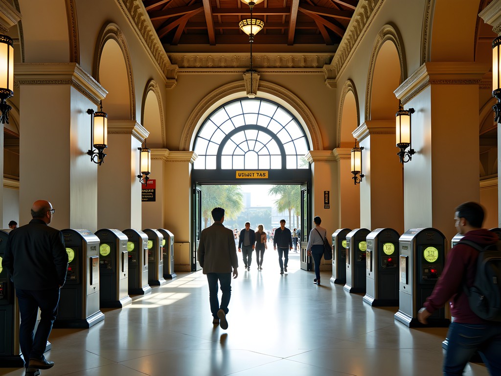
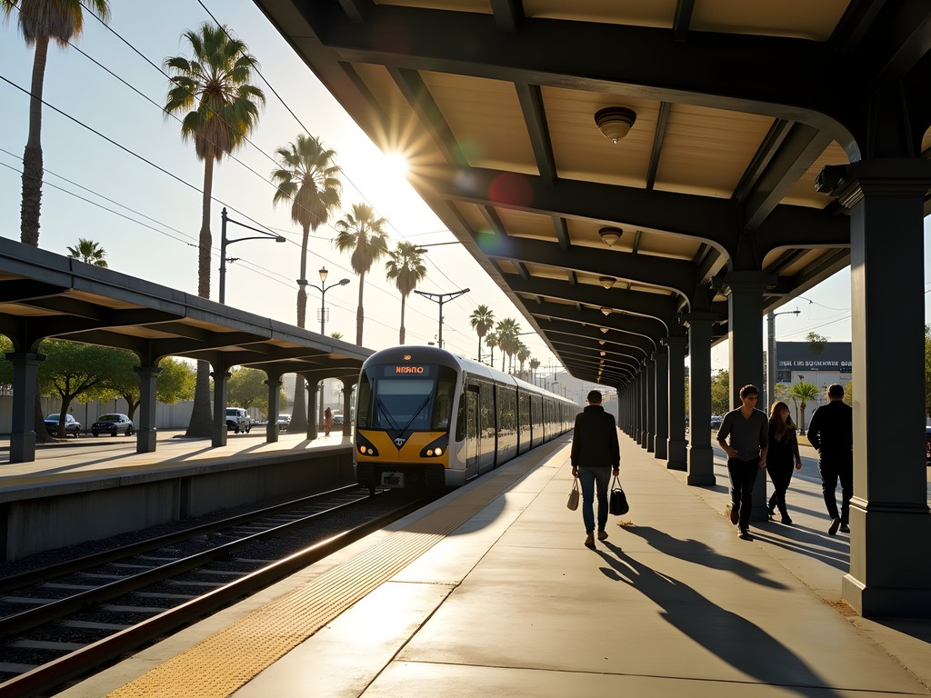
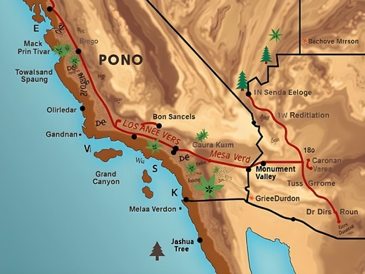
The Metro Rail network has six lines—Red, Purple, Blue, Expo, Gold, and Green—that connect more of the city than most people realize. I spent my first morning at Union Station (itself a stunning example of Spanish Colonial Revival architecture worth photographing) studying the system map like a design blueprint. The key insight? LA's transit works on a hub-and-spoke model rather than the dense grid I'm used to in London.
Your essential tool is the TAP card, a reloadable smart card that works across Metro Rail, Metro Bus, and several municipal systems. At $1.75 per ride with free transfers within two hours, it's remarkably affordable. I loaded mine with a 7-Day Pass for $25—absolute bargain considering I was making 4-5 trips daily. You can grab one at any Metro station vending machine, and I'd recommend getting a RFID-blocking card holder to keep it protected alongside your credit cards; LA's crowded trains during rush hour made me grateful for that small security measure.
💡 Pro Tips
- Download the Transit app before arriving—it's more accurate than Google Maps for LA's system
- Avoid rush hours (7-9am, 4-7pm) on the Red and Purple lines if possible
- Keep your TAP card in an easily accessible pocket; turnstiles move quickly and locals get impatient
Strategic Route Planning: Connecting the Dots
Here's where my UX design background became unexpectedly useful—I approached LA's transit like designing a user journey. The Metro Rail gets you to major destinations, but the real magic happens when you layer in Metro Rapid buses (the red ones) and municipal lines.
For a typical day, I'd take the Red Line from Hollywood/Vine to Downtown, switch to the Expo Line toward Santa Monica, then catch the Big Blue Bus for final destinations along the coast. The trick is understanding that LA's neighborhoods are like separate villages, and you're connecting between them rather than moving through continuous urban fabric. I kept a small portable phone charger in my daypack since I was constantly checking routes and photographing signage—there's incredible typographic diversity in LA's transit wayfinding that I documented throughout the week.
The Gold Line became my favorite for pure visual interest, running through neighborhoods where you'll see everything from street murals in Boyle Heights to the architectural gems of South Pasadena. I'd position myself by the window with my headphones and just observe—it's like watching the city's cultural layers unfold in real-time.
💡 Pro Tips
- Screenshot your route before descending into subway stations where signal gets spotty
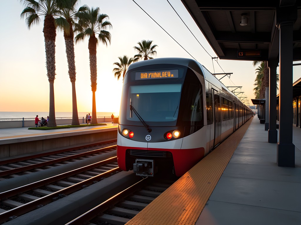
- The Expo Line to Santa Monica takes 48 minutes from Downtown—factor this into sunset timing
- Bus stops in LA often lack shelter; bring a sun hat for extended waits
Neighborhood Access: Where Transit Actually Takes You
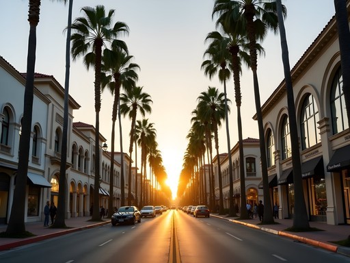
Let me be honest about limitations: Beverly Hills, Malibu, and Griffith Observatory require creative solutions. But here's what works brilliantly—Downtown LA (Arts District, Grand Central Market, The Broad), Hollywood (Red Line drops you right at Hollywood/Highland), Koreatown (Purple Line), Santa Monica and Venice (Expo Line plus short bus/bike), Pasadena (Gold Line), and Long Beach (Blue Line).
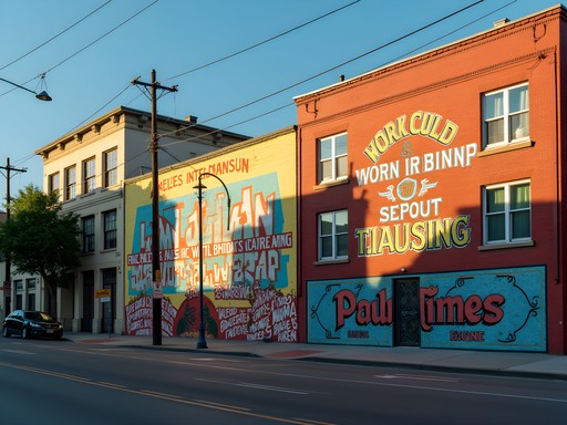
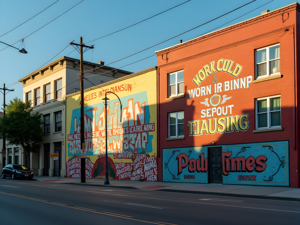
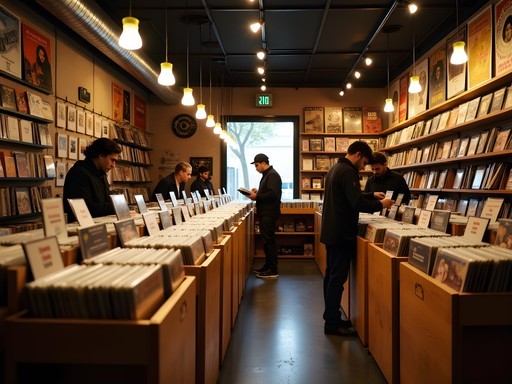
I spent an entire day in the Arts District, accessible via the Gold Line to Little Tokyo/Arts District station. The neighborhood's transformation into a street art mecca means every corner offers something to photograph. I found myself most captivated by the layered typography—old painted signage bleeding through new murals, creating accidental palimpsests that speak to LA's constant reinvention.
For destinations slightly off the grid, I used a combination of Metro Bike Share (accessible with TAP card) and ride-sharing for the last mile. The bike share stations cluster around transit hubs, and I'd often ride from the Metro stop to my final destination, which added maybe $3-5 to my daily budget but saved significant time. Pro tip: download the Metro Bike Share app separately; it's clunky but necessary.
💡 Pro Tips
- The Red Line to Universal City station connects to a free shuttle up to Universal Studios
- For Griffith Observatory, take Red Line to Vermont/Sunset, then DASH Observatory shuttle ($0.50)
- Arts District is best explored on foot—give yourself 3-4 hours minimum

Practical Survival Tips: What They Don't Tell You
LA's transit culture operates differently than London or even New York. Trains run every 8-20 minutes depending on line and time, so missing one isn't catastrophic, but evening service thins out considerably after 9pm. I learned to check last train times religiously—nothing worse than being stranded in Downtown at midnight.
Safety-wise, use common sense. I rode trains at all hours and never felt genuinely unsafe, but I stayed alert, kept valuables concealed, and positioned myself in moderately crowded cars rather than empty ones. The Metro has security presence, but it's inconsistent. Some stations, particularly in Downtown, attract significant homeless populations—approach with empathy rather than fear, and you'll be fine.
Temperature management became unexpectedly important. Trains blast air conditioning while waiting at outdoor platforms in 85°F heat means you're constantly adjusting layers. I kept a lightweight merino wool shirt in my pack—it regulated temperature brilliantly and didn't develop that transit-funk smell even after daily wear. Also, invest in a refillable water bottle; LA's heat is no joke, and you'll want to stay hydrated during platform waits.
💡 Pro Tips
- Download offline maps in Google Maps for each neighborhood you're visiting
- Bathrooms are scarce in Metro stations; plan accordingly at major stops like Union Station
- Bring earbuds—transit rides are long, and you'll want your own soundtrack
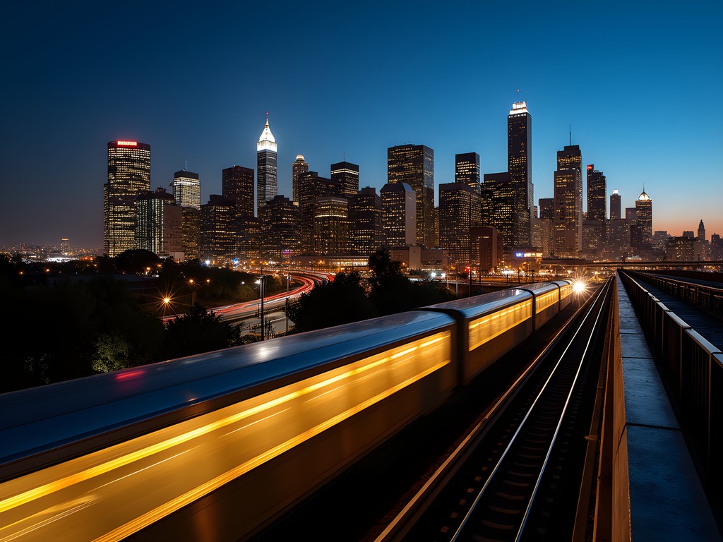
Night Transit and Evening Photography
Here's where my astronomy background intersects with urban transit—LA's light pollution creates this incredible amber glow that transforms the city after dark. The Metro runs until around midnight on most lines (later on weekends), and I found evening rides offered the most interesting photographic opportunities.
The Red Line through Hollywood at night becomes a moving gallery of LA archetypes—club-goers, service workers heading home, tourists clutching their Hollywood Boulevard souvenirs. I'd position myself by the window and shoot reflections, using the train's motion to create intentional blur that captured the energy better than any sharp image could.
For actual night photography at destinations, the Expo Line to Santa Monica puts you at the pier for sunset and blue hour—though you'll want to catch the train back before the crowds thin out too much. I also discovered that Downtown's Grand Park, accessible via Red/Purple Line to Civic Center, offers surprisingly good views of the city lights with minimal light pollution interference. Not dark sky territory by any means, but you can make out major constellations and the occasional planet if you know where to look.
💡 Pro Tips
- Evening trains are less crowded but run less frequently—check schedules carefully
- The Santa Monica Pier is magical at dusk but gets cold quickly; bring layers
- Union Station at night is architecturally stunning and well-lit for photography
Final Thoughts
Navigating LA without a car isn't just possible—it's a fundamentally different way of experiencing a city that's usually seen through windshields at 65mph. You'll move slower, see more, and interact with the actual fabric of Los Angeles rather than just its postcard destinations. My week on transit cost me roughly $100 total (7-day pass plus occasional bike shares and strategic ride-shares), compared to what I'd have spent on rental car, parking, and gas.
The real revelation wasn't about transportation logistics—it was about pace. When you're dependent on transit schedules, you're forced to slow down, to sit with a neighborhood for a few hours rather than checking it off a list. You'll have conversations at bus stops, discover hole-in-the-wall restaurants near Metro stations, and see the Los Angeles that actually lives here rather than the one designed for tourists.
Is it perfect? No. Will you occasionally wait 15 minutes in the heat for a delayed bus? Absolutely. But you'll also have the budget left over to actually enjoy Grand Central Market, catch a show at the Hollywood Bowl, or invest in experiences rather than transportation infrastructure. And isn't that the point of travel—to experience rather than just transit through?
✨ Key Takeaways
- LA's Metro system is more extensive than its reputation suggests—six rail lines connect major neighborhoods efficiently
- Budget $25 for a 7-day TAP pass plus $50-75 for occasional bike shares and strategic ride-shares
- Success requires planning—download Transit app, check last train times, and embrace a slower pace of exploration
📋 Practical Information
Best Time to Visit
Year-round (avoid summer heat peaks in July-August if heat-sensitive)
Budget Estimate
$100-150 for one week of comprehensive transit access
Recommended Duration
Minimum 5 days to properly explore via transit; 7-10 days ideal
Difficulty Level
Moderate


Comments
freeace
Going there next month! Can you actually get to Griffith Observatory on public transit or is that a no-go?
Adam Nichols
There's a DASH bus that goes up there on weekends, but it's limited hours. Weekdays you'd need to take a bus partway and either walk uphill (brutal) or rideshare the last bit. Some spots in LA just aren't transit-friendly unfortunately.
starone
As someone who lives in LA, I'm impressed you made this work! Most locals won't even attempt it. The Metro is actually pretty clean and safe during the day. My only advice would be to avoid the red line after 9pm and always have a backup rideshare budget for those late nights when buses stop running. Also the TAP card is essential—don't try to figure out exact change every time.
freeace
TAP card saved my life when I visited last year lol
wandernomad
How long did it take you to get from Santa Monica to downtown? Thinking about doing this but worried about wasting time on buses
Frank Garcia
Not Paul but I did this route last summer—took about 90 minutes with the Expo Line. Honestly not terrible if you're not in a rush. Bring a book or download some podcasts.
hikingvibes
Love this perspective!
smartvibes
Wait this is actually possible?? Always thought LA was impossible without a car!
Adam Nichols
It's definitely challenging compared to European cities, but Paul's right that it forces you to experience neighborhoods differently. I spent 4 days in LA last year using only Metro and buses—you just need to be strategic about which areas you prioritize.
smartvibes
ok good to know! might actually try this
Venture X
Premium card with 2X miles, $300 travel credit, Priority Pass