


Disclosure: This article contains affiliate links. We may earn a commission from purchases at no extra cost to you, which helps our travel content.
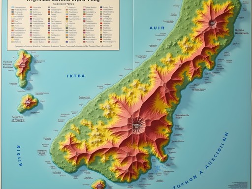
As someone who first fell in love with New Zealand during my MBA study abroad program, returning to Auckland's volcanic landscape feels like reconnecting with an old friend. The city's unique geography – built on and around 48 volcanic cones – creates a playground for hikers seeking both urban adventure and natural wonder. Having methodically explored these formations over multiple trips, I've compiled this guide based on data-driven research and personal experience hiking these trails solo. Auckland's volcanic field offers something truly special: the rare opportunity to witness a city built around dormant volcanoes, each offering its own perspective on the harbor, skyline, and surrounding islands. While the volcanic field has been dormant for over 600 years, the geological features remain dramatic and accessible, making these seven hikes perfect for intermediate hikers with limited time and budget.

Mount Eden (Maungawhau): The Classic First Hike
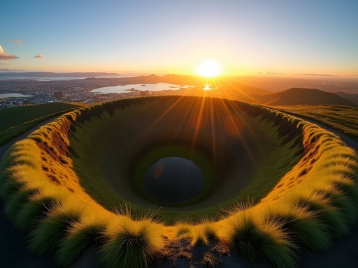
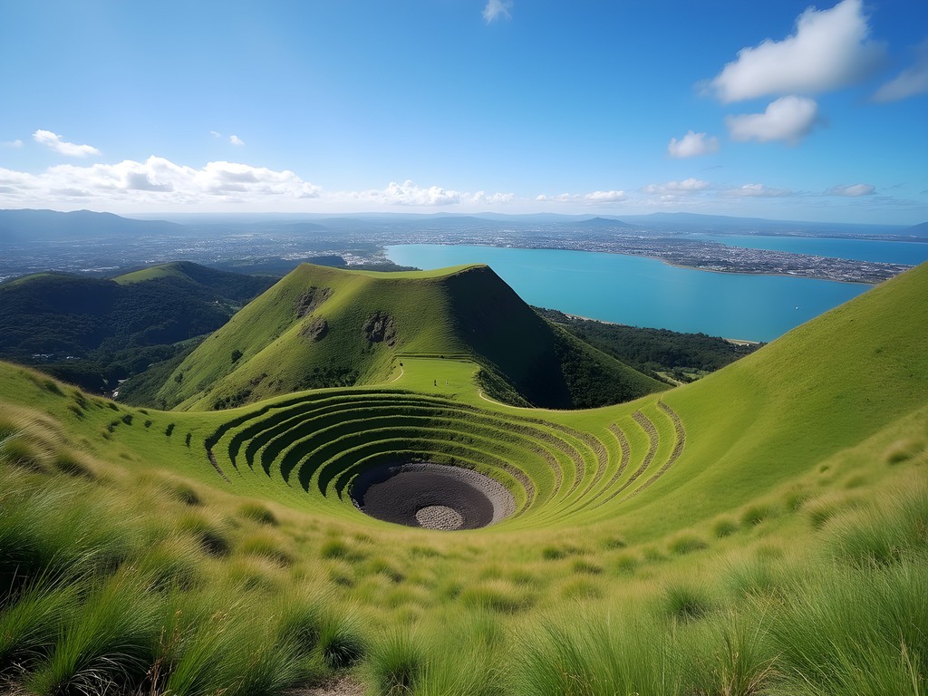
Mount Eden (Maungawhau) stands as Auckland's highest natural point at 196 meters and offers what I consider the perfect introduction to the city's volcanic landscape. The 50-meter deep crater – perfectly preserved and sacred to Māori – provides a sobering reminder of the powerful forces that shaped this land.
My first visit to Maungawhau came during my initial New Zealand trip as a risk-averse MBA student looking for something 'safe' to explore. What I discovered was a perfectly accessible 2km loop trail that delivers stunning payoffs with minimal investment. The paved pathway winds gradually upward, making this suitable even for those with moderate fitness levels.
The panoramic views from the summit are truly spectacular – a 360-degree vista encompassing the harbor, Rangitoto Island, and the entire city skyline. I've found sunrise to be the optimal time for both photography and contemplation, as the golden light illuminates the crater and city below. The morning hours also mean fewer tourists and more opportunities to hear native birds like the tūī and kererū.
As a risk manager who appreciates proper preparation, I always carry my hydration pack on these hikes. Auckland's weather can change rapidly, and staying properly hydrated is essential even on what seems like a short urban hike.

💡 Pro Tips
- Visit at sunrise for the best lighting and fewest crowds
- Take the eastern approach for a more gradual ascent if you have knee issues
- Respect the crater rim by staying on marked paths – the crater floor is sacred to Māori
Rangitoto Island: The Ultimate Volcanic Experience
While technically requiring a short ferry ride, no discussion of Auckland's volcanic hikes would be complete without Rangitoto Island. As the youngest and largest volcanic cone in the Auckland field (erupting just 600 years ago), Rangitoto offers the most dramatic and comprehensive volcanic experience available.
The symmetrical cone rising from the Hauraki Gulf creates an unmistakable silhouette visible from most Auckland vantage points. During my second visit to New Zealand, I blocked an entire day for this adventure – a decision I've never regretted. The 25-minute ferry ride from downtown Auckland (approximately NZ$39 return) provides spectacular harbor views before depositing you on the island's black sand shores.
The Summit Track (2.4km each way) traverses fascinating lava fields where you'll witness the pioneering pohutukawa trees that have somehow taken root in the harsh volcanic rock. The contrast between black lava rock and vibrant red pohutukawa flowers (if you visit during December) creates a photographer's dream.
As an experienced backpacker who values proper footwear, I strongly recommend wearing sturdy hiking shoes for this terrain. The sharp, uneven lava rock can be treacherous in regular sneakers, and I've witnessed many unprepared tourists struggling with inappropriate footwear.
The summit crater view is magnificent, but don't miss the detour to explore the lava caves on your descent. Bringing a headlamp allows you to venture safely into these fascinating geological formations – just be sure to duck your head if you're tall like me (I learned this lesson the hard way).

💡 Pro Tips
- Bring all necessary food and water – there are no shops on the island
- Check the ferry schedule carefully – missing the last ferry means an uncomfortable night on the island
- Take the detour to the lava caves but bring a headlamp or flashlight
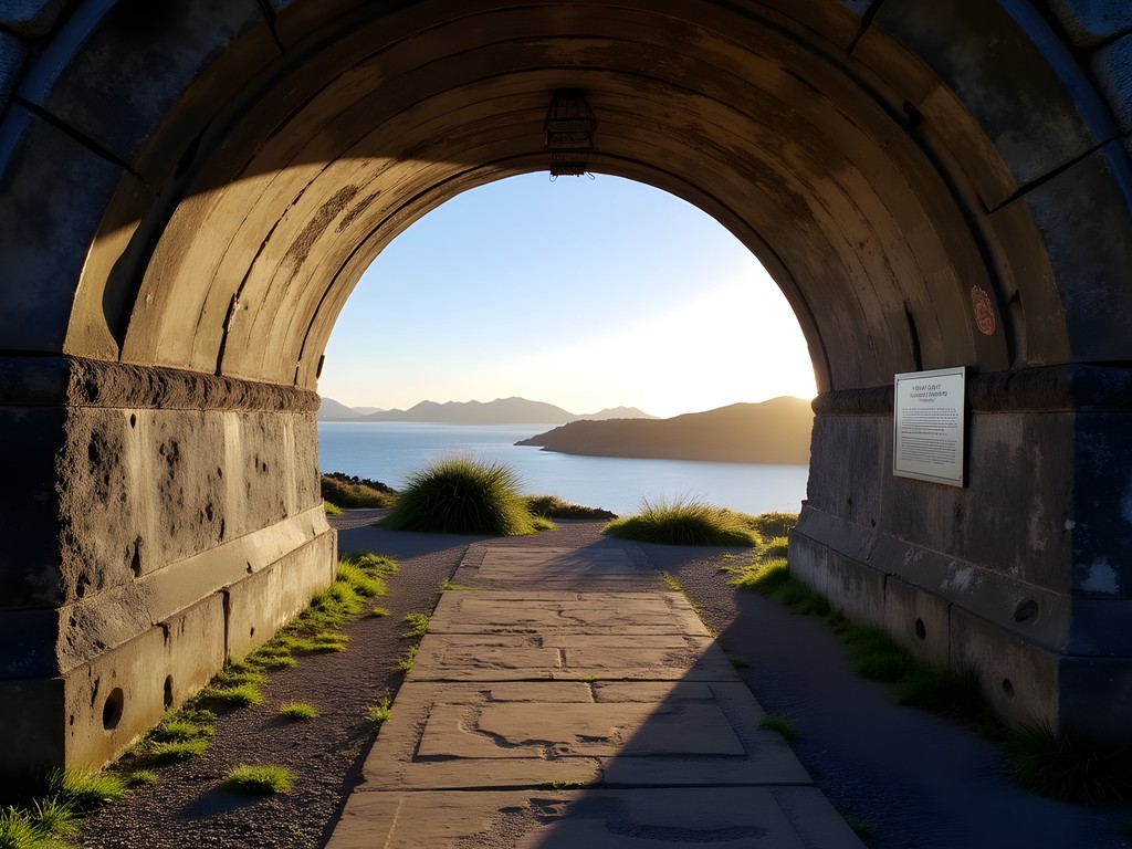
North Head: Volcanic History Meets Military Heritage
North Head (Maungauika) in Devonport offers a fascinating blend of natural volcanic formation and military history. This 2-3 hour exploration ranks among my favorite half-day activities when I'm seeking both exercise and education.
The volcanic cone has been extensively modified over the years for military purposes, with a network of tunnels, gun emplacements, and fortifications dating back to the 1880s. As someone who appreciates the intersection of natural and human history, I find this site particularly compelling.
Access to North Head is straightforward – either drive to Devonport or take the ferry from downtown Auckland (approximately NZ$14 return). From the Devonport wharf, it's a pleasant 15-minute walk along the waterfront to reach the base of the hill.
The network of trails crisscrossing North Head offers multiple perspectives of the harbor, ranging from sweeping panoramas to intimate coves. I've found that methodically exploring each trail and tunnel system provides the most comprehensive experience. The summit offers spectacular views of Rangitoto Island, the harbor bridge, and the Auckland skyline.
During my last visit, I was grateful for my compact binoculars which allowed me to spot passing marine life in the harbor and examine distant landmarks in detail. For the photography enthusiasts, the late afternoon light bathes the Auckland skyline in a golden glow that's particularly photogenic from this vantage point.
💡 Pro Tips
- Download the Department of Conservation's North Head guide before visiting for historical context
- Bring a flashlight to explore the tunnels safely – some sections have limited lighting
- Visit on weekdays to avoid weekend crowds from cruise ships

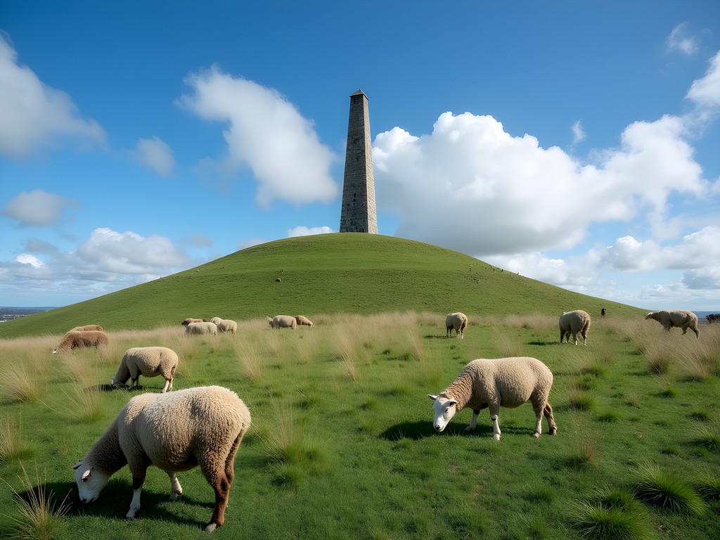
One Tree Hill (Maungakiekie): Cultural Significance and Pastoral Beauty
One Tree Hill (Maungakiekie) stands as one of Auckland's most culturally significant volcanic cones and offers a more expansive hiking experience within the beautiful surroundings of Cornwall Park. The 182-meter summit provides excellent views while the surrounding parkland creates a perfect half-day adventure.
As an experienced backpacker who values understanding cultural context, I was particularly moved by the significance of Maungakiekie to Māori history. This was once the largest and most important Māori pā (fortified settlement) in the region, home to over 5,000 people. The obelisk at the summit commemorates both Māori and European heritage.
The hike to the summit takes approximately 40 minutes at a moderate pace, following graded paths through Cornwall Park's pastoral landscapes. Unlike some of Auckland's other volcanic cones, One Tree Hill offers a more gradual ascent, making it accessible to hikers of varying abilities.
What makes this hike unique is the juxtaposition of volcanic geography with a working farm – don't be surprised to find yourself sharing the trail with grazing sheep! The stone walls and mature trees throughout the park create numerous photography opportunities, particularly in the golden hours of early morning or late afternoon.
After several visits to One Tree Hill across different seasons, I've found spring to be the optimal time, when the new lambs are present and the gardens are beginning to bloom. The expansive grounds make this an excellent place to enjoy a picnic after your hike – something I highly recommend.
💡 Pro Tips
- Visit the information center at the base to understand the site's cultural significance
- Allow extra time to explore the adjacent Cornwall Park gardens
- The summit can be windy – bring an extra layer even on warm days
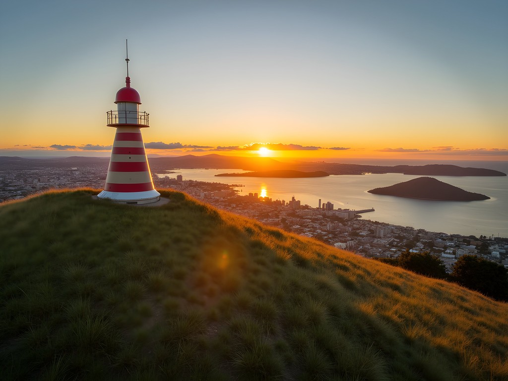
Mount Victoria (Takarunga): The Perfect Sunset Hike
Mount Victoria (Takarunga) in Devonport offers what I consider the perfect late-afternoon hike, culminating in spectacular sunset views across the harbor to Auckland's skyline. At just 87 meters high, this is one of the more accessible volcanic cones, but what it lacks in elevation it makes up for in charm and perspective.
I first discovered Takarunga quite by accident during my initial New Zealand trip. After exploring Devonport's charming shops and cafes, I noticed the distinctive hill with its colorful mushroom-shaped painted ventilation shafts (remnants of its use as a military observation post) and decided on a whim to make the climb.
The ascent takes just 10-15 minutes via residential streets and a well-maintained path. While less dramatic than some of Auckland's other volcanic cones, Mount Victoria offers perhaps the most picturesque view of the harbor, with Rangitoto Island perfectly framed against the city skyline.
As a risk manager who values efficiency, I appreciate how this hike can be easily combined with a visit to North Head and Devonport's charming commercial district for a perfect day trip from Auckland. The ferry from downtown Auckland (approximately NZ$14 return) makes this easily accessible without a car.
For photography enthusiasts, I recommend timing your visit for the golden hour before sunset. The changing light on the harbor and city creates magical opportunities for landscape photography. My travel tripod has proven invaluable for capturing these low-light scenes without sacrificing image quality.
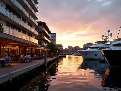
After enjoying the sunset, you can easily descend in time for dinner at one of Devonport's excellent restaurants – the perfect way to conclude your volcanic exploration.
💡 Pro Tips
- Combine with North Head for a comprehensive Devonport volcanic experience
- Check ferry schedules in advance if planning a sunset visit to ensure return transportation
- The colorful mushroom ventilation shafts make for unique photography subjects
Mangere Mountain: Off the Tourist Trail
Mangere Mountain represents one of Auckland's best-kept secrets – a significant volcanic cone that remains largely overlooked by tourists but offers a fascinating glimpse into both Māori history and volcanic geology. Standing at 106 meters, this well-preserved volcano features clearly visible crater formations and terraced slopes from its past as an important Māori pā (fortified village).
Located in South Auckland, approximately 15km from the city center, Mangere Mountain requires either a rental car or public transportation to access (take bus 32 from Britomart). This extra effort acts as a natural filter, keeping visitor numbers low and preserving the authentic experience.
As someone who values getting off the beaten path, I've found Mangere Mountain to offer one of the most rewarding and least crowded hiking experiences in the Auckland region. The main loop track takes approximately 1-1.5 hours to complete at a leisurely pace, with various interpretive signs explaining the geological and cultural significance of different features.
The summit offers expansive views across Manukau Harbor and the southern suburbs – a completely different perspective from the northern volcanic cones. On clear days, you can see all the way to the Waitakere Ranges in the west and the Hunua Ranges in the east.
The Mangere Mountain Education Centre at the base provides excellent context for understanding both the volcanic formation and Māori history of the area. I highly recommend beginning your visit here to fully appreciate what you'll be seeing on the hike.
The terrain can be uneven in places, so proper footwear is essential. My approach to risk management always includes appropriate gear, and I've found my hiking poles particularly useful on the steeper sections of this hike, especially after rainfall when the clay soil can become slippery.
💡 Pro Tips
- Visit the Education Centre first to understand the mountain's significance
- The eastern path offers the most gradual ascent if you have mobility concerns
- Bring binoculars to spot shorebirds in the adjacent Manukau Harbor
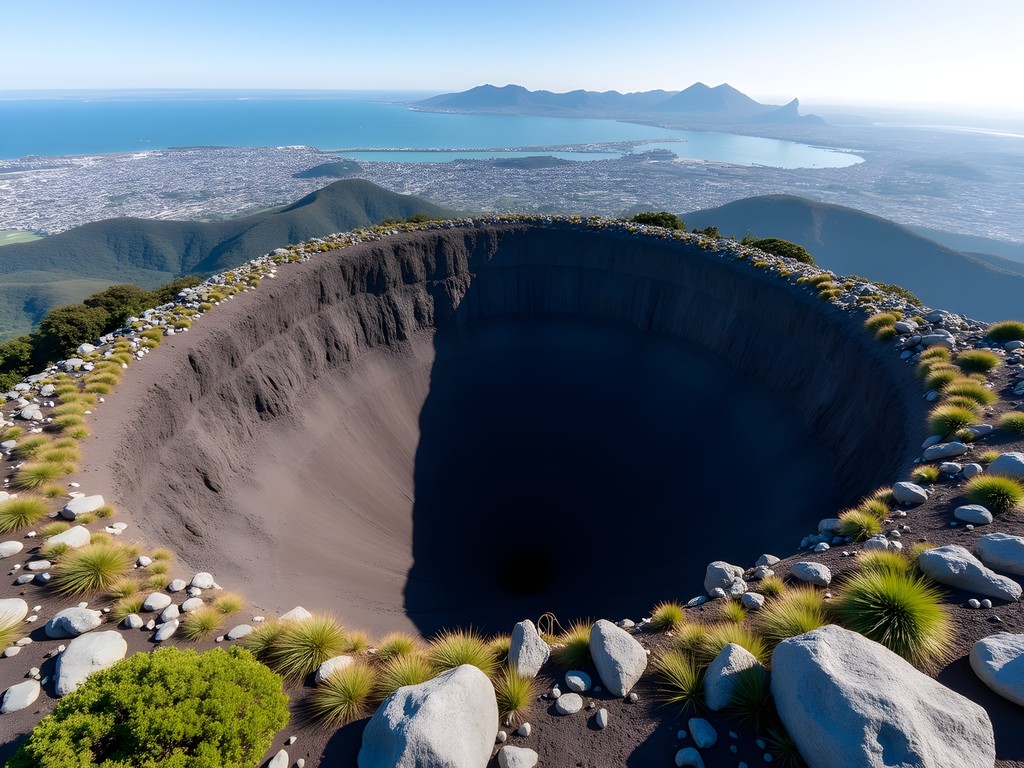
Maungarei (Mount Wellington): The Geological Wonder
Maungarei (Mount Wellington) offers perhaps the most dramatic geological features of Auckland's accessible volcanic cones. At 135 meters high with a crater 9 meters deep, this symmetrical volcano provides both an excellent workout and fascinating insights into Auckland's volcanic field.
Located approximately 10km southeast of Auckland's CBD, Maungarei is accessible via public transportation (take bus 32 from Britomart) or a short drive. The mountain is surrounded by residential neighborhoods, creating an interesting juxtaposition of natural geological wonder and suburban development.
As someone with a background in risk management, I find the geological story of Maungarei particularly fascinating. This volcano erupted approximately 10,000 years ago in a series of explosive events that created the distinctive scoria cone we see today. The evidence of these violent geological processes remains clearly visible in the exposed rock formations.
The hike to the summit takes approximately 30-40 minutes via a well-maintained but steep path. The reward is a 360-degree view encompassing both the Waitemata and Manukau harbors – a perspective that helps you understand Auckland's unique geography straddling this narrow isthmus.
During my most recent visit in spring, I was particularly struck by the contrast between the ancient volcanic landscape and the vibrant new growth of native plants being reintroduced through local conservation efforts. The mountain is undergoing ecological restoration, with volunteers replanting native species to recreate the original forest cover.
While less visited than some of Auckland's other volcanic cones, Maungarei offers a more rugged and authentic experience. I recommend allowing 2-3 hours to fully explore the various paths and features of this impressive geological formation.
💡 Pro Tips
- The western approach offers the most gradual ascent
- Visit on weekdays to have the mountain almost entirely to yourself
- Look for the information panels explaining the geological formation process
Final Thoughts
Auckland's volcanic field offers a truly unique hiking experience – where else can you explore ancient volcanic cones within a modern urban setting? These seven hikes provide not just breathtaking views but a deeper understanding of the powerful geological forces that shaped this remarkable city. As a risk manager by profession, I've found these well-maintained trails to be accessible for intermediate hikers while still delivering substantial rewards in terms of both exercise and perspective. Whether you have just a few days or a full week in Auckland, I encourage you to incorporate at least two or three of these volcanic explorations into your itinerary. They provide not only excellent exercise and stunning photography opportunities but also a deeper connection to both the natural and cultural history of Tāmaki Makaurau Auckland. The next time you find yourself in New Zealand's largest city, lace up your hiking boots and discover the volcanic wonders hiding in plain sight.
✨ Key Takeaways
- Auckland's volcanic field offers accessible day hikes suitable for intermediate fitness levels
- Spring provides optimal hiking conditions with moderate temperatures and blooming vegetation
- Each volcanic cone offers a unique perspective on Auckland's geography and history
- These hikes can be done on a budget using public transportation and packing your own supplies
📋 Practical Information
Best Time to Visit
Spring (September-November) or Autumn (March-May)
Budget Estimate
$30-50 NZD per day including transportation and packed lunch
Recommended Duration
5-7 days to comfortably explore all seven volcanic hikes
Difficulty Level
Intermediate - Requires Reasonable Fitness But No Technical Skills


Comments
summerfan
Really cool post!
globehero
Is it easy to do these without a car? Visiting for a week and trying to figure out logistics
Ana Robinson
Mount Eden and One Tree Hill are super easy by bus. Rangitoto you take the ferry from downtown which is actually part of the fun. North Head you can bus to Devonport then walk. We did everything by public transport and it worked great!
freeclimber
Did North Head last weekend and honestly it was way cooler than expected. The tunnels and old military stuff add something extra you don't get at the other volcanic spots. Plus the views of the harbour are insane. Only took about an hour total so it's perfect if you're short on time.
summerfan
Can you explore the tunnels?
freeclimber
Yeah some of them are open! Bring a torch though, it gets pretty dark
summerfan
Great photos! Heading there in March
globediver
How hard is the Rangitoto hike really? I'm reasonably fit but not a hardcore hiker. Worth doing or should I stick to Mount Eden?
Ana Robinson
Rangitoto is totally doable! We did it with our 8-year-old last year. It's more about the distance than difficulty - pretty steady uphill but nothing crazy. Just bring lots of water and start early to avoid the heat. The black lava rock makes it feel hotter than it is!
globediver
Thanks! That's really helpful
Jean Wells
Having lived in Yokohama (another city built on volcanic terrain) for 20+ years, I found Auckland's volcanic cones particularly fascinating from a geological perspective. The accessibility of these formations within an urban setting is truly unique. I would add that Māngere Mountain offers a less touristed experience with equally impressive views. The cultural significance of these sites shouldn't be overlooked - I appreciated how you highlighted the Māori connections, Douglas. For those interested in the geological history, the Auckland Museum has an excellent exhibit that provides context before you embark on these hikes.
Douglas Sanders
Thank you for mentioning Māngere Mountain, Jean! You're absolutely right - it's a hidden gem that deserves more attention. And the Auckland Museum recommendation is spot-on. They have that amazing virtual eruption simulation that really helps visitors understand how the volcanic field formed.
Fatima Sims
Just got back from Auckland last week and followed your guide to the letter, Douglas! Rangitoto was the absolute highlight - that 360° view from the summit is unreal. One thing I'd add for fellow hikers: the volcanic rock gets HOT in summer, so proper hiking shoes are a must. I saw several tourists struggling in flip-flops. My hiking boots were perfect for the terrain. Also worth noting that the weather can change quickly - we started our One Tree Hill hike in sunshine and ended it in a quick shower. The volcanic soil gets surprisingly slippery when wet! Pack a light rain jacket even on sunny days. The Māori cultural significance of these sites added so much depth to our experience - definitely take time to read the information boards along the way.
travelace6815
Thanks for the tip about the shoes! Was just about to pack sandals for our trip.
Hunter Thompson
Brilliant post, Douglas! I spent 3 weeks backpacking around Auckland last year and these volcanic hikes were the highlight! One tip for anyone heading to Rangitoto - the last ferry back can fill up quickly in summer, so book your return ticket in advance. I nearly got stranded overnight! Also, the lava caves there are WILD - bring a headlamp if you have one. For those doing Mount Eden, the Kyber Pass Road side has a much gentler ascent if you're not up for a steep climb. Auckland's volcanic field is so underrated compared to the South Island attractions, but it's what makes this city special!
hikingfan3853
Is December a good time to do these hikes? Planning a trip around Christmas and wondering about weather conditions.
Douglas Sanders
December is summer in Auckland, so it's actually perfect for hiking! Temperatures are usually between 20-25°C (68-77°F). Just be prepared for sudden rain showers (they pass quickly) and wear sun protection as the NZ sun is quite strong. The longer daylight hours mean you can fit more hikes in too!
moonchamp
Those sunset pics from North Head are incredible! Added to my bucket list!
Venture X
Premium card with 2X miles, $300 travel credit, Priority Pass