
Disclosure: This article contains affiliate links. We may earn a commission from purchases at no extra cost to you, which helps our travel content.
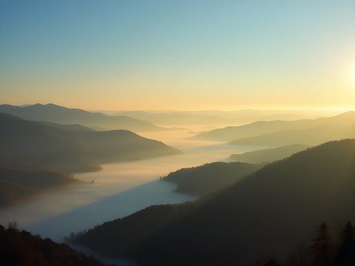
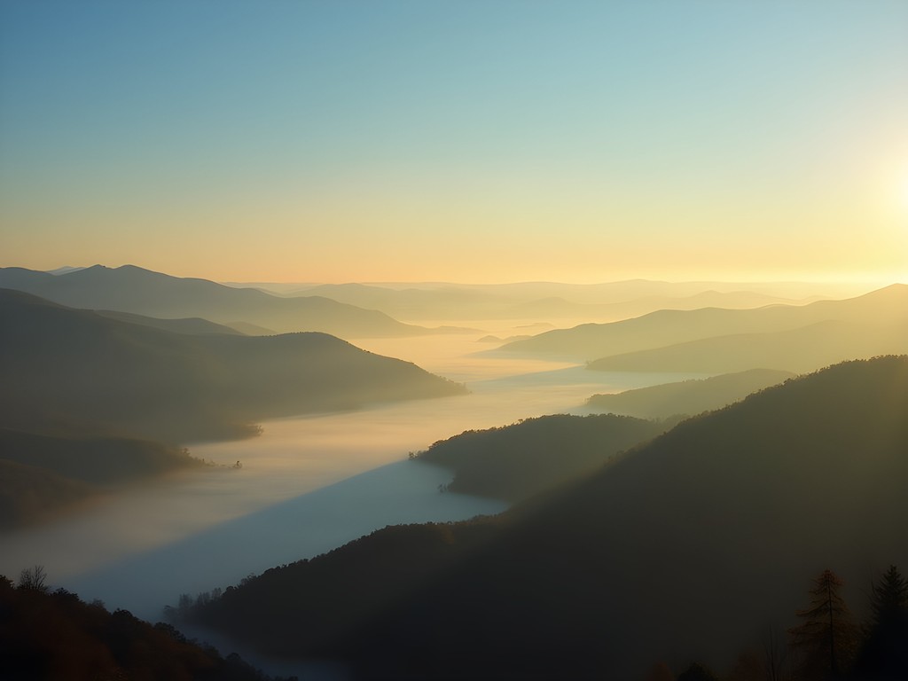
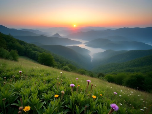
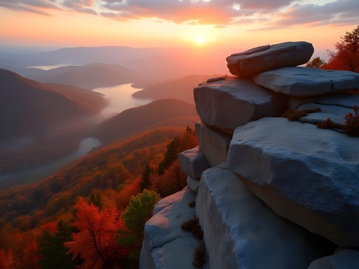
Standing at the overlook on Mill Mountain as dawn breaks over the Roanoke Valley, I'm struck by how the morning fog creates microclimates throughout the Blue Ridge Mountains. As an epidemiologist who studies environmental patterns, I find these Appalachian valleys fascinating not just for their biodiversity but for the resilient communities that have adapted to the changing climate here. This past week, I traded my lab coat for hiking boots to explore this outdoor paradise where adventure and science intersect in the most magnificent ways.

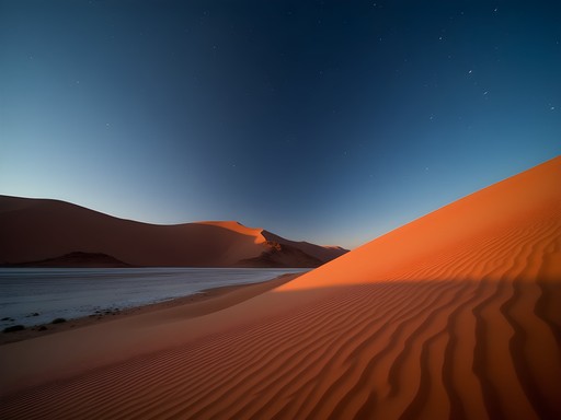
The Blue Ridge Parkway: A Meteorological Marvel
The 469-mile Blue Ridge Parkway isn't just a scenic drive—it's a living laboratory of climate adaptation. My journey began at Explore Park (milepost 115), where the visitor center provides excellent context on how the region's weather patterns have shaped both recreational opportunities and ecological challenges.
The parkway's elevation changes create distinct microclimates that support remarkable biodiversity. Hiking the Chestnut Ridge Trail here, I documented temperature variations of up to 15°F between valley floor and ridge—a phenomenon that explains why you can experience multiple seasons in a single day's adventure.
For data collection during hikes, I rely on my handheld weather meter which has proven invaluable for tracking these microclimatic shifts. The barometric pressure readings have helped me predict afternoon thunderstorms with surprising accuracy, a critical safety factor when planning ridge hikes.
💡 Pro Tips
- Start Blue Ridge Parkway hikes early to avoid afternoon thunderstorms common in summer months
- Check the parkway's real-time closure map before heading out as weather events frequently close sections
- Pack for multiple climate zones, even for short hikes—temperature variations can be extreme
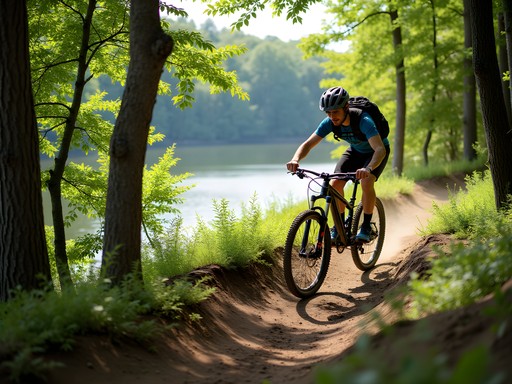
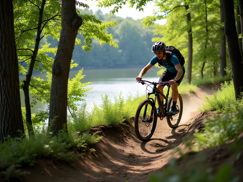
Carvins Cove: Watershed Protection Meets Mountain Biking
Carvins Cove Natural Reserve represents a fascinating case study in watershed management doubling as a recreational haven. At 12,700 acres with over 60 miles of trails, it's the second-largest municipal park in America and protects Roanoke's primary water source.
As someone who's studied water systems globally, I was impressed by how the trail system was designed to minimize erosion and protect water quality while still offering world-class mountain biking. The Gauntlet trail provides a technical descent that follows natural water drainage patterns, while the gentler Songbird Trail offers stunning reservoir views.
For hydration during long rides here, I've switched to the filtered water bottle which allows me to safely refill from streams when needed. The filtration system removes 99.99% of waterborne pathogens—critical knowledge for an epidemiologist who understands what lurks in seemingly pristine mountain water.
💡 Pro Tips
- Purchase a day pass online before arriving to avoid waiting at the limited entrance kiosks
- The Tuck-a-way trail offers the best intermediate riding experience with sustainable berms and drainage features
- Bring twice as much water as you think you'll need—the reservoir water is not treated for drinking despite appearances
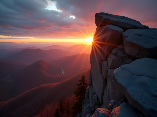
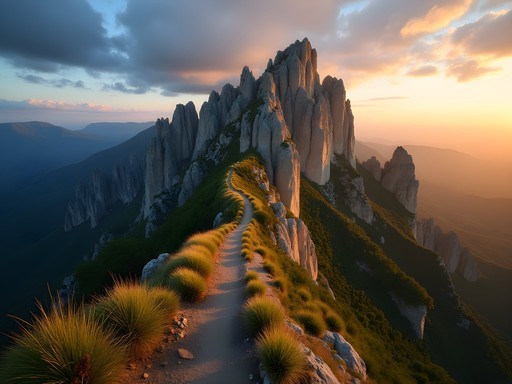
McAfee Knob: Analyzing Footpath Sustainability on the Appalachian Trail
The iconic McAfee Knob hike represents both the promise and challenges of sustainable outdoor recreation. As one of the most photographed spots on the 2,190-mile Appalachian Trail, it faces significant human impact. My 8.8-mile round-trip journey to this legendary outcrop offered insights into trail maintenance techniques that mitigate erosion in high-traffic areas.
The Appalachian Trail Conservancy has implemented innovative solutions here, including stone water bars and elevated walkways that have dramatically reduced trail degradation despite increasing visitor numbers. Having documented similar interventions in Nepal's trekking corridors, I was impressed by how these techniques have been adapted to local conditions.
For navigation and environmental data collection, I've come to rely on my GPS hiking watch which not only tracks my route but provides barometric pressure readings that help me anticipate weather changes—crucial when you're exposed on ridgelines like McAfee Knob.
💡 Pro Tips
- Use the shuttle service from the Orange Market on weekends to avoid parking challenges
- Start by 7am to avoid crowds and afternoon heat—the parking lot fills completely by 8:30am in summer
- The fire road route is less scenic but offers a more sustainable alternative when the main trail is muddy

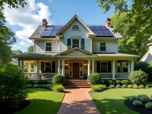
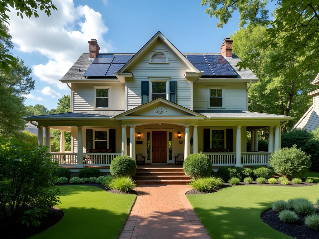
Sustainable Accommodations: Climate-Resilient Lodging in Roanoke
My research into climate-adaptive architecture has led me to seek out accommodations that demonstrate environmental resilience. In Roanoke, I discovered several options worth highlighting.
The historic Hotel Roanoke has implemented impressive water conservation systems and energy efficiency upgrades while maintaining its 1882 Tudor-style charm. Their rainwater collection system reduces runoff into the nearby Roanoke River watershed—a model for historic building adaptation.
For a more immersive experience, I spent two nights at the portable hammock camping system along the Appalachian Trail near Dragon's Tooth. This ultralight shelter allowed me to monitor nighttime temperature variations while minimizing my environmental footprint. The integrated bug net proved essential during Virginia's humid summer nights.
Most impressive was Black Lantern Inn, a B&B in nearby Roanoke that has retrofitted a 1920s home with passive solar design elements and permeable hardscaping that mitigates stormwater runoff—increasingly important as climate change brings more intense precipitation events to the region.
💡 Pro Tips
- Request south-facing rooms at Hotel Roanoke for natural heating in cooler months
- Black Lantern Inn's rooms 3 and 4 feature the most effective cross-ventilation for summer stays without AC
- If camping, choose elevated sites away from drainage paths as summer thunderstorms can cause rapid runoff
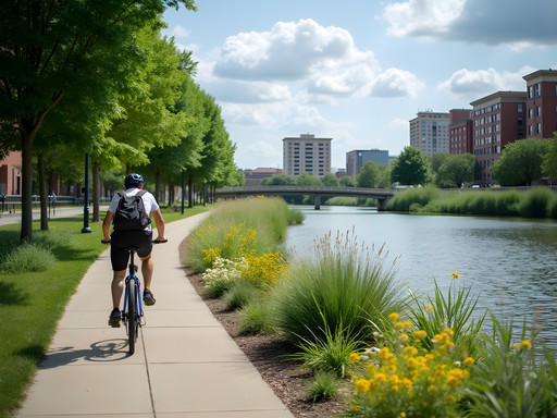
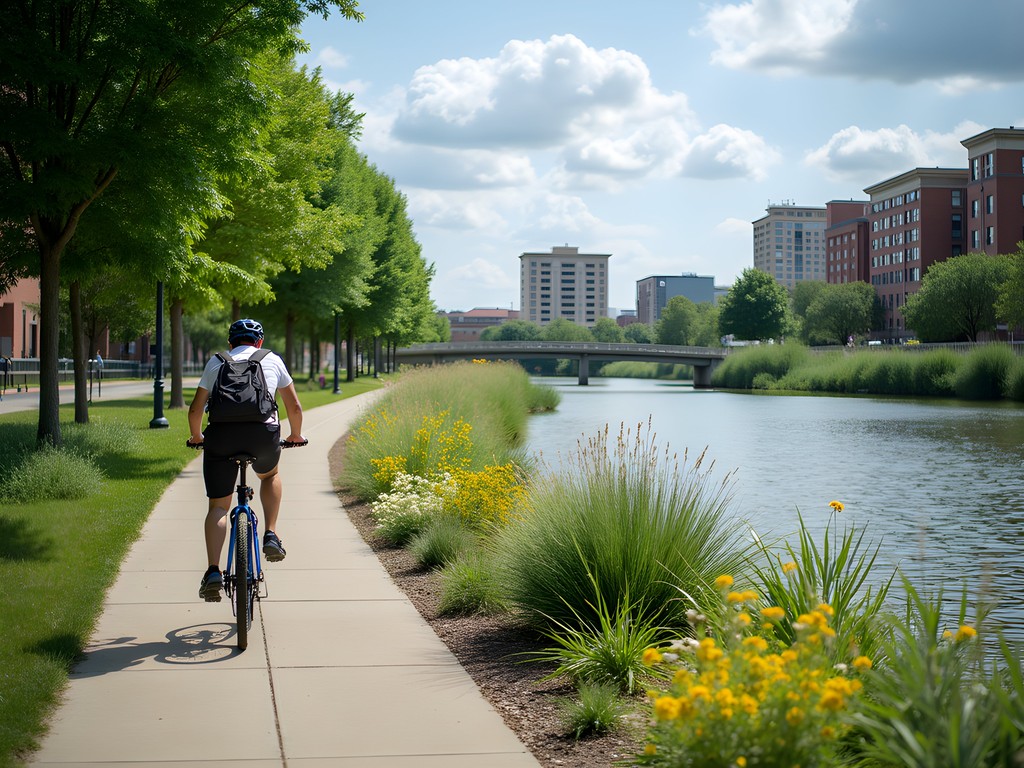
Roanoke River Greenway: Urban Flood Mitigation as Recreation
The 30-mile Roanoke River Greenway represents an ingenious approach to urban flood management doubling as recreational infrastructure. As climate change increases flooding events, cities worldwide are implementing similar projects—but Roanoke's stands out for its comprehensive integration with the urban environment.
Cycling the greenway from Wasena Park to Explore Park, I documented how the trail's permeable surfaces and adjacent rain gardens help absorb stormwater while creating habitat corridors. The system has reduced flooding impacts while providing a car-free transportation network connecting neighborhoods previously divided by the river.
For my greenway explorations, I used the packable daypack which proved perfect for carrying water, snacks, and my field equipment while being completely waterproof during an unexpected afternoon thunderstorm. Its ability to pack down to pocket-size meant I could easily stow it when stopping at riverside restaurants.
💡 Pro Tips
- The interactive flood history markers along the greenway provide fascinating context on how climate patterns have shaped the city
- Rent e-bikes from Roanoke Mountain Adventures to cover the entire greenway in a single day
- The section between Carilion Clinic and Wasena Park offers the best urban wildlife viewing opportunities
Final Thoughts
As my week in Roanoke Valley concludes, I'm struck by how this region serves as a living laboratory for climate adaptation through outdoor recreation. The integration of scientific understanding with adventure opportunities here offers valuable lessons for communities worldwide facing similar environmental challenges. From the microclimate variations along the Blue Ridge Parkway to the flood-resilient design of the Roanoke River Greenway, these outdoor spaces demonstrate how recreation and environmental resilience can reinforce each other.
For couples seeking both adventure and understanding, Roanoke offers a perfect balance of challenging activities and opportunities to witness climate adaptation strategies firsthand. As both an epidemiologist and adventure seeker, I've found few places that so seamlessly blend scientific interest with pure outdoor enjoyment. Pack your hiking boots, bring your curiosity, and prepare to experience a region where natural beauty and human ingenuity create a truly sustainable adventure landscape.
✨ Key Takeaways
- Roanoke Valley's elevation changes create distinct microclimates that offer diverse adventure opportunities within short distances
- The region demonstrates how outdoor recreation infrastructure can double as climate adaptation through thoughtful design
- Summer visits require flexible planning due to afternoon thunderstorms common in the mountain environment
- The combination of historical architecture and modern sustainability makes Roanoke ideal for couples seeking both adventure and learning opportunities
📋 Practical Information
Best Time to Visit
Late May through early October, with June offering optimal conditions
Budget Estimate
$1,200-1,800 per couple for one week including accommodations, activities and meals
Recommended Duration
5-7 days to experience the full range of activities
Difficulty Level
Moderate With Options To Scale Up Or Down Based On Fitness Level

Comments
escapeperson
Really cool photos!
Bryce Diaz
Matthew, loved your approach to this! The climate adaptation angle is fascinating. I spent three days at Carvins Cove last year and was blown away by how well they've balanced conservation with recreation. The mountain biking trails are some of the best-maintained I've seen on the East Coast. What really struck me was talking to the rangers about their watershed management practices - it's rare to find that level of environmental stewardship at a place that's so accessible to mountain bikers. Did you get a chance to ride the new trail section they opened up near the reservoir? I heard they designed it specifically to minimize erosion.
escapeperson
Carvins Cove is legit. Best trails in VA imo
Casey Andersson
Matthew, I absolutely loved reading your take on Roanoke's outdoor scene through the lens of climate adaptation. It reminded me so much of the conservation work happening around Wellington's regional parks. The comparison between McAfee Knob's trail erosion management and what we're seeing on the Te Araroa Trail is fascinating. I visited Roanoke last autumn and was genuinely impressed by how the city has balanced accessibility with environmental stewardship - something that's not always easy to achieve. The sunrise from Mill Mountain is absolutely worth the early wake-up call. Did you get a chance to explore any of the smaller trails off the Parkway? Some of those hidden gems are incredible.
springqueen
ooh which smaller trails would you recommend?
springqueen
How hard is the McAfee Knob hike? I'm not super experienced but really want to do it. Also is there a place to rent bikes near Carvins Cove?
mountainblogger
McAfee Knob is moderate, about 8 miles round trip. Totally doable if you take your time!
Casey Andersson
There are a few bike rental spots in downtown Roanoke that'll deliver to the trailhead. Worth it!
mountainblogger
Love this! Been wanting to check out Roanoke for ages.
hikingrider
How crowded does McAfee Knob get on weekends? Planning to go in March and wondering if sunrise hike is worth it to avoid crowds?
Bryce Diaz
Definitely do sunrise if you can! I was there last spring and by 10am it was packed. The early morning light is incredible too.
hikingrider
Thanks! That's what I was thinking.
Amit Sullivan
Matthew, your scientific lens on outdoor recreation spaces is fascinating! As someone who typically focuses on cultural aspects of travel, I found your analysis of trail sustainability particularly enlightening. It reminded me of how New Zealand manages our popular tracks. The Roanoke Valley seems to share that delicate balance between accessibility and preservation. I visited last autumn and was struck by how the community has embraced outdoor tourism while maintaining authentic local character. The farmers market downtown provided incredible post-hike meals, and the craft breweries were perfect for swapping trail stories with locals. Did you happen to explore any of the historical aspects of the region? I found the railroad heritage museum gave interesting context to how this valley became a crossroads for Appalachia. Your climate adaptation observations have me thinking about returning to document how traditional knowledge and modern conservation practices intersect in these mountain communities.
adventurelife
Just got back from Roanoke last week! Used my hiking poles on McAfee Knob and they were lifesavers on those rocky sections. The sustainable lodging options have really expanded since this was posted!
smartphotographer
The light on Blue Ridge Parkway at sunset is photographer's heaven. Got my best shots ever there last summer.
happyclimber
How difficult is the hike to McAfee Knob? Is it suitable for someone moderately fit but new to hiking?
adventurelife
It's about 8 miles round trip with moderate elevation gain. Take plenty of water and start early! The views are totally worth it, and if you're moderately fit you'll be fine, just take your time.
Venture X
Premium card with 2X miles, $300 travel credit, Priority Pass