


Disclosure: This article contains affiliate links. We may earn a commission from purchases at no extra cost to you, which helps our travel content.
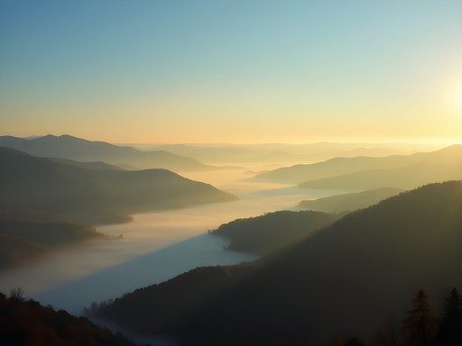
There's something structurally perfect about the Blue Ridge Mountains in autumn. As an engineer, I find myself analyzing not just the trails beneath my boots, but the geological formations that have withstood millennia of erosion to create these rounded, ancient peaks. Last October, while my children were attending a leadership camp, I seized the opportunity for a solo expedition to Roanoke, Virginia—a destination I'd long catalogued in my mental repository of engineering marvels meets natural splendor. The region's unique position along the Blue Ridge Parkway offers an accessible entry point to some of the most spectacular hiking in the Appalachian range, with trails that range from gentle strolls suitable for contemplative walks to challenging ascents that would test my classroom theories about grade percentages and sustainable path design. Armed with my trusty trekking poles and a week of solitude, I set out to document the engineering marvel that is the Blue Ridge Mountain trail system.

McAfee Knob: The Structural Icon of the Appalachian Trail
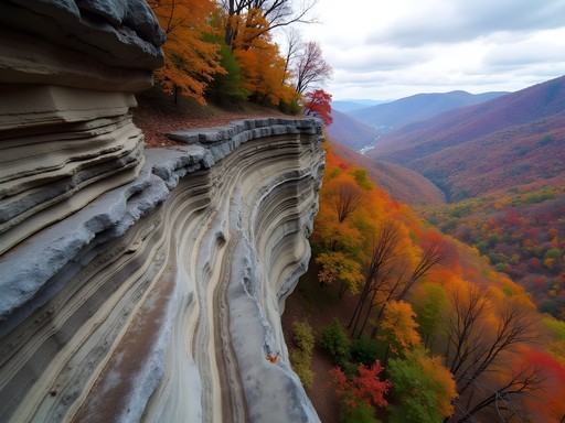
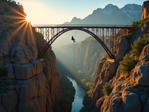
Every great engineering project has its signature element—the Golden Gate's distinctive towers, the Eiffel's elegant taper. For the Appalachian Trail, that iconic feature is undoubtedly McAfee Knob, a protruding rock formation that cantilevers dramatically over the Catawba Valley.
The 8.8-mile round trip begins at the VA-311 parking lot, which I arrived at by 7:00 AM to secure a spot (a critical timing calculation during peak fall foliage season). The trail's first section presents a moderate grade of approximately 8-10%, following a carefully designed path that mitigates erosion through strategic switchbacks—a textbook example of sustainable trail engineering.
What strikes me as particularly impressive is how the trail builders incorporated natural rock formations as steps, reducing the need for artificial reinforcements while providing stable footing. At about the 3-mile mark, the Fire Road offers a brief respite with its more gradual incline before the final push to the summit.
Reaching McAfee Knob itself is a structural revelation. The rock outcropping extends approximately 15 feet beyond its supporting base, creating what engineers would recognize as a natural cantilever that has withstood centuries of wind, rain, and the weight of countless hikers. As I sat on this geological marvel, watching the morning light illuminate the valley's tapestry of crimson, amber, and gold, I couldn't help but calculate the forces at play in keeping this formation intact.
The panoramic 270° view showcases the Blue Ridge's distinctive wavelike ridgelines—the result of differential erosion patterns on varying rock types, primarily metamorphic gneiss and schist. It's nature's demonstration of material science at its finest.
💡 Pro Tips
- Start before 8 AM to avoid crowds and catch morning light on the valley
- The hike takes 4-5 hours round trip at a moderate pace with photography stops
- Bring at least 2 liters of water—there are no reliable sources on the trail
Dragon's Tooth: A Vertical Engineering Challenge
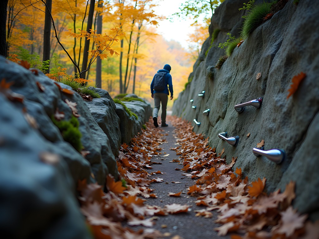
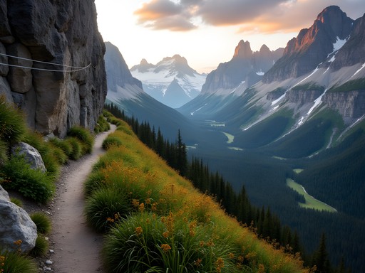
If McAfee Knob represents the elegant horizontal cantilever of the Blue Ridge, then Dragon's Tooth stands as its vertical counterpart—a monolithic quartzite spire that rises approximately 35 feet from the surrounding terrain. The 4.6-mile round trip trail to this geological anomaly presents what I consider the region's most fascinating engineering challenge for both trail designers and hikers alike.
The trail begins innocuously enough at the Dragon's Tooth parking area off VA-311. The first mile follows Catawba Creek with a gentle grade that belies what's ahead. It's at the trail junction with the Appalachian Trail where the real engineering begins. The final ascent involves a series of near-vertical rock scrambles where trail maintainers have installed metal rebar handholds—a pragmatic solution that minimizes environmental impact while ensuring hiker safety.
As a civil engineer, I was particularly impressed by how the trail incorporates natural rock features as stairs and handholds where possible, supplementing with minimal artificial supports only where absolutely necessary. This balance between accessibility and preservation represents thoughtful trail design at its finest.
Reaching the base of Dragon's Tooth itself presents hikers with a choice: observe from below or attempt the final scramble to the summit. Having tested similar rock formations for stability in my professional work, I chose to make the climb, using techniques I typically reserve for inspecting bridge foundations. The quartzite composition of the tooth—nearly pure silica that's been metamorphosed under intense pressure—creates an exceptionally durable formation with natural fracture patterns that provide surprisingly reliable handholds.
From the summit, the view extends across the valley to McAfee Knob, offering a perfect vantage point to observe the parallel ridgelines that give the Blue Ridge its name. The autumn colors here seemed particularly intense, with the red maples creating ribbons of crimson along the elevation contours—nature's own topographic map rendered in seasonal hues.
💡 Pro Tips
- Pack lightweight hiking gloves for the rock scramble sections
- Allow 4 hours minimum for this hike to safely navigate the technical sections
- Avoid this trail when wet—the quartzite becomes extremely slippery
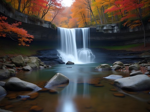
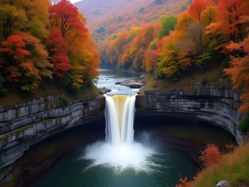
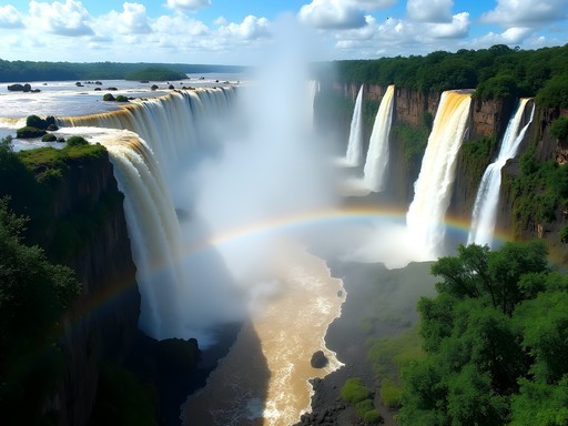
Cascade Falls: Hydraulic Engineering in Nature
While most Blue Ridge hikes focus on summit views, the Cascade Falls trail offers something equally compelling to an engineer's eye: a study in natural hydraulics. This 4-mile round trip excursion follows Little Stony Creek to a spectacular 69-foot waterfall that demonstrates principles of fluid dynamics I often cover in my undergraduate courses.
The trail itself is a model of accessibility engineering, featuring a well-maintained path with wooden walkways and reinforced stream crossings. What particularly impressed me was the trail designers' use of local stone for retaining walls—a technique that both prevents erosion and blends seamlessly with the surrounding environment.
As you progress along the creek, the trail offers numerous vantage points to observe how water velocity changes with channel width—a perfect real-world example of the continuity equation in fluid mechanics. The creek bed's natural step formations create a series of small cascades before the main event, each demonstrating the erosive power of water on the region's predominantly metamorphic bedrock.
The main falls represent what hydraulic engineers would classify as a plunge waterfall, where water maintains contact with the underlying bedrock before free-falling approximately 69 feet to the pool below. During my autumn visit, the water volume was moderate—approximately 20-30 cubic feet per second by my estimate—creating a perfect white noise backdrop for contemplation.
I spent nearly an hour at the base of the falls, my waterproof notebook in hand, sketching the structural features and calculating rough estimates of the erosion rates. My late wife would have laughed at this—she always teased that I couldn't simply enjoy natural beauty without analyzing it. Yet I find these calculations deepening my appreciation rather than diminishing it.
The surrounding forest of yellow birch, red maple, and American beech trees created a spectacular autumn canopy, their reflected colors dancing in the pools below the falls. It struck me that this combination of flowing water and fall foliage represents a perfect intersection of dynamic and static beauty—much like the balance we strive for in thoughtful civil engineering.

💡 Pro Tips
- Visit early morning or late afternoon to avoid crowds and get the best light for photographs
- Bring a polarizing filter if you're photographing the falls to reduce glare on the water
- The lower observation deck offers the best view of the entire waterfall structure

Sharp Top Trail: Historical Engineering Significance
Some trails offer more than natural beauty—they provide windows into historical engineering practices. The Sharp Top Trail at the Peaks of Otter is precisely such a path, combining challenging terrain with fascinating historical context.
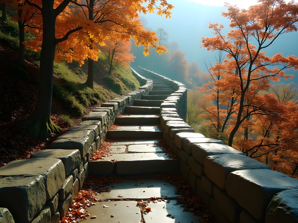
This 3.6-mile round trip hike ascends approximately 1,340 feet to the summit of Sharp Top Mountain (elevation 3,875 feet). What makes this trail particularly interesting from an engineering perspective is its age and construction. Built in the 1930s by the Civilian Conservation Corps (CCC), the trail showcases depression-era stonework techniques that have withstood nearly a century of use and weather exposure.
The stone steps—approximately 2,000 of them by my count—demonstrate remarkable craftsmanship. Each was hand-cut from local granite and meticulously placed to create a sustainable grade that minimizes erosion while providing secure footing. As someone who teaches modern infrastructure design, I find these enduring structures humbling; they remind me that sometimes the most elegant engineering solutions are also the most timeless.
Near the summit, remnants of an old aerial tramway that once transported visitors to the top can be spotted—an early example of tourism infrastructure engineering that predates modern environmental considerations. Today's more sustainable foot path approach represents an evolution in our thinking about access versus preservation.
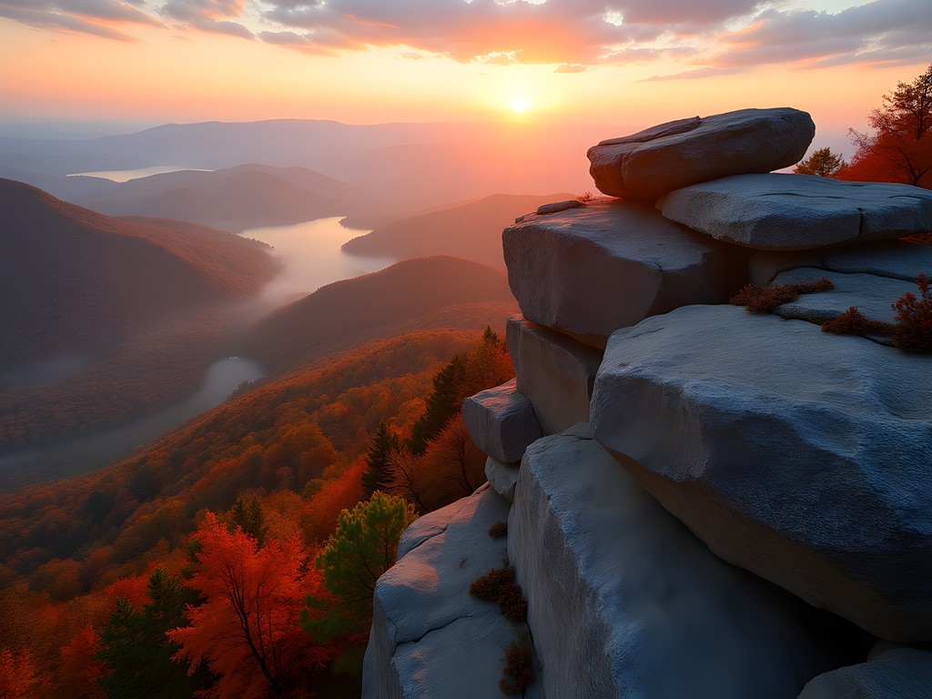
The summit itself offers a 360-degree panorama that includes the town of Bedford, the undulating Blue Ridge, and Abbott Lake below. On clear days, the geometric precision of the agricultural fields in the distance creates a fascinating contrast with the organic shapes of the mountains—a visual representation of humanity's attempts to impose order on natural landscapes.
During my visit, I encountered a park ranger who shared that Sharp Top was originally believed to be Virginia's highest peak (a title actually held by Mount Rogers). This misconception led to it being surveyed as a potential location for the Washington Monument before the DC site was selected—a fascinating historical footnote connecting this remote peak to national engineering history.
💡 Pro Tips
- Start early to avoid afternoon thunderstorms common in the mountains
- The stone steps can be slippery when covered with fallen leaves—use caution during autumn hikes
- Pack a windbreaker for the summit as it's typically 10-15°F cooler than the base
Tinker Ridge: The Geological Classroom
For those interested in both moderate hiking and geological education, Tinker Ridge offers what I consider the perfect outdoor classroom. This 7.8-mile out-and-back trail follows the ridgeline that gives Roanoke its distinctive valley setting, providing exceptional opportunities to observe the region's complex geological history.
Accessed via the Andy Layne Trail, the path climbs steadily through private property (maintained through conservation easements—an interesting study in land use engineering) before connecting with the Appalachian Trail. The initial ascent gains approximately 1,600 feet over 3 miles, representing a sustainable average grade of about 10%.
What makes Tinker Ridge particularly fascinating is the exposed bedrock along the trail. Here you can clearly observe the Chilhowee Group formations—primarily quartzite and metamorphosed sandstone—that date back to the Cambrian period (approximately 500 million years ago). These formations represent ancient beach deposits that were later compressed and uplifted during the Alleghenian orogeny, the mountain-building event that created the Appalachian range.
At several points along the ridge, natural rock outcroppings create perfect rest stops with expansive views of the Roanoke Valley. During my hike, I used these locations to set up my portable stove and prepare a simple lunch of instant ramen enhanced with foraged ramps (wild leeks) I discovered along the lower portions of the trail. This impromptu cooking session reminded me of the classes I teach my children—finding ways to enhance basic provisions with local ingredients.
The trail's ridgeline section follows the Appalachian Trail for approximately 2 miles, offering relatively level hiking with occasional rock scrambles. What impressed me most was how the trail design takes advantage of natural contours to minimize erosion while maximizing views—a perfect example of working with, rather than against, topographical constraints.
The fall colors along Tinker Ridge were particularly striking during my visit, with the northern red oaks and sugar maples creating a canopy of crimson and gold. These deciduous species typically dominate at elevations between 2,000-3,000 feet in the Blue Ridge, creating distinct vegetation zones that correspond to elevation changes—another fascinating aspect of the region's natural engineering.

💡 Pro Tips
- Bring binoculars to spot migrating hawks that use the ridgeline for navigation during fall
- The trail crosses private property at the beginning—respect all posted guidelines
- Allow 5-6 hours to complete the full out-and-back with adequate time for geological observation
Bottom Creek Gorge: Riparian Engineering and Conservation
While many Blue Ridge hikes focus on elevation gain and summit views, the Bottom Creek Gorge Preserve offers a different perspective: the chance to observe riparian ecosystems and natural water management systems. As someone who has worked on urban water management projects, I find these natural systems particularly instructive.
This 5-mile loop trail, maintained by The Nature Conservancy, follows Bottom Creek as it flows through a steep-sided gorge before plunging over the second-highest waterfall in Virginia—an 80-foot cascade that demonstrates principles of hydraulic head and energy dissipation that we often try to replicate in engineered systems.
The trail's design showcases thoughtful conservation engineering, with elevated boardwalks crossing sensitive wetland areas and reinforced stream crossings that minimize impact on the creek bed. What particularly impressed me was the use of localized materials for trail reinforcement—a sustainable approach that reduces both cost and carbon footprint associated with material transportation.
Bottom Creek itself is classified as a Tier III Exceptional State Water—Virginia's highest water quality designation. This pristine condition allows for observation of natural filtration processes as water moves through various substrate types, from rocky cascades that increase oxygenation to slower pools where sediment naturally settles out.
During my autumn visit, the creek's clarity was exceptional, allowing me to observe the natural rock formations that create the stream's step-pool morphology. I spent considerable time photographing these features with my waterproof camera, which proved invaluable for capturing underwater details without risk of equipment damage.
The surrounding forest in fall offered a spectacular display of color, with the dominant tulip poplars and red maples creating golden and crimson reflections in the creek's surface. These reflections create a perfect symmetry that reminds me of the balanced forces we strive for in structural design.
What makes Bottom Creek particularly valuable from an educational perspective is how clearly it demonstrates the relationship between geology, hydrology, and ecology. The creek's path follows natural fault lines in the underlying bedrock, creating a textbook example of how water takes the path of least resistance while shaping the landscape over millennia.

💡 Pro Tips
- Visit after a light rain when the waterfall is flowing vigorously but the trail isn't too muddy
- Pack a polarizing filter for your camera to reduce glare when photographing the creek
- Allow extra time for the Knight Trail loop addition if you want to see the upper watershed
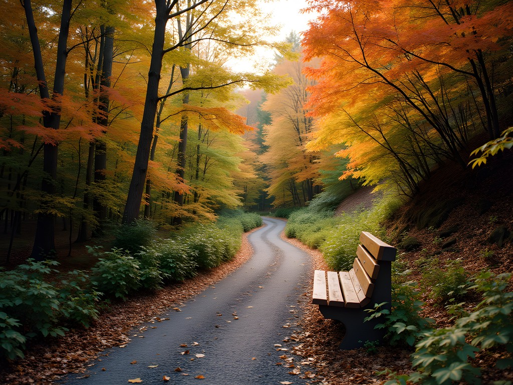
Buck Mountain Trail: The Accessible Engineering Marvel
Not all impressive trail engineering involves conquering the highest peaks. The Buck Mountain Trail at the Peaks of Otter represents what I consider an excellent example of accessible design that accommodates multiple user groups without compromising the natural experience.
This 4.8-mile loop trail features a more moderate elevation gain of approximately 780 feet, making it suitable for families and hikers seeking less strenuous terrain. What impressed me most as an engineer was how the trail design incorporates universal design principles where possible, with carefully calculated grades that rarely exceed 8% and strategically placed rest areas approximately every quarter mile.
The trail surface itself demonstrates thoughtful material selection, with crushed stone and natural soil compacted to create a stable walking surface that still allows proper drainage—a critical consideration for trail longevity. At several points, French drains have been discreetly installed to divert water away from the path without creating visible infrastructure—an elegant solution to prevent erosion while maintaining aesthetic integrity.
Buck Mountain offers something many more challenging hikes don't: multiple interpretive stations that explain the ecological and geological features along the route. These educational elements remind me of how I structure my engineering lectures—providing context that helps people understand the 'why' behind what they're seeing.
The summit area features several clearings that offer panoramic views of Abbott Lake and Sharp Top Mountain. During my autumn visit, these vistas were particularly striking, with the lake reflecting the surrounding fall colors like a mirror. I found myself sketching the scene in my field notebook, noting how the mountain's profile demonstrated classic principles of mass wasting and erosion that I often discuss in my geotechnical engineering courses.
What makes Buck Mountain particularly valuable is how it demonstrates that thoughtful engineering can create accessible outdoor experiences without diminishing the natural character of a place. As someone who has designed infrastructure for public spaces, I appreciate the careful balance struck here between access and preservation.
During my hike, I encountered several families with children and older adults who might not have been able to attempt the more strenuous trails in the area. Their presence reminded me that the most successful engineering serves human needs while respecting natural systems—a philosophy I try to instill in my students and my own children.
💡 Pro Tips
- This trail is excellent for sunrise photography of Abbott Lake and Sharp Top Mountain
- Pack a trail map as some junctions can be confusing for first-time visitors
- The interpretive signs are excellent—allow extra time to read and learn from them
Final Thoughts
As I packed my gear for the return to London, Ontario, I found myself reflecting on how these seven trails represent not just hiking experiences, but lessons in natural engineering that I'll incorporate into my upcoming semester's lectures. The Blue Ridge Mountains offer something uniquely valuable: accessible examples of geological processes, sustainable trail design, and natural hydraulic systems—all wrapped in the spectacular aesthetic of autumn's transformation. For the solo hiker with an analytical mind, Roanoke provides an ideal laboratory for both recreation and education. I've already begun planning a return trip next fall, perhaps with my children in tow. They've grown increasingly interested in my professional work, and I can think of no better classroom than these ancient mountains to explain how natural forces inform our built environment. After all, the best engineers have always been those who learn from nature's 480-million-year head start.
✨ Key Takeaways
- Fall offers the optimal combination of comfortable hiking temperatures and spectacular foliage displays in the Blue Ridge Mountains
- Roanoke's trail system provides options for all skill levels, from accessible paths to challenging technical scrambles
- Early morning starts are essential during peak season (mid-October) to secure parking and experience trails before crowds arrive
📋 Practical Information
Best Time to Visit
Mid-October for peak fall foliage, though early November offers fewer crowds
Budget Estimate
$600-800 for a week including modest accommodations, food, and transportation
Recommended Duration
5-7 days to experience the variety of trails without rushing
Difficulty Level
Moderate, With Options Ranging From Accessible To Challenging

Comments
sunnylegend
Going there next month, thanks for sharing!
cityguy
Which trail would you recommend for someone who hasn't hiked in like 5 years? Don't want to embarrass myself lol
hikingfan
Cascade Falls for sure! Super manageable and you'll feel accomplished
Megan Martin
Excellent guide! I was in Roanoke for a conference last year and managed to squeeze in Cascade Falls between meetings. It's genuinely doable for business travelers with limited time - only took about 90 minutes round trip. The geological formations you mentioned are fascinating. For anyone combining business and hiking, downtown Roanoke has solid hotel options within 20 minutes of most trailheads. The Star on Mill Mountain is also worth a quick sunset visit if you're short on time.
sunnylegend
good to know! heading there for work in august
sunnyblogger
Love the photos!
Haley Hamilton
Samuel, I love your engineering perspective on these trails! I did McAfee Knob and Dragon's Tooth back-to-back last fall and nearly died on Dragon's Tooth - that scramble is no joke. The view from the top though? Absolutely worth every bruised knee. Pro tip: if you're doing multiple trails in one trip, Sharp Top is perfect for a recovery day. It's short but the views rival the harder climbs. The autumn colors you mentioned are peak late October in my experience.
citywanderer
How's the parking situation at McAfee Knob? Heard it can get crazy crowded on weekends
Haley Hamilton
Get there before 7am on weekends or you'll be parking way down the road. Weekdays are much better!
citywanderer
thanks! planning a tuesday trip then
hikingfan
This is awesome!! Been wanting to visit Roanoke forever!
Taylor Moreau
Excellent write-up, Samuel. I particularly appreciate your engineering perspective on the geological formations - it adds a unique dimension that most hiking guides overlook. I visited Roanoke in 2019 for a business conference and managed to squeeze in McAfee Knob. The sunrise views were absolutely worth the early start. One tip for international visitors: the autumn timing you mention (late October) is spot on, but do book accommodations well in advance as the leaf-peeping season draws considerable crowds. Would you say Dragon's Tooth is manageable for reasonably fit hikers without technical climbing experience?
winterwalker
yeah it's doable, just slow down on the rock scramble part
winterwalker
Dragon's Tooth is no joke! Did it last fall.
Taylor Moreau
How long did it take you? I'm considering it for a client itinerary but concerned about the technical sections.
winterwalker
took me about 4 hours round trip. the scramble at the top is fun but definitely need good shoes
staradventurer
Which trail would you recommend for someone with moderate hiking experience but bringing along kids (ages 8 and 11)?
roamace8413
Cascade Falls would be perfect! Moderate difficulty but the waterfall payoff keeps kids motivated. My nephew loved it!
Samuel Bailey
I'd second Cascade Falls, and also suggest the first portion of Sharp Top. You don't need to go all the way to the summit for great views, and there are plenty of interesting rock formations along the way that kids tend to love exploring.
Venture X
Premium card with 2X miles, $300 travel credit, Priority Pass