


Disclosure: This article contains affiliate links. We may earn a commission from purchases at no extra cost to you, which helps our travel content.
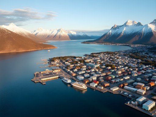
Standing at the edge of Tierra del Fuego, with the Antarctic winds whipping my ponytail and the Beagle Channel stretching toward the horizon, I couldn't help but think of the indigenous Yámana people who once called this harsh landscape home. Their resilience mirrors the rugged beauty of Ushuaia itself—Argentina's southernmost city and self-proclaimed 'Fin del Mundo' (End of the World). As someone who's tracked across Mongolia's steppes and navigated Canada's northern wilderness, I'm no stranger to remote terrain. But there's something uniquely humbling about hiking where the Andes finally surrender to the sea, where human presence feels like a temporary concession granted by nature. Over my week exploring Ushuaia on a doctoral research break, I discovered trails that would challenge seasoned trekkers alongside paths gentle enough for casual day-hikers. This guide maps out the best of both worlds, proving you don't need an explorer's resume to experience the raw majesty of Patagonia's southern edge.

Getting Your Bearings: Understanding Ushuaia's Geography
Ushuaia sits nestled between the Martial Mountains and the Beagle Channel, creating a unique microclimate where alpine and coastal ecosystems converge. Before hitting any trails, I spent my first morning simply orienting myself to this geographical crossroads.
The city itself is compact, with most accommodations within walking distance of the main drag, Avenida San Martín. What struck me immediately was how the urban grid quickly gives way to wilderness—you're never more than a 20-minute walk from genuine backcountry. This proximity to nature is both Ushuaia's charm and its challenge; the weather can shift dramatically within hours.
During my stay at a modest hostel near the port (Hostel Antarctica—basic but clean at 30 USD/night), I witnessed four distinct weather patterns before lunch. The locals have a saying: 'If you don't like the weather in Ushuaia, wait five minutes.' They're not exaggerating.
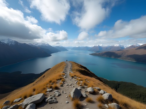
For orientation, think of Ushuaia's hiking terrain as divided into three zones: the accessible city-adjacent trails like Glaciar Martial, the coastal paths along the Beagle Channel, and the more remote wilderness of Tierra del Fuego National Park. Each offers distinctly different experiences, from gentle forest walks to demanding alpine traverses.
Before setting out, I highly recommend stopping by Club Andino Ushuaia (the local alpine club) for the most current trail conditions and weather forecasts. The tourist information center on San Martín is helpful but doesn't always have the granular details serious hikers need.
💡 Pro Tips
- Download the Wikiloc app and cache offline maps before arriving—cell service is spotty beyond city limits
- The local time zone (GMT-3) means summer daylight extends until nearly 11 PM, giving you extended hiking hours
- Weather changes rapidly—pack layers even for short hikes
Beginner Trails: Gentle Introductions to Patagonian Wilderness
For those new to hiking or traveling with varying fitness levels, Ushuaia offers several accessible trails that deliver stunning views without demanding technical skills or exceptional endurance.
Sendero Costera (Coastal Path) My first morning hike began right from the eastern edge of town, following the coastline toward Playa Larga. This 3.5km one-way trail hugs the Beagle Channel, offering constant views of the water and distant Chilean islands. The path is mostly flat with occasional gentle inclines, making it perfect for acclimatizing to Patagonian terrain. I spotted several endemic bird species and even a family of austral dolphins playing offshore.
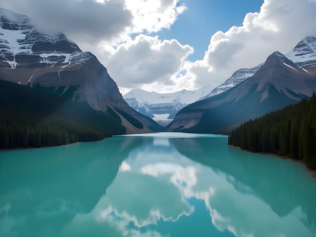
Laguna Esmeralda Trail Perhaps the best balance of accessibility and reward is the trail to Laguna Esmeralda. Located about 20 minutes from town by taxi (roughly 15 USD each way), this 9km round-trip route takes you through peat bogs and lenga forests to a stunning emerald-colored glacial lake. The trail can be muddy—very muddy—so proper footwear is essential. My hiking boots were lifesavers here, keeping my feet dry through numerous bog crossings.
The elevation gain is modest (about 300m), spread gently across the route. I completed the hike in about 4 hours, including a lengthy lunch stop by the lake. The final approach reveals the emerald waters dramatically, framed by hanging glaciers and mountain peaks—a postcard-worthy moment that requires minimal hiking experience to achieve.
Glaciar Martial Circuit For those staying in town without transportation, the Martial Glacier trail begins just a short taxi ride from the center. You can take the chairlift up (operating in summer, 20 USD round-trip) to skip the steepest section, then follow a well-marked 2km loop that offers panoramic views of Ushuaia and the channel. Even in summer, you'll encounter snow patches near the glacier, but the trail remains manageable for anyone with basic fitness.
💡 Pro Tips
- Wear waterproof footwear on all Ushuaia trails—bog crossings are common even on beginner routes
- The Laguna Esmeralda trail gets crowded midday; start before 9 AM for a more solitary experience
- Bring cash for trail entrance fees (typically 10-15 USD) as card machines are unreliable
Intermediate Adventures: Tierra del Fuego National Park
Tierra del Fuego National Park deserves at least two full days of exploration. Located 12km west of Ushuaia, this protected wilderness showcases the region's ecological diversity across several well-maintained trail systems. The entrance fee (around 25 USD for foreigners) is worth every peso.
Reaching the Park: You have three options—take the End of the World Train (touristy but scenic, 45 USD round-trip), catch the public shuttle bus from the tourist office (10 USD round-trip), or arrange a taxi (approximately 30 USD each way). I opted for the shuttle bus, which runs several times daily in summer.
Senda Costera (Coastal Trail) Not to be confused with the coastal path near town, this 8km trail connects Ensenada Bay to Lapataia Bay, following the Beagle Channel through diverse ecosystems. The path undulates gently, crossing streams and passing through forests where I spotted Magellanic woodpeckers—their distinctive red heads flashing among the trees.
What makes this trail special is how it showcases the park's various ecosystems: from dense southern beech forests to wind-sculpted coastal areas and peat bogs. The trail took me about 3.5 hours with frequent photography stops.
Cerro Guanaco Trail For those seeking more challenge, the trail up Cerro Guanaco (approximately 12km round-trip) offers the park's most panoramic views. The first half follows gentle terrain, but the final ascent climbs steeply through lenga forests before emerging above the treeline.
At 970m, the summit provides a 360-degree panorama of the park's lakes, the Beagle Channel, and distant Chilean mountains. On clear days, you can even spot Ushuaia. The hike demands good stamina but requires no technical skills—just persistence on the final push.
I tracked the entire hike on my GPS watch, which showed about 700m of elevation gain over the 12km journey. The battery life lasted the entire 7-hour adventure with plenty to spare—essential when you're this remote.
Paso de la Oveja This lesser-known circuit requires registration at the park office (free) as it crosses into more remote terrain. The 10km loop passes through pristine forests and across several streams. While not technically difficult, its isolation demands better preparation and navigation skills.

💡 Pro Tips
- Pack a comprehensive first aid kit for national park hikes—the nearest medical help can be hours away
- Start Cerro Guanaco early to avoid afternoon winds that can make the exposed summit unpleasant
- The park's rivers provide safe drinking water, but use a filter or purification tablets as precaution

Advanced Treks: For the Experienced Hiker
Ushuaia's surroundings offer several challenging routes that demand experience, proper equipment, and thorough planning. These trails aren't widely advertised in tourist brochures—for good reason.
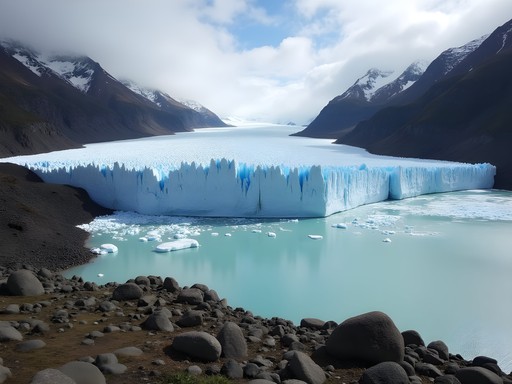
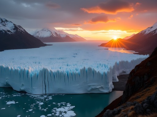
Vinciguerra Glacier and Laguna de los Témpanos This demanding 18km round-trip journey takes you to a spectacular glacial lake with floating ice chunks and the imposing Vinciguerra Glacier. The trail begins deceptively easy, following the Valle de Andorra before climbing steeply through dense forest and eventually emerging onto rocky moraines.
I set out at dawn with my trekking poles, which proved invaluable on both the ascent and descent. The route gains roughly 750m elevation, with the final approach crossing unmarked rocky terrain where the trail becomes faint. Navigation skills are essential here.
The glacier itself is actively calving, creating the ice chunks floating in Laguna de los Témpanos. The scene reminded me of similar landscapes in northern Canada, though with a distinctly Patagonian character—more dramatic and compressed. The entire hike took me about 8 hours, including an hour at the glacier.
Sierra Valdivieso Circuit For those seeking multi-day adventures, the 3-4 day Sierra Valdivieso circuit traverses remote valleys and mountain passes. This 40km route requires camping gear, food supplies, and serious backcountry experience. Weather conditions can deteriorate rapidly, and trail markings are minimal.
I didn't attempt this during my week in Ushuaia, but spoke with several experienced hikers who had just completed it. Their unanimous advice: only attempt this with proper equipment, wilderness first aid knowledge, and the ability to navigate with map and compass when visibility drops.
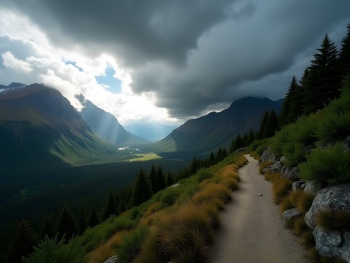
Montes Martial Circuit This challenging day hike connects several peaks in the Martial range above Ushuaia. Starting from the ski area, the route climbs steeply to Glacier Martial before traversing exposed ridgelines to several summits. The views are extraordinary, but the weather is unpredictable and the terrain exposed.
During my attempt, I turned back halfway due to rapidly deteriorating visibility—a decision I don't regret. The mountains will always be there for another day, as we say in mountaineering circles. Always check conditions with Club Andino Ushuaia before attempting advanced routes.

💡 Pro Tips
- Register your hiking plans with park authorities or your accommodation before attempting advanced trails
- Carry emergency shelter even on day hikes—weather can trap you unexpectedly
- Advanced routes often require permits or registration—check requirements before setting out
Essential Gear and Practical Considerations
Ushuaia's trails demand respect and proper preparation, regardless of your experience level. The region's weather patterns are notoriously unpredictable—I experienced sunshine, rain, hail, and snow all within a single six-hour hike.
Layering is Essential Even in summer (December-February), temperatures can range from freezing to pleasantly warm within hours. I relied on a four-layer system: 1. Moisture-wicking base layer 2. Insulating mid-layer (fleece or down) 3. Windproof/waterproof outer shell 4. Emergency insulation layer packed away
My rain jacket proved invaluable multiple times when sudden showers appeared from seemingly clear skies. The breathability was crucial during steep climbs, while the waterproofing kept me dry through persistent Patagonian drizzle.
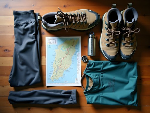
Footwear Considerations The terrain around Ushuaia presents unique challenges—you'll encounter everything from muddy peat bogs to rocky moraines and occasional snow patches, sometimes all on the same trail. Waterproof hiking boots with good ankle support are non-negotiable. Gaiters are also worth considering for the muddier routes like Laguna Esmeralda.
Navigation and Safety Cell service is unreliable beyond town limits. I downloaded offline maps using both Maps.me and Gaia GPS before arriving. For more remote hikes, I carried a physical topographic map and compass as backup—a habit formed during my Canadian wilderness experiences that has served me well globally.
Always inform someone of your hiking plans, including expected return time. Solo hikers (like myself on several routes) should be particularly cautious about route selection and timing.
Local Transportation Many trailheads require transportation from Ushuaia. Options include: - Public buses to accessible trailheads (inexpensive but limited schedule) - Taxis (negotiable rates for wait-and-return service) - Rental cars (approximately 70-90 USD per day in high season) - Organized transfers through hostels/hotels (often the most convenient option)
I found that combining public transport with occasional taxi splurges worked well for my budget approach. For Tierra del Fuego National Park, the shuttle bus service offers the best value.

💡 Pro Tips
- Pack high-energy snacks—hiking burns significantly more calories in Patagonia's wind and variable temperatures
- Trail markers vary in quality; don't rely exclusively on them for navigation
- Ushuaia's tap water is safe to drink—fill reusable bottles to save money and reduce plastic waste
Final Thoughts
As my week in Ushuaia drew to a close, I found myself standing at the official 'End of the World' sign in Tierra del Fuego National Park, reflecting on the landscapes I'd traversed. From the emerald waters of hidden lakes to wind-sculpted peaks and ancient forests, each trail revealed another facet of this remarkable ecosystem. What struck me most wasn't just the raw beauty, but the accessibility of these experiences—Ushuaia truly offers something for every hiker, from casual walkers to seasoned trekkers. The indigenous Yámana people called this land 'Ushuaia'—meaning 'bay penetrating westward'—but for modern travelers, it might better be described as 'wilderness penetrating inward,' a place where nature's grandeur works its way into your consciousness, leaving an indelible mark. Whether you have a single day or a dedicated week, Ushuaia's trails promise encounters with Patagonia at its most authentic and unfiltered. Just remember to bring layers, respect the weather, and step lightly on these fragile southern landscapes.
✨ Key Takeaways
- Ushuaia offers hiking options for all skill levels, from gentle coastal walks to challenging glacier treks
- Weather preparedness is essential—pack for four seasons regardless of when you visit
- The shoulder seasons (October-November and March-April) offer fewer crowds but require more preparation
- Many spectacular trails can be accessed without a vehicle or with simple public transportation
📋 Practical Information
Best Time to Visit
December through February (summer)
Budget Estimate
$50-100 USD daily (excluding flights)
Recommended Duration
5-7 days
Difficulty Level
Variable (Trails Available For All Levels)

Comments
Gregory Boyd
Excellent breakdown of the trail options, Alex. I'd add that the Martial Glacier trail deserves a mention for intermediate hikers - the views over Ushuaia from halfway up are spectacular. One thing I found crucial was starting early regardless of skill level. The weather can turn dramatically by afternoon, and I got caught in horizontal sleet on what started as a clear morning. Also worth noting that trail markers can be sparse on some of the advanced routes, so a proper topographic map isn't optional. The sense of remoteness out there is real.
springseeker
Thanks! Adding Martial Glacier to my list now
springseeker
Planning to go in May - is that too cold for the beginner trails?
Gregory Boyd
May is actually autumn there (southern hemisphere) so it'll be quite chilly - temps around 3-8°C typically. The beginner trails are still doable but you'll want proper layering. I went in March and even then the wind chill was brutal near the Beagle Channel. The Laguna Esmeralda trail should still be accessible though snow might be starting at higher elevations. Just check with the park office when you arrive about current conditions.
Mason Sullivan
Great guide Alex! I spent 5 days in Ushuaia last year on a shoestring budget and it was honestly one of my favorite stops in South America. For anyone doing the Cerro Guanaco trail you mentioned - start EARLY. I made the mistake of starting at 11am and the afternoon winds were brutal coming back down. Also, the refugio at Laguna Esmeralda makes amazing empanadas if you need lunch. They're cash only though! The bus from town to the national park is super affordable too, saved me a ton compared to the tour groups.
roamqueen
Good to know about the bus! How much was it?
Mason Sullivan
It was around 3000 pesos back then but prices change. Way cheaper than the 40 USD tours though!
roamqueen
This looks amazing! Quick question - what time of year did you go? I'm thinking about visiting in August but worried about the weather being too crazy for hiking.
Mason Sullivan
Not the author but I went in September last year and it was COLD but doable. Just layer up! The wind is no joke though - had my hat fly off twice on the Laguna Esmeralda trail haha. Summer (Dec-Feb) is definitely easier for beginners.
roamqueen
Thanks! Yeah I'm definitely a beginner so might wait til warmer weather lol
Savannah Walker
Alex, this guide brought back all the memories from my trip to Ushuaia last year! I stayed an extra day just to do the Laguna Esmeralda hike after a local recommended it. One tip for anyone going - the boardwalk sections over the peat bogs can be super slippery after rain. I'd add that the coastal path in Tierra del Fuego National Park is perfect for wildlife spotting - I saw foxes, woodpeckers, and even a family of geese waddling along the shore. The way you described the indigenous history really added depth to your piece - something I wish I'd researched more before my visit.
beachbuddy
Planning a trip for November - is that too early in the season for the more advanced trails? Would the Cerro Guanaco trail be accessible then?
Savannah Walker
November should be fine for most trails! Spring is actually a beautiful time to visit. Cerro Guanaco might still have some snow at higher elevations, but the trail should be accessible. Just check with the park rangers when you arrive - they'll have the most up-to-date info on conditions. I hiked in February (their summer) and it was perfect, if a bit crowded.
beachbuddy
Thanks so much! Good tip about checking with the rangers. Did you need any special gear for the higher trails?
Savannah Walker
For the higher trails, good hiking boots with ankle support are a must! I used my trekking poles which were lifesavers on the steeper sections. And definitely bring a waterproof shell - the weather changes in minutes down there.
springzone
Just got back from Ushuaia last month and did the Laguna Esmeralda trail you mentioned! That turquoise water is even more stunning in person. We got caught in one of those famous Patagonian wind gusts and I nearly lost my hat! Definitely agree with your advice about layering - I went from sweating to freezing within minutes. Did you make it to Martial Glacier? We ran out of time but heard it's amazing.
Savannah Walker
Yes! The Martial Glacier was actually my favorite hike of the trip. The views of the city and channel from up there are unbeatable. If you ever go back, definitely make time for it. The weather changes so fast there - I packed and unpacked my layers about 20 times a day!
springzone
Adding it to my list for next time! Those wind gusts are no joke though 😂
EndOfWorldTraveler
Don't forget to get your passport stamped at the End of the World Post Office! It's a cool souvenir.
SoloHiker42
That shot of the Beagle Channel at sunset is breathtaking!
oceanclimber219
Just got back from Ushuaia last week and followed your beginner trail recommendations - they were perfect for my skill level! The coastal path was exactly as you described, with those amazing views of the Beagle Channel. We even spotted some dolphins! I was worried about hiking as a beginner, but your detailed descriptions gave me confidence. One tip for others: the public buses to Tierra del Fuego National Park can get crowded early, so plan accordingly. Also, I used my hiking boots and they were perfect for the sometimes muddy conditions. Thanks for this guide, Alex!
WanderlustMama
Did you need to book the park entry tickets in advance? Planning to visit with my kids next year.
oceanclimber219
We just bought them at the entrance, but I've heard it can get busy in peak season. If you're going with kids, the shorter trails near the visitor center are really nice and have good facilities.
Venture X
Premium card with 2X miles, $300 travel credit, Priority Pass