


Disclosure: This article contains affiliate links. We may earn a commission from purchases at no extra cost to you, which helps our travel content.
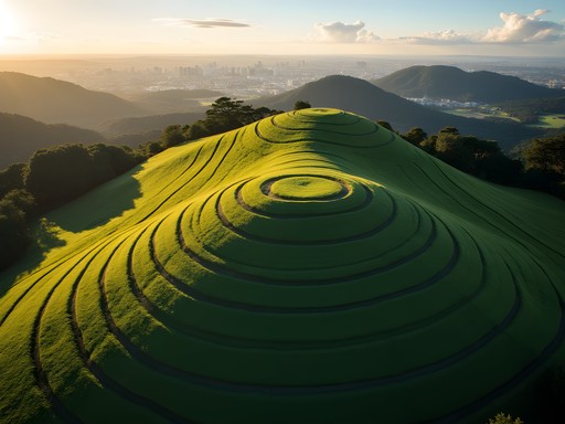
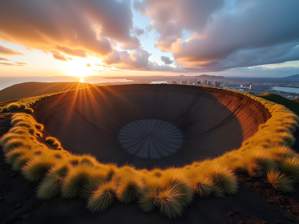
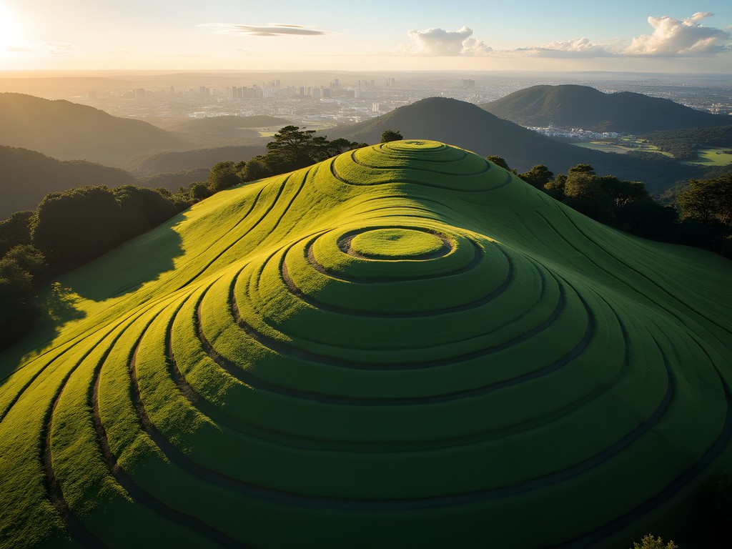
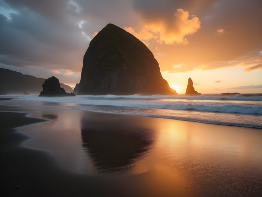
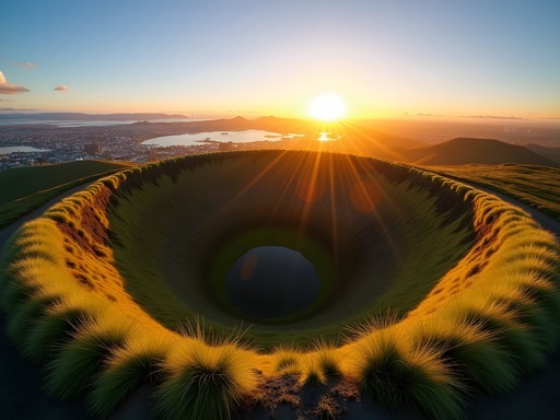
Standing atop Maungawhau/Mount Eden as the sun dips below Auckland's skyline, I'm struck by the surreal juxtaposition: a perfectly preserved volcanic crater in the heart of New Zealand's largest city. The golden hour light traces the undulating rim, creating a dance of shadows across the bowl-shaped depression that formed some 15,000 years ago. It's my third visit to Auckland, but my first dedicated to exploring its volcanic field—a playground of 53 ancient cones and craters that tell the geological story of this land while offering some of the most accessible urban hiking I've encountered anywhere.

The Volcanic Circuit: A Geological Time Machine
Auckland sits atop a monogenetic volcanic field—meaning each volcano erupted just once, creating this scattered constellation of cones that punctuate the city's landscape like geological exclamation points. Rather than tackling them randomly, I crafted a five-day volcanic circuit that would take me through different neighborhoods while maximizing both sunrise and sunset photography opportunities.
I began with the Three Kings (Te Tātua-a-Riukiuta), where ancient Māori defensive terraces are still visible on the slopes. The morning light here casts long shadows across the scoria, revealing the human modifications to this natural fortress. From there, I moved to Maungakiekie/One Tree Hill, where the expansive Cornwall Park provided not just volcanic exploration but a chance to photograph grazing sheep against the backdrop of Auckland's skyline—a contrast that perfectly captures New Zealand's blend of urban and pastoral.
For navigation between these scattered volcanic gems, I relied heavily on my Garmin eTrex 22x. While most trails are well-marked, having precise GPS coordinates for sunrise positions and optimal photography vantage points proved invaluable, particularly for pre-dawn hikes when I was chasing that perfect morning light.
💡 Pro Tips
- Visit Maungawhau/Mount Eden at sunset for the best photography lighting and fewer tourists
- Pack a headlamp for early morning hikes to catch sunrise from the summits
- Download the Auckland Volcanic Field app for interactive maps and eruption histories
Night Photography on Ancient Peaks
While Auckland's light pollution challenges serious astrophotography, I discovered that several volcanic cones offer surprisingly dark skies for urban stargazing. Equipped with my travel star chart and a thermos of chai, I spent three consecutive nights mapping the southern constellations from different vantage points.
Mangere Mountain in South Auckland provided the darkest skies, with its more remote location away from the city center. Here, I captured the Southern Cross hanging above the volcanic cone—a quintessentially Kiwi celestial scene. The symmetrical shape of the crater rim created a perfect natural frame for long-exposure photography.
The real revelation came when I discovered that certain viewpoints aligned perfectly with astronomical events. From North Head (not a volcano but a military defensive position with panoramic views), I photographed moonrise between Rangitoto Island's distinctive volcanic silhouette. Planning these shots required precise timing, which I managed using my sky tracking app subscription—an essential tool for any photographer interested in celestial events.
The cool autumn air meant I needed proper layering, and my merino wool base layer proved perfect for these night sessions, regulating temperature while I waited patiently for the perfect astronomical alignment.
💡 Pro Tips
- Use the NightCap Camera app to capture better night photos with just your smartphone
- Check the lunar calendar and plan your visit during a new moon for better star visibility
- Bring a lightweight camping chair for comfort during long-exposure photography sessions
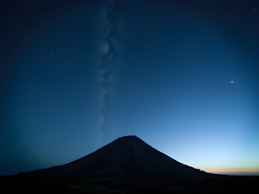
Rangitoto: The Youngest Volcano
No volcanic exploration of Auckland would be complete without visiting Rangitoto Island, the region's youngest and largest volcano at just 600 years old. The 25-minute ferry ride from downtown Auckland offers increasingly dramatic views of the symmetrical cone rising from the Hauraki Gulf.
Unlike the grass-covered cones of the mainland, Rangitoto presents a more primal volcanic landscape—fields of jagged black scoria, twisted pōhutukawa forests, and lava tubes that tunnel beneath the surface. The contrast between the harsh black rock and the vibrant red flowers of the pōhutukawa trees (when in bloom) creates a photographer's dream landscape.
The summit track winds through these varied ecosystems, eventually opening to a panoramic view that encompasses the entire Auckland isthmus. Here, I pulled out my pocket volcanic field guide to identify each of the distant cones dotting the city landscape.
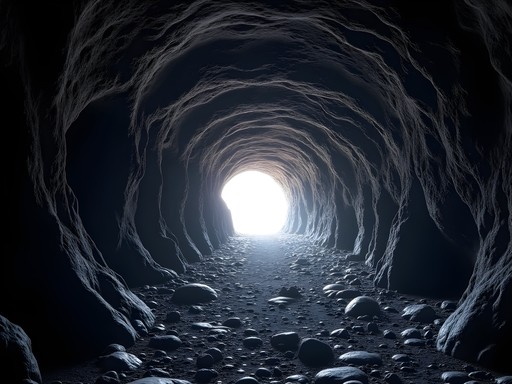
Exploring the lava caves requires some scrambling and ducking through low passages. My headlamp proved essential here, illuminating the fascinating textures formed as molten rock cooled and solidified centuries ago. I spent nearly an hour photographing the intricate patterns where the lava had dripped from the cave ceiling, creating what looked like frozen waterfalls of stone.
💡 Pro Tips
- Book the first morning ferry to Rangitoto to avoid crowds and catch the best light
- Wear sturdy hiking boots with ankle support for the sharp volcanic rock
- Pack more water than you think you'll need—there are no facilities on the island

Cultural Landscapes: The Māori Connection
What transformed my volcanic circuit from mere geological tourism to something deeper was understanding the cultural significance these landmarks hold for Māori. Many of Auckland's volcanic cones (maunga) were once pā sites—fortified settlements with elaborate terracing still visible today.
At Maungakiekie/One Tree Hill, I joined a guided cultural walk led by a local Māori elder who explained how the volcanic soil's fertility made these sites not just defensively advantageous but agriculturally precious. The terraces I had initially photographed for their geometric patterns gained new meaning as I learned they were sophisticated kumara (sweet potato) growing systems.
I spent one afternoon sketching the distinctive terracing patterns at different sites, noting how they followed the natural contours while maximizing growing space. These agricultural innovations spoke to a deep understanding of the landscape that predated European arrival by centuries.
The cultural significance extends beyond agriculture—many maunga are considered ancestors in Māori tradition. I was fortunate to witness a dawn ceremony at Maungawhau/Mount Eden where local iwi (tribes) gathered to greet the sun. The experience reminded me of similar dawn gatherings I'd witnessed in Pakistan during family visits, where connection to ancestral land transcended religious boundaries.
To record these cultural insights alongside my photographs, I used my waterproof notebook, which proved invaluable when unexpected autumn showers caught me mid-sketch on exposed volcanic slopes.
💡 Pro Tips
- Join a Māori-led tour to understand the cultural significance of the volcanic cones
- Visit the Auckland Museum to see ancient artifacts recovered from pā sites on the volcanoes
- Respect areas marked as culturally significant and avoid climbing on the terracing
Final Thoughts
As I pack my hiking boots for the flight back to London, I'm left reflecting on how Auckland's volcanic landscape offers a rare intersection of natural history, cultural heritage, and urban adventure. These ancient cones—some erupting as recently as 600 years ago—create a geological playground unlike any other major city I've visited. They're simultaneously public parks, sacred sites, astronomical observatories, and living museums.
What began as a photography project capturing volcanic forms has evolved into something more profound: an appreciation for how these landmarks have shaped Auckland's identity across centuries. From Māori pā sites to modern-day picnic spots, the volcanoes remain central to understanding this place.
For fellow travelers seeking more than standard tourist experiences, I encourage you to lace up your boots and explore these accessible peaks. Whether you're chasing the perfect sunset photograph, seeking to understand indigenous connections to the land, or simply wanting a free workout with world-class views, Auckland's volcanic field delivers in ways that continually surprise. Just remember to tread lightly—you're walking on living history that continues to shape the cultural landscape of Tāmaki Makaurau (Auckland's Māori name).
Until next time, when I hope to return for the summer pōhutukawa bloom on Rangitoto's slopes.
- Paul
✨ Key Takeaways
- Auckland's volcanic field contains 53 distinct volcanoes, most accessible by public transport or short drives
- Dawn and dusk provide the most dramatic lighting for photography on the volcanic cones
- Many volcanoes hold significant cultural importance to local Māori as ancestral sites
- Rangitoto Island offers the most dramatic and recent volcanic landscape in the region
- The volcanic circuit can be completed in 5-7 days, depending on photography time and weather conditions
📋 Practical Information
Best Time to Visit
March-May (autumn) for mild temperatures and fewer tourists
Budget Estimate
$75-100 NZD per day (excluding accommodation)
Recommended Duration
5-7 days
Difficulty Level
Moderate
Comments
bluewanderer
Pro tip: Download the Auckland Volcanoes app before you go. It has walking routes, history, and Māori place names with pronunciation guides. Made our trip so much better understanding the stories behind each maunga. Also pack layers - the weather changes fast up there!
adventureblogger
Your night photography section inspired me! I've been wanting to try astrophotography and this seems like the perfect spot. Did you use any special filters or just long exposure? The Milky Way shot over the crater is stunning!
Hunter Thompson
Mate, this brings back memories! Did the whole volcanic circuit when I was backpacking NZ two years ago. Mount Mangere is criminally underrated - hardly anyone there and the views are mint. Also, if you're on a budget, you can easily do all the city volcanoes by bus. The Auckland transport app makes it dead simple. Skip the expensive tours and just explore on your own!
hikinglover
Thanks for the budget tip! Which volcano should I do first?
Hunter Thompson
Mount Eden for sure - easy to get to and epic sunset views over the city
explorewanderer
Just got back from Auckland and followed your volcanic circuit recommendation - absolutely brilliant! We did Mount Eden, One Tree Hill, and Rangitoto over three days. The local bus system made it super easy to reach the city cones. For Rangitoto, we took the early morning ferry which gave us plenty of time to explore before the midday crowds. The black sand beaches near some of these volcanic areas were a highlight too. One thing to note - some paths can get slippery after rain, so proper footwear is essential. The Māori cultural center near Maungakiekie was closed for renovation though - might want to check before visiting. Thanks for inspiring our itinerary!
vacationexplorer
Love the crater photos! Really cool perspective.
coolzone
Really cool photos! Going to NZ in March
redking
Those sunset pics from the crater rim are incredible! What a unique landscape.
wanderseeker
Can you drive to the top of Mount Eden or do you have to walk? Traveling with elderly parents
coolzone
They closed it to cars a few years back. But the walk from the carpark is pretty gentle, maybe 15-20 mins?
Frank Garcia
Did the Rangitoto crossing last year and honestly it was the highlight of my NZ trip. The lava fields are otherworldly - like walking on another planet. One tip though: bring way more water than you think you need. There's zero shade on that island and it gets brutally hot even in autumn. Also the ferry times are pretty strict so don't miss the last one back unless you fancy camping on a volcano! The Auckland transport pass covers the ferry which saved me a bit of cash.
vacationexplorer
Good to know about the water! How long did the whole hike take you?
Frank Garcia
About 3 hours total including the summit and lava caves. Could do it faster but I was taking photos constantly haha
Megan Martin
Excellent guide, Paul. I visited Auckland last year for a conference and squeezed in Mount Eden at sunrise - absolutely worth the early alarm. The cultural significance you mentioned is so important. I'd recommend anyone doing this circuit to book a guided tour with a Māori guide to really understand the mana of these sites. The stories add so much depth to the landscape.
Paul Franklin
Thanks Megan! Completely agree about the guided tours. The historical context transforms the experience.
Venture X
Premium card with 2X miles, $300 travel credit, Priority Pass