


Disclosure: This article contains affiliate links. We may earn a commission from purchases at no extra cost to you, which helps our travel content.
When my manufacturing firm sent me to Auckland for a week-long conference, I immediately spotted an opportunity. Between morning meetings and evening networking events, I discovered that New Zealand's largest city sits atop a volcanic field containing 48 ancient cones—each offering unique perspectives of this stunning harbor city. Having navigated business trips in mountain regions across three continents, I've developed a knack for maximizing limited free time. Auckland presented a fascinating challenge: how to experience its volcanic wonders efficiently while balancing work commitments. What I discovered was a series of accessible urban hikes that transformed my business trip into an unexpected adventure through geological history—one that couples on a budget can easily replicate without sacrificing authentic experiences or breaking the bank.

Understanding Auckland's Volcanic Field
Before lacing up your hiking boots, it's worth understanding what makes Auckland's volcanic landscape so unique. Unlike most volcanic regions I've explored in my travels, Auckland's field isn't centered around one dominant volcano but consists of 48 monogenetic volcanoes—meaning each erupted only once, creating the distinctive cones and craters that now define the city's topography.
The Auckland Volcanic Field has been active for approximately 250,000 years, with the most recent eruption creating Rangitoto Island just 600 years ago—practically yesterday in geological terms. What fascinated me most is how thoroughly integrated these volcanic features are into urban life. Aucklanders have built neighborhoods around them, converted some into parks, and incorporated others into the city's infrastructure.
During my first morning in Auckland, I visited the Auckland War Memorial Museum, which offers an excellent overview of the region's volcanic history. The museum's volcano exhibition provides crucial context for the hikes to follow and includes interactive displays that demonstrate how the city's landscape has evolved through successive eruptions. This background knowledge transformed my subsequent hikes from simple exercise into meaningful geological exploration.
Before setting out, I invested in a detailed topographical map of the Auckland region. While smartphone apps are convenient, I've found that a waterproof hiking map provides reliability when cell service is spotty and offers a better overview of elevation changes between volcanic sites.
💡 Pro Tips
- Visit the Auckland Museum first to understand the volcanic field's formation
- Download the Auckland Volcanic Walks app for self-guided tours
- Early mornings offer the clearest views and fewer crowds on popular cones
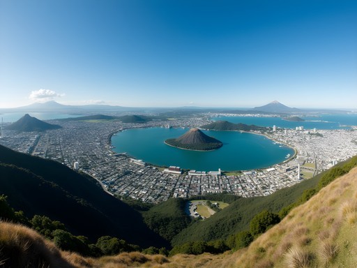
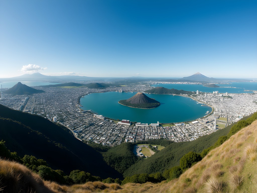
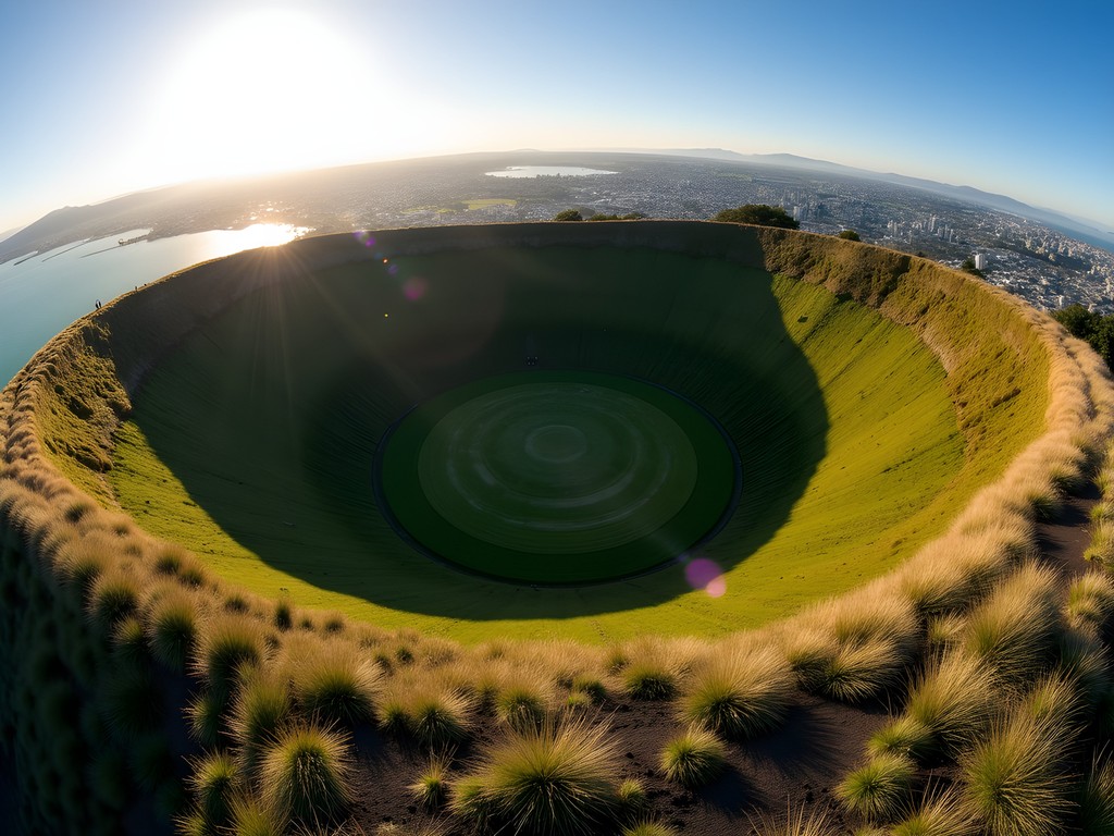
Mount Eden (Maungawhau): The Perfect Introduction
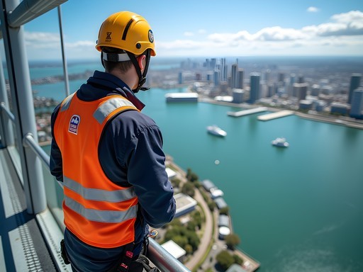
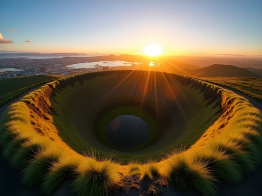
For time-pressed travelers or those balancing work commitments like I was, Mount Eden (Maungawhau) offers the perfect introduction to Auckland's volcanic landscape. Just a 15-minute bus ride from the central business district, this 643-foot cone features the city's most intact crater and delivers 360-degree views that orient you to Auckland's geography.
I slipped away from conference proceedings during a long lunch break, catching the frequent 27H bus from downtown. The hike to the summit takes just 20 minutes via a well-maintained path that winds through grassy slopes dotted with sheep—a quintessentially New Zealand experience in the heart of the city.
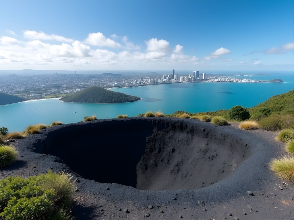
The reward at the summit is worth every step: a perfect bowl-shaped crater approximately 50 meters deep, which Māori traditions forbid anyone from entering due to its sacred status. Standing on the rim, I gained immediate appreciation for Auckland's unique position straddling two harbors, with the Waitematā to the east and Manukau to the west.
As a production manager accustomed to efficiency, I appreciated how Mount Eden maximizes the experience-to-effort ratio. In under two hours round-trip from downtown, including transportation time, I'd completed a meaningful volcanic hike and gained crucial perspective on the city's layout that would inform my later explorations.
Wear sturdy shoes with good traction, as the path can be slippery after rain. I relied on my hiking shoes which provided excellent grip on the sometimes muddy slopes while remaining comfortable enough to wear back to business meetings afterward.
💡 Pro Tips
- Visit at sunrise or sunset for dramatic lighting and fewer tourists
- Take bus route 27H from downtown for direct access
- Walk the full crater rim for different perspectives of the city
One Tree Hill and Cornwall Park: A Half-Day Adventure
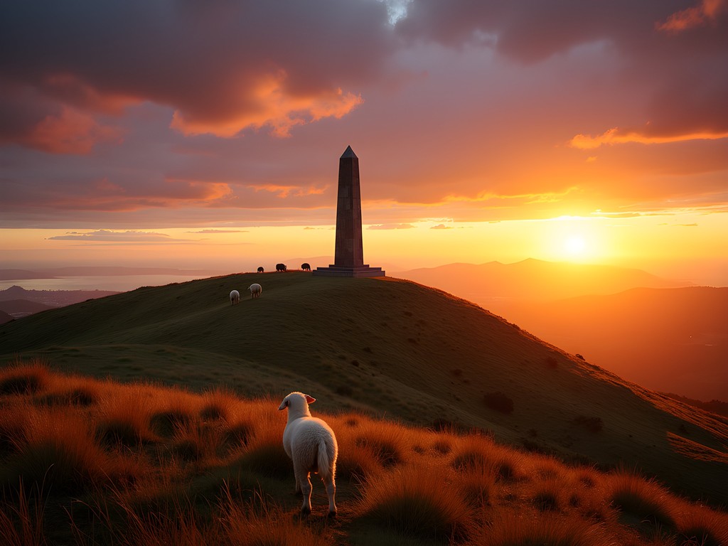
When my conference schedule allowed for a half-day exploration, I headed to One Tree Hill (Maungakiekie), Auckland's second-highest volcanic peak and one of its most culturally significant sites. What makes this location particularly appealing for budget travelers is that it sits within Cornwall Park, a sprawling 425-acre public space that combines natural, cultural, and historical elements into one efficient visit.
I reached One Tree Hill via public bus (route 309) for just NZ$3.50 each way. The volcanic cone rises 182 meters above sea level, with a distinctive obelisk marking its summit—a memorial to the Māori people and the final resting place of John Logan Campbell, who gifted this land to the city.
The climb to the summit takes approximately 30 minutes along a paved pathway that spirals gradually upward. While less rugged than other volcanic hikes in the region, the historical significance and sweeping views make it essential. From the top, I could identify at least six other volcanic cones across the city, creating a connect-the-dots effect that revealed Auckland's geological foundation.
What truly sets One Tree Hill apart is the surrounding Cornwall Park, where free-roaming sheep graze beneath mature trees, creating postcard-perfect scenes that belie the urban setting. After descending, I followed the 5km loop trail that circles the park's perimeter, passing historic stone buildings, a working farm, and ancient Māori terracing systems that tell the story of pre-European settlement.
The park offers several picnic areas with free-to-use barbecue facilities. I packed a simple lunch in my insulated lunch bag, which kept my food fresh throughout the morning hike and saved considerable money compared to dining out. For couples on a budget, this makes for a romantic and economical afternoon—pick up supplies from a local supermarket and enjoy a picnic with volcanic views.
💡 Pro Tips
- Combine your visit with the Saturday farmers market at Cornwall Park for fresh local produce
- Download the free Cornwall Park app for self-guided walking tours
- Visit Acacia Cottage (Auckland's oldest surviving wooden building) within the park grounds

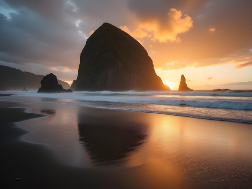
Rangitoto Island: Auckland's Youngest Volcano
No volcanic exploration of Auckland would be complete without visiting Rangitoto, the symmetrical island cone that dominates the harbor. At just 600 years old, it's the youngest and largest volcano in the Auckland field, and offers perhaps the most comprehensive volcanic experience in the region.
I blocked out a full day between business commitments for this excursion. Fullers Ferry operates regular services from downtown Auckland to Rangitoto, with return tickets costing NZ$39—one of the few unavoidable expenses in this otherwise budget-friendly itinerary. The ferry ride itself provides spectacular views of Auckland's skyline receding behind you as Rangitoto grows larger on the horizon.
Unlike the grassy slopes of the mainland cones, Rangitoto presents a stark landscape of black scoria rock and pioneer pohutukawa forest—the largest pohutukawa forest in New Zealand. The main summit track is a well-maintained 2-hour return journey that takes you through lava fields and emerging forest to the perfectly formed crater rim.
What made Rangitoto particularly fascinating was exploring the lava caves along the summit route. These tunnels formed when the exterior of lava flows cooled and hardened while the interior remained molten and eventually drained away. Bring a reliable headlamp if you plan to explore these caves—I found mine essential for navigating the darker recesses while keeping hands free for scrambling over uneven surfaces.
As a production manager accustomed to manufacturing processes, I was struck by the parallels between industrial flows and these natural lava formations—both following the path of least resistance to create efficient systems. The island has no food or water facilities, so pack everything you'll need for the day. I filled my reusable water bottles before departing and carried enough snacks to fuel the hike.
💡 Pro Tips
- Book the first morning ferry to maximize your time on the island
- Take the detour to visit the lava caves—they're worth the extra time
- Pack at least 2 liters of water per person as there are no services on the island
North Shore Volcanoes: Off the Tourist Track
While most visitors focus on the central Auckland volcanoes, I discovered some of the most rewarding experiences across the harbor on Auckland's North Shore. When my business meetings concluded early one afternoon, I hopped on the frequent Northern Express bus and headed to Lake Pupuke and North Head—two volcanic features that offer distinctly different experiences from the cone-shaped mounts of central Auckland.
Lake Pupuke in Takapuna is Auckland's only freshwater lake, formed in the crater of a volcano that erupted 150,000 years ago. What makes this site unique is that it's a maar volcano—formed by explosive interaction between magma and groundwater—rather than the scoria cones found elsewhere in Auckland.
I circumnavigated the 4.5km lake perimeter in about an hour, enjoying the peaceful residential setting and stopping at Takapuna Beach for coffee. The juxtaposition of this tranquil blue crater lake against the nearby ocean creates a striking visual reminder of Auckland's complex volcanic history.
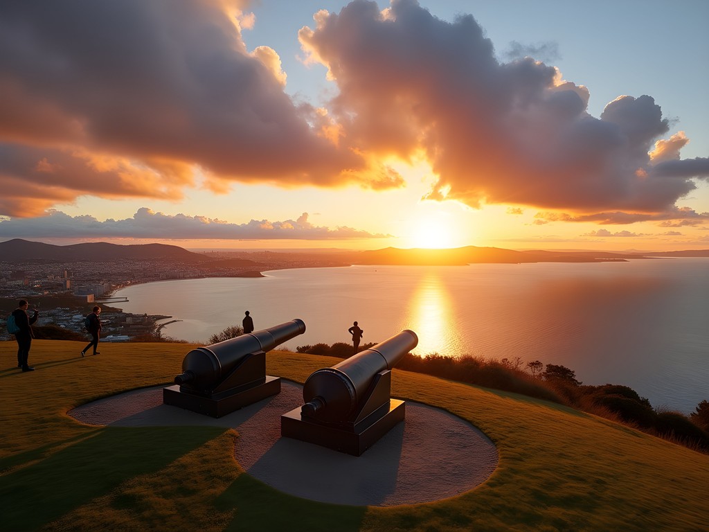
Just a short bus ride away, North Head (Maungauika) in Devonport offers yet another volcanic experience—this time with added military history. This small volcanic cone has been modified extensively for coastal defense purposes, with a network of tunnels and gun emplacements dating back to the late 19th century.
The 30-minute climb provides some of the most spectacular views of downtown Auckland and Rangitoto Island. I timed my visit for sunset and was rewarded with golden light illuminating the city skyline across the harbor—a perfect end to my volcanic explorations.
For couples on a budget, the North Shore excursion offers excellent value: the bus fare is minimal, the walks are free, and the Devonport area has several affordable dining options. I particularly enjoyed picking up fish and chips from the local shop and eating them on the beach while watching the city lights come on across the harbor—a simple pleasure that cost less than NZ$15 but created lasting memories.
💡 Pro Tips
- Use the AT HOP card for discounted public transport to North Shore locations
- Combine Lake Pupuke with a swim at Takapuna Beach in summer months
- Visit North Head at sunset for the best photography opportunities
Creating Your Own Volcanic Circuit: Practical Planning
After a week of balancing work commitments with volcanic explorations, I developed an efficient approach that couples on a budget can easily adapt. The key is strategic planning around Auckland's excellent public transportation system, which connects most volcanic sites for just a few dollars per journey.
Start by purchasing an AT HOP card (NZ$10) from any transport hub or convenience store. This reloadable card reduces bus and train fares by approximately 25% and eliminates the need for exact change. For a couple spending a week exploring Auckland's volcanoes, this investment typically pays for itself within 2-3 days.
I found the most efficient circuit begins with the central cones (Mount Eden and One Tree Hill) to gain geographical context, followed by Rangitoto Island for contrast, and concluding with the North Shore volcanoes. This progression builds your understanding of the volcanic field while minimizing transit time between locations.
For tracking my routes and recording geological observations, I relied on my waterproof notebook which proved invaluable during unexpected rain showers. The dot-grid pages allowed me to sketch cross-sections of the various volcanic features while keeping notes on their distinctive characteristics.
Accommodation represents the largest expense for most travelers, but Auckland offers several budget-friendly options near volcanic sites. I stayed at a business hotel downtown, but couples might consider the YHA Auckland International hostel, which offers private rooms from NZ$90 per night and sits at the base of Mount Eden—perfect for early morning summit hikes before the crowds arrive.
Food costs can be managed by combining picnic lunches at the volcanic parks with selective dining out. Most major supermarkets (Countdown, New World) offer prepared food sections where you can assemble affordable meals. The Auckland Night Markets (rotating through different suburbs each evening) provide excellent street food options from NZ$5-15 per dish—I particularly enjoyed the Thursday night market in Henderson after hiking nearby Te Atatū Peninsula.
💡 Pro Tips
- Purchase an AT HOP card for public transport discounts throughout your stay
- Consider accommodation near Mount Eden for central access to multiple volcanic sites
- Use the Auckland Council's free GeoMaps tool to identify lesser-known volcanic features
Final Thoughts
Auckland's volcanic landscape offers a rare opportunity to experience dramatic geological features within an urban context—all accessible via public transportation and mostly free to explore. As someone who's hiked mountain regions across three continents, I found these volcanic cones uniquely rewarding precisely because they're integrated into city life rather than isolated in wilderness. They tell a story of how human settlement adapts to and coexists with powerful natural forces. For couples seeking adventure on a budget, Auckland's 48 volcanoes provide an ideal framework for exploration—each cone offering a different perspective on both the geological and cultural landscape. Whether you're extending a business trip like I did or planning a dedicated vacation, make time to connect these volcanic dots across Auckland's skyline. You'll gain not just spectacular views but a deeper understanding of how this city rose from fire and continues to evolve in the shadow of sleeping giants.
✨ Key Takeaways
- Auckland's volcanic field offers accessible hiking opportunities directly from the city center
- Public transportation connects most major volcanic sites, making car rental unnecessary
- Combining volcanic hikes with public parks and beaches creates budget-friendly day itineraries
- The geological diversity among Auckland's volcanoes provides varied experiences despite their proximity
📋 Practical Information
Best Time to Visit
November through April (Southern Hemisphere summer and shoulder seasons)
Budget Estimate
NZ$100-150 per day for a couple (excluding flights)
Recommended Duration
3-7 days
Difficulty Level
Moderate (Most Hikes Require Reasonable Fitness But No Technical Skills)

Comments
George Hayes
Great post! When we visited Auckland last year, we made it to Mount Eden, One Tree Hill, and Rangitoto. I'd add that timing is everything for Rangitoto - try to catch the first ferry out in the morning before the crowds arrive. We packed a picnic lunch and ate it at the summit with incredible views of the harbor. The kids were fascinated by the contrast between the black volcanic rock and the bright green pohutukawa trees growing through it. If you're into photography, the golden hour light on Mount Eden is absolutely spectacular too. The city views with the volcanic cone in the foreground make for amazing shots.
wildzone
Are there any safety concerns with these being actual volcanoes? Sorry if that sounds silly, but I've never hiked on volcanic terrain before!
Abigail Matthews
Not a silly question at all! The Auckland volcanic field is considered dormant, with the last eruption (Rangitoto) about 600 years ago. The trails are well-maintained and perfectly safe. Just wear good hiking shoes as some volcanic terrain can be uneven. I used my hiking boots and they were perfect for grip on the scoria surfaces.
travellife
Just did Rangitoto last month and it was INCREDIBLE! The lava caves were my favorite part. Make sure you book the ferry in advance though - we almost missed out because it was full. Great post Abigail!
wildzone
How long did the Rangitoto hike take you? Trying to plan my itinerary.
travellife
We spent about 4 hours total on the island. The summit hike is about 1 hour each way, plus we spent extra time exploring the lava caves and having lunch at the top. Definitely worth dedicating half a day to it!
wintervibes
Going there next month!! Can't wait to do Mount Eden
Sophia Gomez
You're going to love it! Don't skip the crater walk around the rim
wanderclimber
This looks amazing! Are any of these volcanic hikes suitable for beginners? Planning a trip to Auckland in January and wondering which ones I should prioritize if I only have 2 days.
George Hayes
Mount Eden is perfect for beginners! It's right in the city, has paved paths most of the way, and the views are incredible. You can easily do it in 2-3 hours including taking photos. One Tree Hill is also beginner-friendly. I took my kids (8 and 11) on both last year and they had no problems.
wanderclimber
Thanks George! Mount Eden sounds perfect then. Did you use public transport or is it better to drive there?
George Hayes
We used buses and they were great! There are several routes that stop near Mount Eden. Just use Google Maps or the Auckland Transit app to plan your route. Saved us dealing with parking.
Ahmed Palmer
Excellent overview of Auckland's volcanic field. What strikes me most about these formations is their accessibility - you can literally walk from the CBD to Mount Eden in 30 minutes. I've hiked volcanic landscapes in Iceland and the Canaries, but Auckland's integration of these geological features into urban planning is remarkable. For those interested in the technical aspects, the Auckland Volcanic Field is monogenetic, meaning each volcano erupted only once. The youngest, Rangitoto, is merely 600 years old. I used my hiking poles on Rangitoto and they were invaluable on the loose scoria.
winterqueen
One Tree Hill is honestly my favorite spot in Auckland. We spent an entire afternoon there just wandering Cornwall Park. The sheep grazing on the slopes are adorable and the views from the summit are 360 degrees. Pro tip: there's a great little cafe at the park entrance called Acacia Cottage - perfect for a coffee before or after your hike. Also the obelisk at the top has some interesting Maori history if you take time to read the plaques.
springguy
Adding this to my list!
nomadfan
We did the public transportation too and it worked perfectly! So easy to get around
hikingfan
How long does the Rangitoto hike actually take? Planning a trip in March and trying to figure out timing
wintervibes
took us about 3.5 hours total including the summit and exploring the lava caves. definitely doable in a half day!
Ahmed Palmer
I'd budget 4 hours to be safe. The trail is 7km return, but the terrain slows you down considerably. The volcanic scoria is quite uneven underfoot.
Sophia Gomez
Abigail, I love how you turned a business trip into an adventure! I did something similar in Auckland last year. Mount Eden at sunrise was absolutely magical - the city was still waking up and the light hitting the harbor was incredible. One thing I'd add: the ferry to Rangitoto is super affordable and runs frequently, but book the earlier ones if you can. We took the 10am and it was packed! The volcanic rock trail is no joke though - definitely wear proper hiking shoes. Those loose lava rocks can be tricky.
smartseeker
Good to know about the ferry times! Thanks!
Venture X
Premium card with 2X miles, $300 travel credit, Priority Pass