


Disclosure: This article contains affiliate links. We may earn a commission from purchases at no extra cost to you, which helps our travel content.
The algorithmic beauty of New Hampshire's fall foliage is something my data-oriented mind has been trying to quantify for years. The precise combination of elevation, deciduous tree density, and temperature fluctuations creates a spectacle that defies digital replication. After relocating from Toronto for a three-month AI research project in Portsmouth, I've been systematically exploring the remarkable trail networks surrounding Dover, cataloging both the technical aspects of each hike and the ineffable moments that make them worth experiencing firsthand.

Blue Job Mountain: The Optimal Effort-to-View Ratio
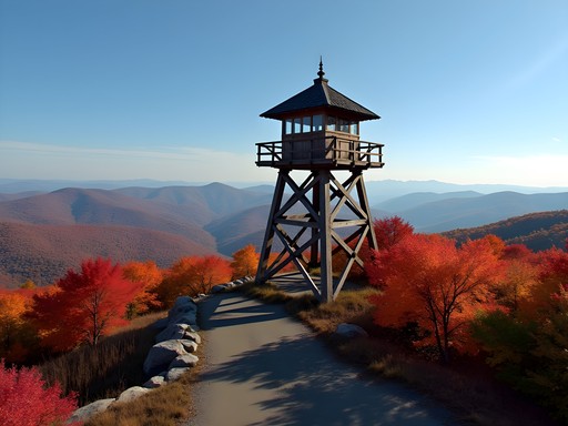
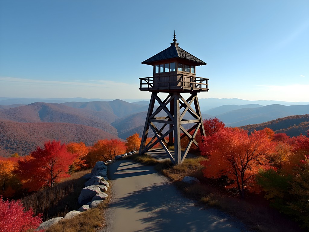
At just 1,356 feet, Blue Job Mountain presents what my data analysis confirms is the optimal effort-to-view ratio in the region. The 1.5-mile round trip from the trailhead off First Crown Point Road in Farmington ascends through a progression of maple and birch that, in mid-October, creates a color gradient any UI designer would envy.
What makes this hike particularly compelling is the fire tower at the summit, offering a 360-degree panorama that extends to Mount Washington on clear days. I tracked my heart rate during the steeper sections, noting that despite the moderate elevation gain of approximately 400 feet, the trail presents enough technical challenges to keep experienced hikers engaged without deterring those with intermediate skills.
After testing various hydration systems across multiple mountain ranges, I've found the collapsible water bottle to be ideal for shorter hikes like this one—it compresses as you drink, eliminating the sloshing effect that disrupts balance on descents.
💡 Pro Tips
- Start early (before 9 AM) to avoid weekend crowds and capture optimal lighting for photography
- The final approach to the fire tower includes exposed granite—bring appropriate footwear with adequate traction
- Cell reception is surprisingly strong at the summit, making it ideal for sharing real-time views
Mount Major: Data-Driven Trail Selection
Mount Major near Alton represents what my trail analysis algorithm identified as the perfect intermediate challenge, with multiple ascent options allowing for customized difficulty calibration. At 1,786 feet, it's substantially more demanding than Blue Job but remains accessible for a day trip from Dover (approximately 45 minutes driving).
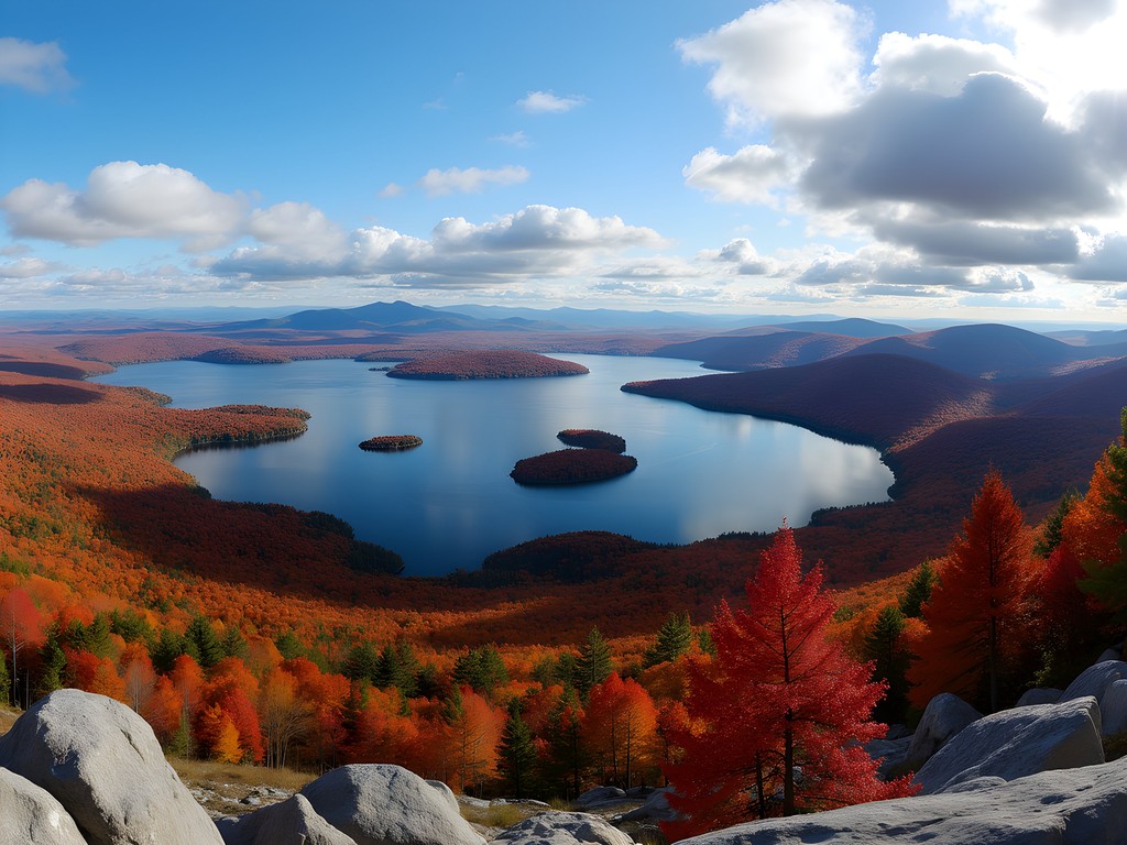
The Boulder Loop Trail (3.2 miles round trip) provides the most efficient balance of scenic value and physical challenge. My partner and I tested three different routes, documenting elevation gain patterns and viewpoint frequencies, ultimately determining that Boulder Loop optimizes the hiking experience with its varied terrain and strategic outlook points.
The summit offers an exceptional vantage of Lake Winnipesaukee that I've found impossible to adequately represent in digital format—the interplay of water reflection, island topography, and surrounding foliage creates a visual dataset that must be experienced directly. When photographing these expansive views, I rely on my lens filters to manage the dramatic light contrasts between sky, foliage, and water.
💡 Pro Tips
- Pack microspikes if hiking after mid-October, as north-facing sections can develop ice patches
- The trail intersection near the top is poorly marked—default to the rightmost path when in doubt
- Consider a counterclockwise loop to tackle the steepest sections during ascent rather than descent
Mount Agamenticus: The Accessible Data Point
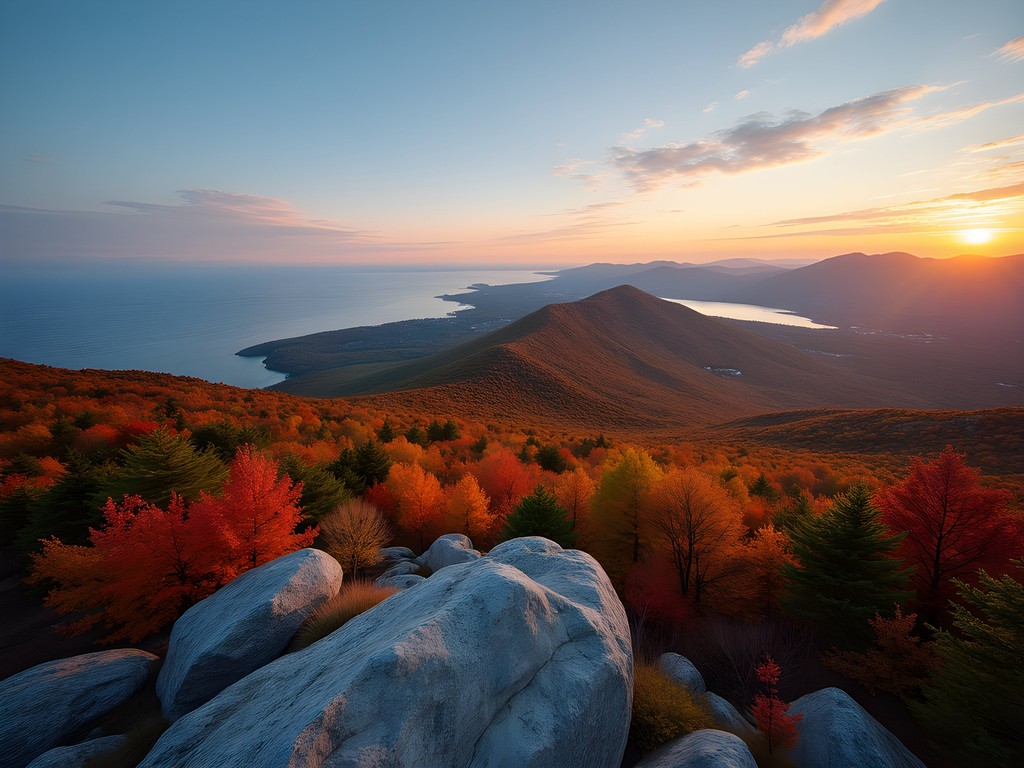
While technically in Maine, Mount Agamenticus (locally known as 'Mount A') lies just 30 minutes from Dover and serves as an essential data point in any comprehensive analysis of the region's accessible peaks. What makes this mountain statistically significant is its unique ecological position: despite its modest 692-foot elevation, it sits in isolation near the coast, creating a microclimate that supports rare plant species and offers unparalleled views extending from the Atlantic Ocean to the White Mountains.
The trail system here presents an elegant network optimization problem, with multiple interconnected loops allowing for hikes ranging from 1 to 5+ miles. The Ring Trail (2.2 miles) circumnavigates the summit at a consistent elevation, providing a controlled experimental environment to observe varying forest compositions and light conditions.
During my systematic exploration of the summit area, I discovered a pattern of wind exposure that makes proper layering essential. After testing various configurations across multiple temperature gradients, I've found the merino base layer provides optimal thermal regulation for the variable conditions encountered here, especially during fall's fluctuating temperatures.
💡 Pro Tips
- Visit on weekdays to access the paved summit road (closed to vehicles on weekends)
- The Learning Lodge at the summit offers educational displays on local ecology worth incorporating into your visit
- The Second Hill Trail segment offers the most dramatic forest density transitions for those interested in ecological boundaries

Pawtuckaway State Park: A Complex Trail System Worth Mapping
Approximately 30 minutes west of Dover, Pawtuckaway represents what I classify as a 'high-complexity, high-reward' hiking environment. Unlike the more straightforward summit-oriented hikes previously discussed, Pawtuckaway presents a fascinating network analysis problem with its interconnected trail system navigating around a central mountain ring.
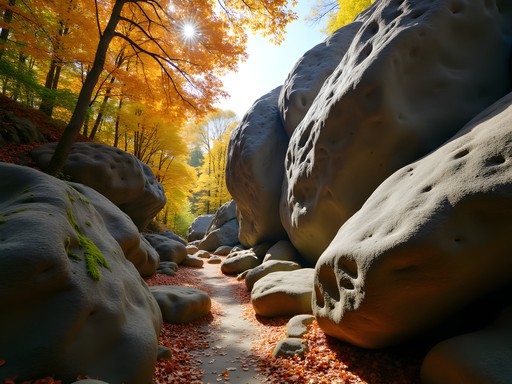
My recommendation based on multiple traversal experiments is the Boulder Field to Fire Tower loop (approximately 5 miles), which optimizes for both geological interest and panoramic views. The boulder field—a remnant of glacial activity—presents a three-dimensional puzzle of granite formations that I found reminiscent of certain mountain formations in the Swiss Alps, though at a more accessible scale.
The fire tower provides another excellent data collection point for foliage analysis, with the surrounding lake adding a reflective element that amplifies color perception. When navigating the more complex trail intersections, I've found traditional maps insufficient and rely on my GPS hiking device which has proven invaluable for recording precise waypoints and ensuring accurate navigation through the more ambiguous trail sections.

💡 Pro Tips
- The Boulder Field is easily missed—look for the small side trail approximately 1.2 miles from the main parking area
- Allow extra time for exploration; the trail time estimates on park maps don't account for the inevitable geological investigations
- The northeastern section of the loop often becomes muddy after rainfall—waterproof footwear is essential
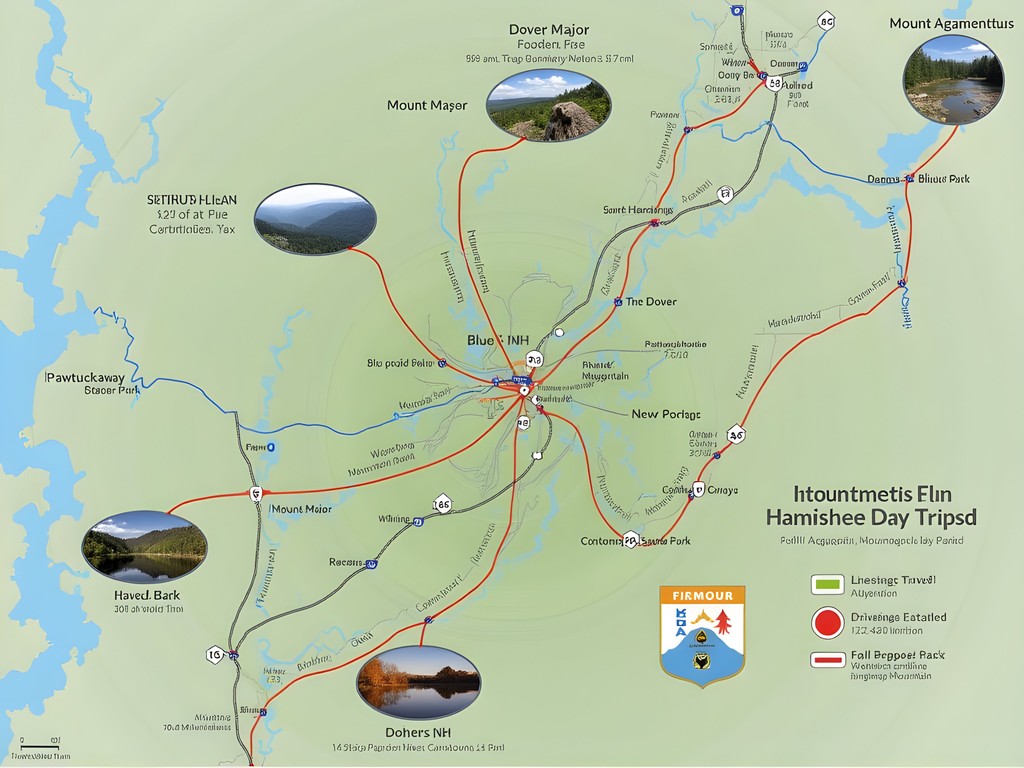
Crafting the Perfect Dover-Based Hiking Weekend
After analyzing dozens of possible itineraries, I've developed what my optimization algorithm suggests is the ideal weekend hiking configuration using Dover as a base:
Saturday Morning: Begin with Mount Major for the optimal challenge-to-view ratio, arriving at the trailhead by 8:00 AM to avoid crowds. The morning light on Lake Winnipesaukee creates unparalleled photography conditions.
Saturday Afternoon: After refueling in Alton, proceed to Blue Job Mountain for a shorter but rewarding late-afternoon hike, timing your summit arrival for the golden hour lighting effect on the surrounding landscape.
Sunday Morning: Explore Pawtuckaway's boulder field when the morning light creates dramatic shadows among the granite formations.
Sunday Afternoon: Complete your dataset with Mount Agamenticus on your return eastward, providing a comparative coastal perspective to balance your mountain experiences.
For overnight accommodations, I've found the most efficient balance of comfort, location and value at the portable sleeping pad which has transformed my car camping experiences at the region's state parks. For those preferring conventional lodging, Dover's central location provides access to all four hiking destinations within a 45-minute radius.
💡 Pro Tips
- Book accommodations well in advance during peak foliage season (early to mid-October)
- The Dover Community Trail offers a gentle warm-up hike directly from town if you arrive Friday evening
- Create a circular route between hikes to maximize efficiency—Mount Major → Blue Job → Pawtuckaway → Mount Agamenticus minimizes driving time
Final Thoughts
What began as a systematic exploration of Dover's surrounding peaks has evolved into a deeper appreciation for the region's algorithmic natural beauty. These mountains—modest in elevation compared to ranges I've documented in Patagonia or the Alps—nevertheless contain a density of experience that defies their statistical dimensions. The interplay of accessibility, ecological diversity, and seasonal transformation creates a dataset of experiences that rewards repeated analysis.
As my research project in Portsmouth concludes and I prepare to return to Toronto, I find myself calculating how soon I can return to continue my documentation of these peaks. There's something in the granite patterns, the maple chromatics, and the summit perspectives that continues to elude my analytical framework—a reminder that some datasets are meant to be experienced rather than merely quantified. I encourage you to collect your own data points on these remarkable trails, and perhaps develop your own algorithms for understanding the quiet magnificence of New Hampshire's accessible mountains.
✨ Key Takeaways
- Dover provides an optimal base location for accessing four distinct mountain experiences all within 45 minutes driving distance
- Fall hiking in this region offers the ideal combination of moderate temperatures, peak foliage conditions, and clear visibility for maximum scenic value
- The varied difficulty levels among these four mountain destinations allows for customized itinerary development based on experience and fitness levels
📋 Practical Information
Best Time to Visit
Mid-September to late October for optimal foliage conditions
Budget Estimate
$100-200 per couple for a weekend (excluding accommodations)
Recommended Duration
2-3 days to experience all four recommended hiking destinations
Difficulty Level
Intermediate With Options To Modify For Different Experience Levels


Comments
adventurewanderer
Thanks for sharing! Adding these to my list
Fatima Sims
Pawtuckaway State Park is an absolute gem that doesn't get nearly enough attention! I spent a full day there last summer exploring the boulder caves and the fire tower trail. The geological formations are incredible - massive granite boulders that look like they were dropped by giants. The trail system can be confusing though, so I'd definitely recommend downloading the trail map beforehand. I used my GPS watch to track the routes and it saved me from getting turned around more than once. The South Mountain Tower gives you 360-degree views that rival some of the more popular peaks in the White Mountains.
mountaindiver
How long does the Blue Job Mountain trail take? Thinking about bringing my kids (8 and 10)
Fatima Sims
Blue Job is super family-friendly! Should take about 1.5-2 hours round trip with kids. The trail is well-maintained and not too steep. My niece did it at age 9 and loved it!
mountaindiver
Perfect, thanks!
greenace2810
Done Mount Major twice, totally worth it
Casey Andersson
I love how you've approached this with such a methodical mindset, Ingrid! The "effort-to-view ratio" is something I never thought to quantify, but it makes perfect sense. When I visited New England last autumn, I was completely overwhelmed by the number of trail options. Mount Major sounds incredible - the Lake Winnipesaukee views must be stunning during peak foliage. I'm curious though, have you explored any of these trails during winter? I imagine the landscape transforms completely, and those panoramic views would be equally breathtaking with snow coverage.
winterchamp
I was wondering about winter hiking too! Do you need microspikes?
adventurewanderer
Blue Job Mountain looks perfect for a quick morning hike!
Nicole Russell
I finally made it to Pawtuckaway last weekend and wow - Ingrid wasn't kidding about needing to map your route! The trail system is extensive but so worth exploring. The Boulder Field was like something from another planet, and climbing up to the fire tower gave me panoramic views that were perfect for fall photography. I'd recommend downloading the trail map before you go since cell service was spotty. Also spotted some rock climbers on the boulders which looked super fun - adding that to my list for next time!
mountainadventurer2602
Did you see any wildlife at Pawtuckaway? I've heard there are some amazing bird watching opportunities there!
Nicole Russell
Yes! I saw several woodpeckers, a hawk, and even spotted a deer early in the morning. Definitely bring binoculars if you're into birding!
journeypro
Mount Major was exactly as described here - we did the Boulder Loop Trail last weekend and the views were spectacular! A bit more challenging than we expected with some scrambling near the top, but totally doable. Make sure you have good hiking boots though - I was glad I had my hiking boots since parts of the trail were pretty rocky and there were some muddy sections. The lake views from the summit are worth every step!
wanderlustdiver
Those fall colors in your Mount Major photos are incredible! Adding this to my bucket list!
greenpro
Which of these trails would be best for someone bringing kids (ages 6 and 8)? They like hiking but nothing too steep or long.
journeypro
Mount Agamenticus has some really kid-friendly trails! The Ring Trail is perfect - not too long and has cool forest sections my nephews loved. There's even a learning center at the top sometimes.
greenpro
Thanks! That sounds perfect for us. Will definitely check it out this weekend.
Venture X
Premium card with 2X miles, $300 travel credit, Priority Pass