


Disclosure: This article contains affiliate links. We may earn a commission from purchases at no extra cost to you, which helps our travel content.
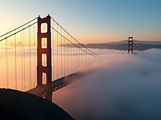
The first time I hiked the Lands End Trail, I was struck by that quintessential San Francisco moment—standing on a windswept cliff with the Golden Gate Bridge framed perfectly in the distance, fog rolling in like nature's own theatrical curtain. But here's what I've learned after countless visits to the Bay Area: San Francisco's true outdoor magic extends far beyond its iconic landmarks. Within just an hour's drive from the city's steep streets lies an astonishing diversity of trails that showcase Northern California's dramatic landscapes—from towering redwood cathedrals to wildflower-dotted coastal bluffs. As someone who believes that understanding a place means getting your boots dusty on its trails, I've spent years documenting these accessible natural escapes. This spring, I'm sharing my curated collection of 12 spectacular hikes that offer the perfect weekend reprieve from urban life—no expensive gear or marathon-level fitness required.

Coastal Escapes: Where Land Meets Sea
There's something almost primordial about hiking along the dramatic meeting point of land and ocean—that jagged edge where California refuses to surrender to the Pacific. The Peninsula's coastal trails offer some of the most accessible yet spectacular hiking experiences near San Francisco.
Mori Point Loop (Pacifica)
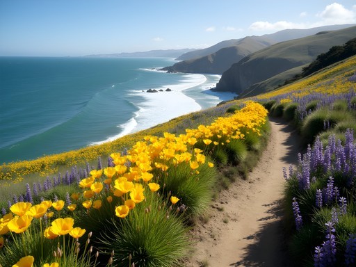
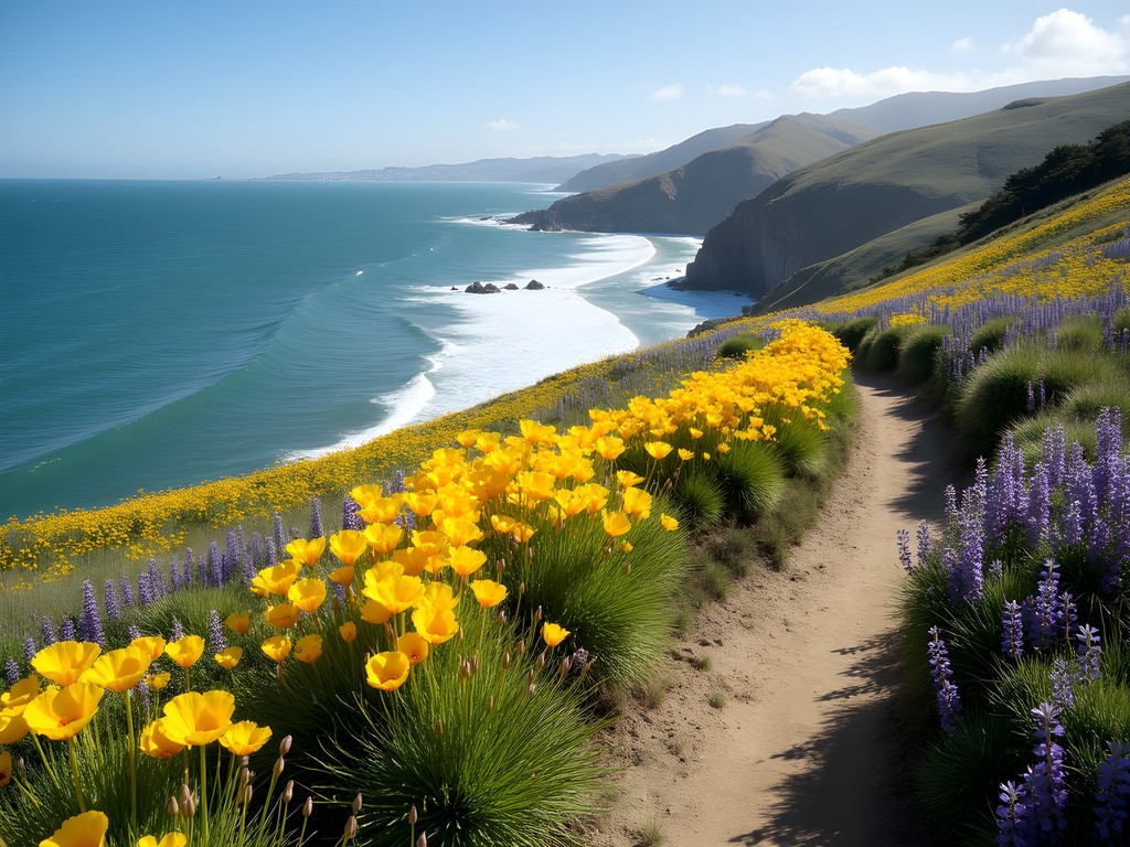
This 2.5-mile loop in Pacifica holds a special place in my heart. Last April, I watched as a blanket of wildflowers transformed the coastal prairie into a painter's palette—yellow California poppies, purple lupines, and delicate sea pinks swaying in the constant ocean breeze. The trail climbs gently to a dramatic headland where, on clear days, you can see all the way to Point Reyes. The wooden stairs built into the hillside create a perfect natural theater for watching surfers tackle Pacifica's waves below.
Gray Whale Cove Trail (Montara)
Just south of Pacifica, this 2.1-mile trail offers constant ocean views as it traverses open grasslands along Highway 1. What many visitors miss is the small unmarked path that leads to a secluded bench perfectly positioned for whale watching from January through March. Bring your compact binoculars to spot the telltale spouts of migrating gray whales—I've counted up to seven in a single hour on winter mornings.
Pillar Point Bluff (Half Moon Bay)
This gentle 1.9-mile trail system offers surprising diversity: coastal prairie, marine terraces, and stunning views of the famous Mavericks surf break. What I love about this hike is how the landscape tells the story of both natural and human forces—from the wave-cut platforms below to the carefully restored native plant communities along the path.
💡 Pro Tips
- Visit coastal trails on weekday mornings to avoid crowds and catch the best light for photography
- Always bring layers—the famous fog can roll in quickly, dropping temperatures by 15+ degrees in minutes
- Check tide tables before visiting beaches connected to these trails, as high tides can cut off return routes
Redwood Sanctuaries: Ancient Giants Within Reach
The first time you stand beneath a coast redwood, something shifts in your perspective. These ancient beings—some older than the Roman Colosseum—create spaces that feel both cathedral-like and intimately grounding. What continually amazes me is how accessible these magnificent forests are from San Francisco.
Purisima Creek Redwoods (Half Moon Bay)
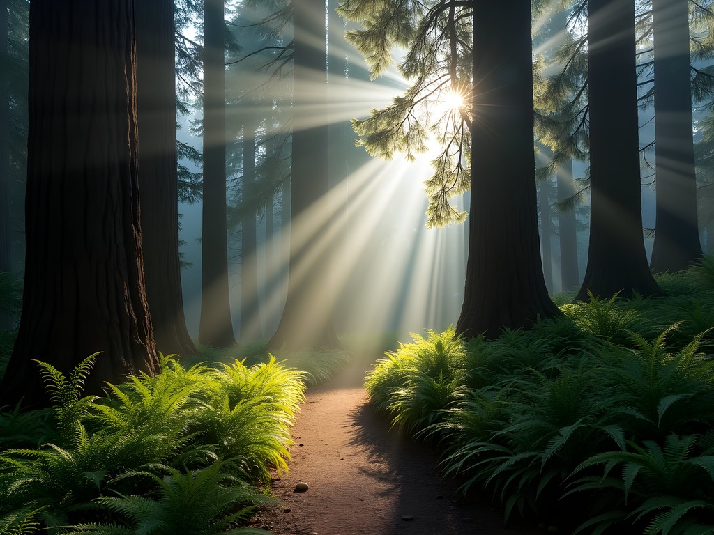
The 7-mile Purisima Creek Trail loop offers a perfect introduction to redwood ecology. Starting from the parking area on Skyline Boulevard, the trail descends through increasingly dense redwood groves, following the creek where I've spotted shy banana slugs and delicate trillium flowers in spring. What makes this trail special is the transition zones—moving from sunny chaparral to cool, misty redwood understory within minutes.
Joaquin Miller Park (Oakland)
Oakland's 500-acre urban forest is criminally underrated. The 3-mile Sequoia-Bayview Trail combines impressive second-growth redwoods with panoramic Bay views. During a recent visit with fellow designers, we marveled at the thoughtful trail construction—how pathways follow natural contours and incorporate local materials in a way that feels both designed and organic.
Redwood Regional Park (Oakland)
The 4-mile Stream Trail follows the path of Redwood Creek, where rainbow trout still spawn and remnants of the logging era can be spotted by observant hikers. What many visitors miss are the interpretive signs explaining how this forest—once clear-cut to build the original San Francisco—represents one of California's most successful reforestation stories. The morning fog that collects in this valley creates perfect growing conditions for these massive trees.
💡 Pro Tips
- Visit redwood forests on foggy days when the mist filtering through branches creates magical light beams
- Bring a headlamp even for day hikes, as redwood canopy can make trails dark earlier than expected
- Download trail maps before going as cell service is limited under dense canopy
Bay Views & Ridge Trails: Panoramic Perspectives
There's something deeply satisfying about gaining elevation and seeing the complex geography of the Bay Area unfold below you—the intricate dance of land and water that makes this region so distinctive. These ridge trails offer the most spectacular panoramic views within an hour of the city.
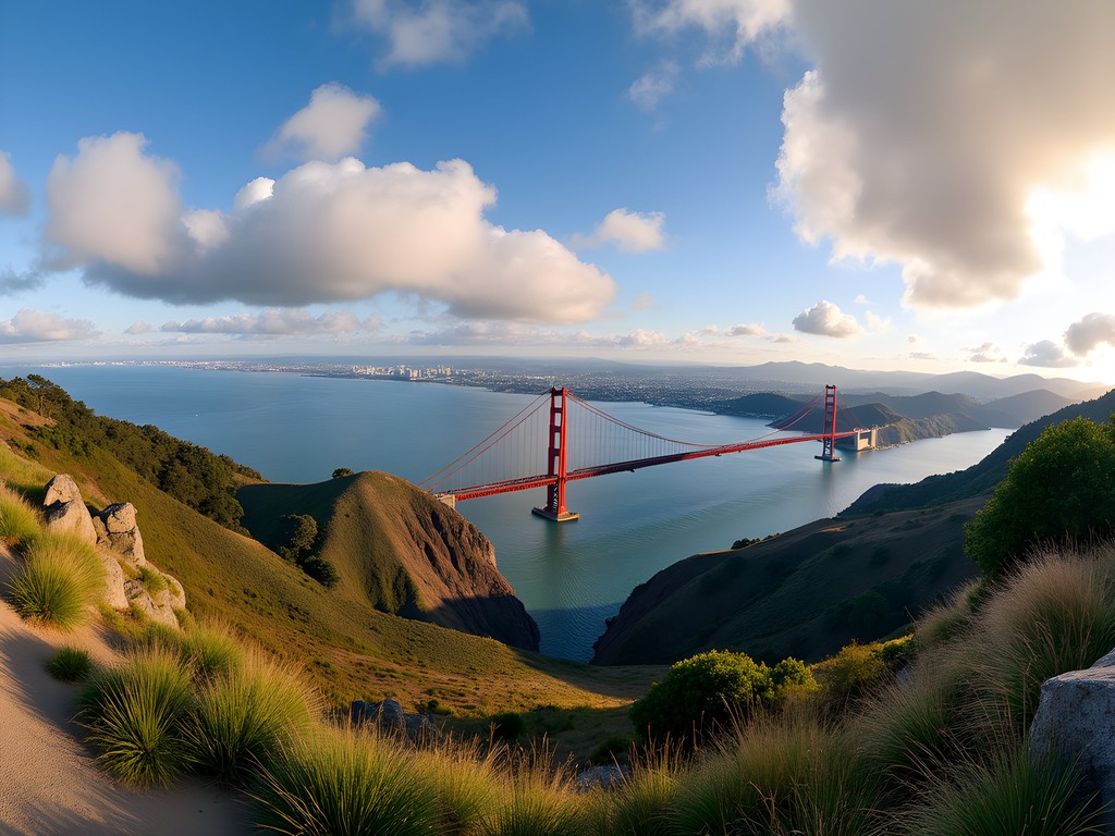
Mount Tamalpais East Peak (Mill Valley)
The 3.4-mile East Peak Summit Loop might be the single best investment of effort-to-view ratio in the entire Bay Area. From the 2,571-foot summit, the entire region reveals itself: San Francisco's skyline, the Golden Gate, the East Bay hills, and on exceptionally clear days, the snow-capped Sierra Nevada. I've brought visiting designer friends here countless times, and without fail, they're struck by how the landscape's natural contours have shaped the region's urban development.
Tilden Regional Park (Berkeley)
The 3.3-mile Seaview Trail lives up to its name, offering sweeping vistas across the bay to San Francisco and the Golden Gate. What I love about this trail is its accessibility—you're just minutes from Berkeley's urban core but transported to open grasslands where red-tailed hawks soar overhead. Last spring, I joined a group of architecture students here at sunset, watching as the city lights began to twinkle on—a perfect illustration of how natural and built environments coexist in the Bay Area.
Mission Peak (Fremont)
This challenging 5.6-mile round trip hike has become something of a Bay Area rite of passage, and for good reason. The distinctive summit pole makes for iconic photos, but what keeps me coming back is the 360-degree panorama that stretches from San Jose to San Francisco. The trail gets crowded on weekends, but start early with a good insulated water bottle (the exposed trail gets hot quickly) and you'll have a more contemplative experience.
💡 Pro Tips
- Start ridge hikes early to catch morning light and avoid afternoon heat on exposed trails
- Bring polarizing filters for your camera to cut haze and enhance the dramatic Bay views
- Check air quality before heading out, as views can be significantly affected by fog or seasonal wildfire smoke

Hidden Urban Escapes: Nature Within the Metropolis
What continues to fascinate me about the Bay Area is how wild spaces persist within and alongside dense urban development. These trails offer the quickest escape from city life—perfect for when you only have a few hours but need that essential reconnection with nature.
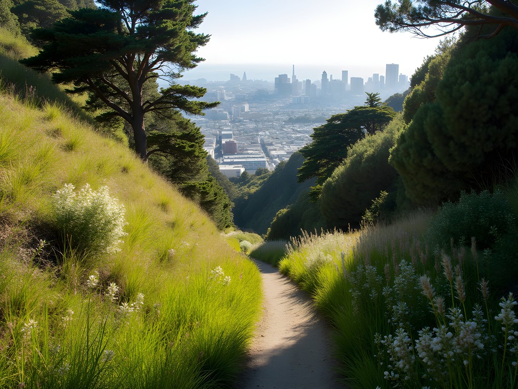
Glen Canyon Park (San Francisco)
Hidden in the heart of San Francisco, this 70-acre canyon feels impossibly remote despite being surrounded by neighborhoods. The 2.1-mile loop trail passes through a remarkable diversity of microhabitats—willow groves, grasslands, and exposed rock formations that reveal the city's geological underpinnings. During a recent design workshop in the city, I brought my team here for a midday break, and they were astonished to find red-tailed hawks nesting in the eucalyptus and a flowing creek just minutes from busy streets.
Albany Bulb (Albany)
This former landfill turned unofficial art park offers a 2-mile trail network unlike anything else in the region. What draws me back repeatedly is the fascinating dialogue between human creativity and natural reclamation—concrete sculptures weather alongside volunteer plants, creating an ever-evolving landscape that tells stories of both ecological resilience and artistic expression. The western point offers spectacular sunset views of the Golden Gate Bridge.
Tennessee Valley Trail (Mill Valley)
This gentle 3.4-mile round trip hike connects the Marin Headlands to a secluded beach where the remnants of the SS Tennessee shipwreck can occasionally be spotted at low tide. What makes this trail special is its accessibility—the wide, mostly flat path accommodates hikers of all abilities while still delivering that quintessential Northern California coastal experience. I've found the hiking daypack perfect for carrying beach essentials and a light picnic for this trail.
💡 Pro Tips
- Urban trails are perfect for sunset hikes when temperatures cool and lighting is magical
- Bring a sketchbook or journal—these transitional landscapes between city and nature inspire creative reflection
- These trails are excellent for introducing hesitant hikers to outdoor experiences—short distances with big payoffs
Waterfall Wonders: Seasonal Cascades
Spring in the Bay Area brings a special gift—seasonal waterfalls that transform familiar landscapes. These ephemeral features remind us of nature's constant change, and how a landscape can reveal different aspects of itself throughout the year.
Cataract Falls (Mount Tamalpais)
After winter rains, this 3-mile out-and-back trail showcases a series of cascading falls that tumble through a lush redwood and Douglas fir forest. What makes this hike extraordinary is the immersive experience—the trail crosses the creek multiple times, bringing you close enough to feel the mist from the falls. During a particularly rainy March a few years ago, I spent a full day photographing how the changing light interacted with the water, revealing how the same landscape transforms throughout the day.
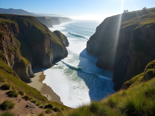
Alamere Falls (Point Reyes)
This 8.4-mile round trip hike requires more commitment but rewards with one of California's rare tidefall spectacles—where a waterfall plunges directly onto the beach. The trail through the Point Reyes National Seashore offers remarkable diversity: coastal scrub, small lakes, and finally the dramatic cliff where Alamere Creek makes its 40-foot drop to the beach below. Time your visit with low tide to safely access the beach viewpoint.
Little Yosemite (Sunol Regional Wilderness)
Despite its ambitious name, this 4.4-mile loop delivers impressive scenery as Alameda Creek tumbles through a granite gorge creating a series of pools and small falls. What I find most fascinating here is the geological story—these granite formations are part of the same batholith that forms Yosemite's famous features, offering a glimpse of similar processes at work on a smaller scale much closer to San Francisco.

💡 Pro Tips
- Visit waterfall trails after recent rains but allow 1-2 days for trails to dry out and become less muddy
- Bring trekking poles for stream crossings and slippery sections near waterfalls
- Research seasonal closures—some waterfall trails close during extremely wet conditions for safety
Final Thoughts
As I've discovered over countless weekends exploring these trails, San Francisco's true wealth isn't measured in tech unicorns or sourdough bread—it's in the extraordinary natural diversity that surrounds the city. These 12 hikes offer more than just exercise; they're immersive experiences that connect us to the geological forces, ecological systems, and human stories that have shaped this remarkable region. Whether you have just a few hours or a full weekend, these accessible adventures provide the perfect antidote to urban intensity without requiring extensive planning or equipment. So lace up your boots, fill your water bottle, and step beyond the Golden Gate—the trails are calling, and spring's ephemeral beauty won't wait. What will you discover on your next hike?
✨ Key Takeaways
- The Bay Area offers incredible hiking diversity within an hour's drive—from coastal bluffs to redwood forests
- Spring is the optimal time for wildflowers, waterfalls, and comfortable hiking temperatures
- Many trails are accessible via public transportation, making them budget-friendly weekend adventures
- Early starts help avoid crowds and parking challenges, especially at popular trailheads
📋 Practical Information
Best Time to Visit
March through May (spring)
Budget Estimate
$0-50 per day (mostly free trails with occasional parking fees)
Recommended Duration
2-3 days to experience multiple trail types
Difficulty Level
Moderate (Options Available For All Fitness Levels)


Comments
winterlover1311
Love the photos! That fog rolling in is so SF
Sarah Powell
Really comprehensive guide, Olivia. I'd add that the microclimates around SF make layering essential—I've learned to always carry a windbreaker even on sunny days. The Dipsea Trail to Stinson Beach is probably my favorite on your list for the diversity of terrain. You start in redwoods, climb through chaparral, and end at the ocean. It's about 7 miles one-way, so logistics require planning (I usually arrange a ride back or take the shuttle). The elevation gain is real but manageable for intermediate hikers. Best done on weekdays if possible.
freemate
Can you do these without a car? Visiting from NYC and not planning to rent.
winterlover1311
Some yes, some no. Lands End is easy on public transit. Muir Woods you'd need a shuttle or tour. Marin headlands is doable but takes forever on the bus.
freemate
Perfect, thanks!
Savannah Torres
Olivia, this brought back so many memories! We took our kids (7 and 9) to Lands End last summer and it was the perfect intro hike for them. The ruins of the Sutro Baths kept them entertained, and they loved spotting sea lions from the overlook. One tip for families—the trail can get narrow and cliffy in spots, so we kept our youngest on the inside. We packed sandwiches and had a picnic at Eagle's Point. The views made it one of those magical family moments where everyone actually stopped complaining for five minutes!
freemate
Good to know about the narrow parts, taking my 6yo soon
wintergal
The Muir Woods hike is absolutely stunning but go EARLY. We made the mistake of showing up at 11am on a Saturday and the parking was a nightmare. Got there at 8am the next day and practically had the trail to ourselves for the first hour. The cathedral grove section is worth the extra walk in. Also layers! It's like 15 degrees cooler under those redwoods.
journeydiver3431
Thanks for the tip! 8am it is lol
journeydiver3431
This is amazing!! Going to SF in April and definitely adding these to my list!
mountainchamp
Pro tip: download the AllTrails app before you go. Saved me multiple times when cell service got spotty on some of the ridge trails.
luckyguy
Love the photos! Really captures the vibe.
greenwanderer
I'm pretty new to hiking - which trail would you recommend for beginners? I'm visiting SF in April and want to try one of these but don't want anything too intense. Also is it safe to hike alone?
Hunter Thompson
Lands End is perfect for beginners! Mostly flat, well-marked, and loads of people around. I hiked it solo my first day in SF and felt completely safe. The views are incredible too. Just bring layers - the wind can be brutal!
Jean Wells
Excellent overview, Olivia. I've analyzed hiking accessibility across 15 major cities, and San Francisco's trail density within a one-hour radius is genuinely impressive. The microclimates are fascinating - you can experience three different weather patterns in a single day. One observation: the redwood trails (particularly Muir Woods and surrounding areas) require advance reservations now. I'd recommend booking at least two weeks ahead during peak season. The Lands End Trail remains my favorite for that perfect intersection of accessibility and dramatic coastal scenery.
luckyguy
Do you need reservations for all the trails or just Muir Woods?
Jean Wells
Just Muir Woods requires reservations. Most other trails mentioned are free access, though parking can fill up quickly on weekends.
Venture X
Premium card with 2X miles, $300 travel credit, Priority Pass