
Disclosure: This article contains affiliate links. We may earn a commission from purchases at no extra cost to you, which helps our travel content.
There's something spiritually invigorating about conquering San Francisco's iconic hills on foot—that moment when your burning calves finally bring you to a vista that unveils the city's soul. As someone who grew up surrounded by Liverpool's relatively flat terrain, my first week in San Francisco was a humbling pilgrimage of sorts. I quickly learned that mastering this city's topography requires both practical wisdom and a touch of reverence for the journey itself. Whether you're a student on a tight budget or simply someone who appreciates experiencing a city's rhythm at ground level, this guide will help you navigate San Francisco's peaks and valleys without breaking the bank—or your spirit.

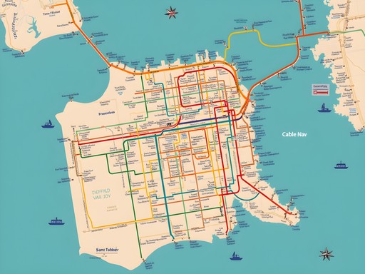
Understanding San Francisco's Public Transit System
San Francisco's public transit network feels like a beautiful tapestry woven through the city's 49 square miles. The system consists of several interconnected services that, once understood, transform from confusing to almost poetic in their functionality.
The Muni (San Francisco Municipal Railway) forms the backbone of the system with its buses, aboveground light rail (the Muni Metro), and the historic streetcars on Market Street. For $3 per ride or $5 for a day pass on the MuniMobile app, it's a budget-conscious traveler's best friend.
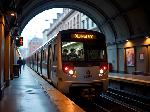
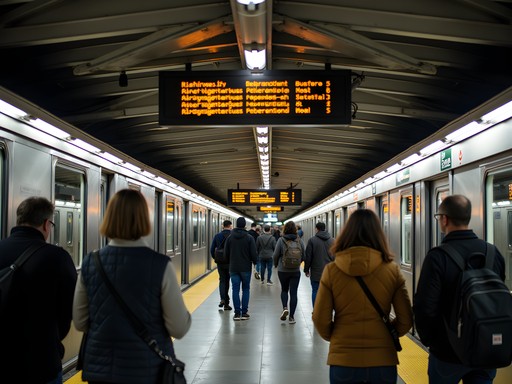
The BART (Bay Area Rapid Transit) connects San Francisco with the wider Bay Area, including direct service to both Oakland and SFO airports. While slightly more expensive, it's essential for longer journeys.
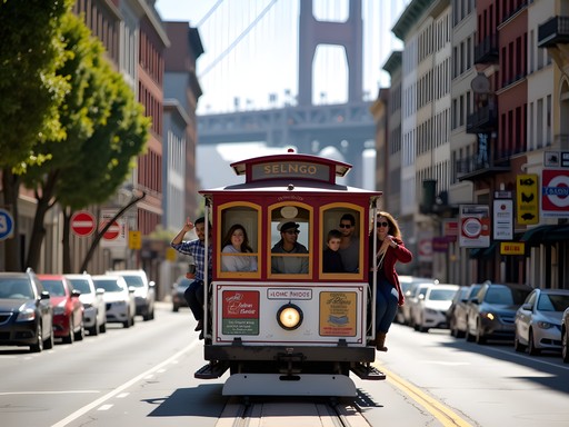
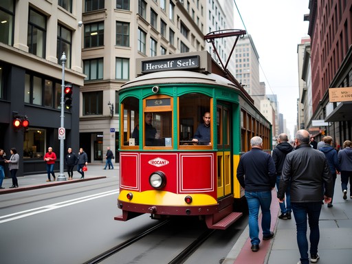
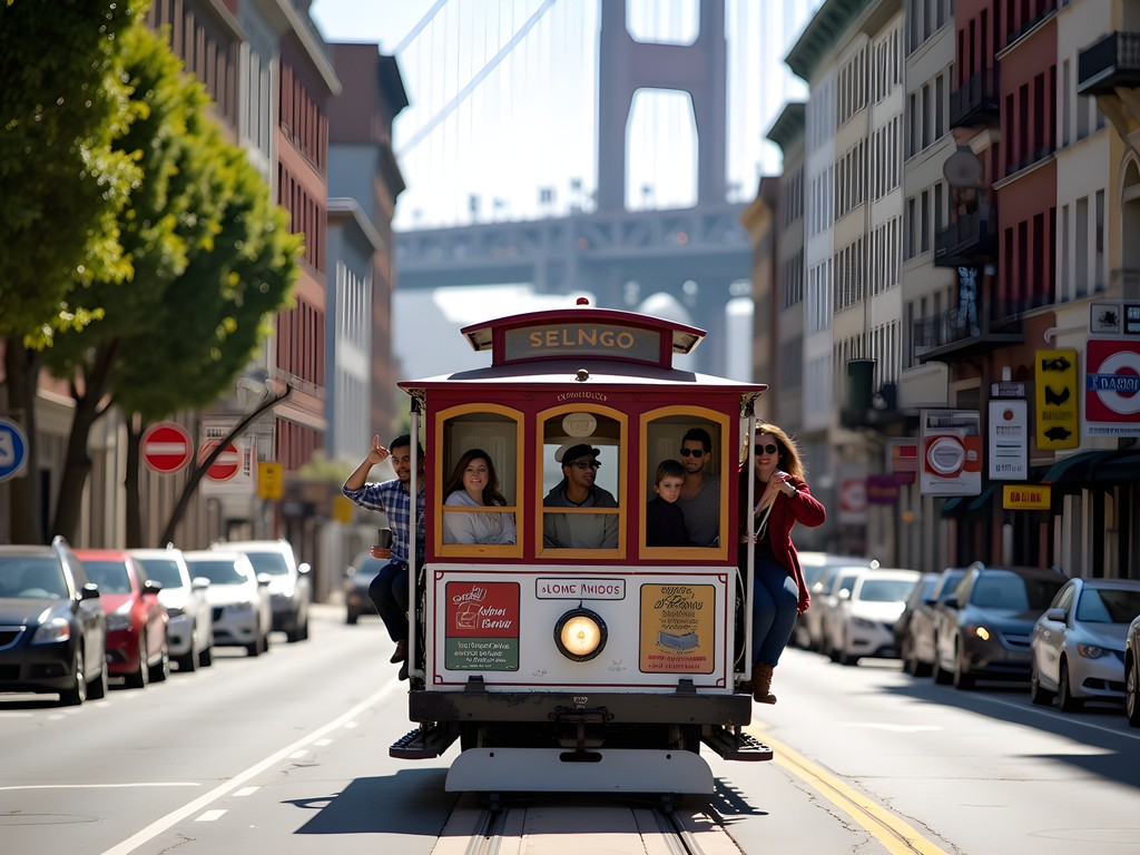
And then there are the Cable Cars—San Francisco's moving historical monuments. At $8 per one-way ride, they're more of a tourist experience than practical transport, but there's something transcendent about gripping that pole as you crest Nob Hill that's worth experiencing at least once.
I recommend downloading the transit app which became my digital companion throughout my stay. For longer visits, consider getting a Clipper Card, which works across all transit systems and saves you from fumbling for exact change.
💡 Pro Tips
- Download the MuniMobile app for easy ticket purchases
- Rides after 8:30pm until 5am are only $1.50 on Muni
- Get a Clipper Card if staying more than 3 days
Navigating the Hills: Walking Strategies & Routes
There's a spiritual discipline to walking San Francisco that I wasn't prepared for. The city's famous hills aren't just incidental features—they're characters in your journey, each with their own personality and challenges.
My first piece of advice: embrace the zigzag. The grid system may suggest a direct route, but locals know better. Walking diagonally up steep hills reduces the grade significantly. For example, when climbing Nob Hill, take the gentler slope of Powell Street rather than the punishing direct route up Jones.
Strategic rest stops are essential. I discovered that many of San Francisco's most beautiful churches, small galleries, and cafés are perfectly positioned halfway up challenging hills, as if divinely placed for weary travelers. The Grace Cathedral's labyrinths on Nob Hill became my favorite midway meditation spot.
For longer journeys, consider the 43 Masonic or 45 Union bus routes—they're known locally as the 'hill-cutting' routes and can save your legs from the steepest climbs.
My hiking poles initially drew curious glances from locals, but by day three, I noticed others with them too. They're not just for trails—they're urban hill survival tools that reduce strain on your knees during steep descents.
Finally, wear proper footwear. My walking shoes were perhaps the best investment for this trip, providing the grip and support needed for both concrete sidewalks and unexpected urban trails.

💡 Pro Tips
- Walk diagonally up hills instead of straight up
- Use the Scenic Walk option on Google Maps to find gentler routes
- Take advantage of the city's public escalators and elevators
Budget-Friendly Transit Hacks for Students
As a minister working with university students, I've become something of a collector of budget travel wisdom. San Francisco, despite its reputation for high costs, offers several transit gems for the financially mindful traveler.
First, the Muni Visitor Passport deserves consideration. At $24 for a 3-day pass, it covers unlimited rides on Muni, cable cars, and streetcars. When you factor in that each cable car ride costs $8 individually, this pass quickly pays for itself if you plan to experience these historic conveyances more than once.
For students specifically, check if your university has a partnership with Bay Area transit. Many California schools offer discounted Clipper Cards through campus programs.
The Free City program is a blessing for longer stays—if you're enrolled in City College of San Francisco (even for a single class), you qualify for free unlimited Muni rides. I've known study abroad students who registered for community classes specifically for this benefit.
Consider investing in a water bottle with filter to avoid buying bottled water. San Francisco has excellent tap water, and staying hydrated is crucial when conquering those hills.
Finally, embrace the art of the transfer. When paying cash for Muni, your transfer is valid for 90 minutes—plenty of time to make connections if you plan strategically. I found the city map invaluable for plotting efficient routes that maximized my transfers.

💡 Pro Tips
- Use the free walking tour app 'SF City Guides' for orientation
- Students can get discounted tickets at many museums with ID
- Take advantage of 'Sunday Streets' events when roads close to cars

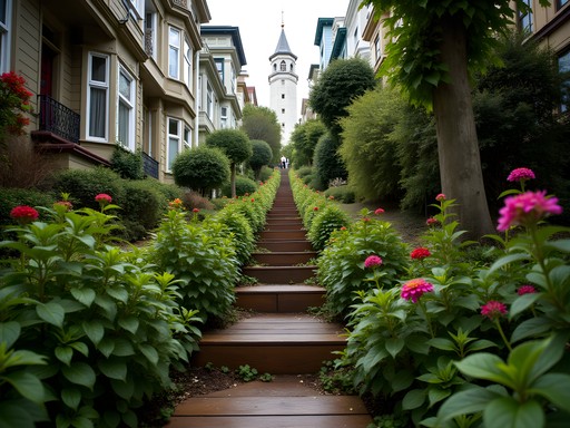
Hidden Pathways: Scenic Shortcuts & Stairway Walks
Perhaps my most profound experiences in San Francisco came from discovering the city's network of hidden stairways, alleys, and pedestrian-only paths—each one a testament to human ingenuity in adapting to challenging topography.
The Filbert Steps on Telegraph Hill became my morning ritual, a 377-step journey through gardens and past hidden cottages, accompanied by the famous wild parrots chattering overhead. There's something almost monastic about the rhythm of climbing these steps that connects you to both the city's history and its natural beauty.
Less known but equally magical are the Greenwich Steps nearby, offering a quieter alternative with equally stunning views. I often found myself alone here, a rarity in such a popular city.
For literary pilgrims, the Macondray Lane (inspiration for Armistead Maupin's 'Tales of the City') offers a verdant respite from the urban grid. Walking this narrow, car-free pathway feels like stepping into another dimension of San Francisco—one where time moves more gently.
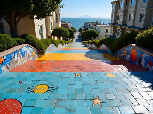
The 16th Avenue Tiled Steps in the Inner Sunset neighborhood transformed my understanding of public art. This community-created mosaic stairway depicts a sea-to-stars journey that becomes a metaphor for your own climbing effort. I recommend bringing a portable phone charger because you'll be taking more photos than you expect.
Most of these pathways aren't obvious on standard maps. I found the hidden walks guidebook indispensable for discovering these treasures—it became my devotional text for daily explorations.

💡 Pro Tips
- Visit the Filbert Steps early morning to see the wild parrots
- Bring water and plan rest stops on longer stairway routes
- Check out the Lyon Street Steps for a less touristy experience
Accessibility Considerations & Rainy Day Alternatives
San Francisco's challenging topography presents obvious difficulties for travelers with mobility considerations, but the city has made commendable efforts to improve accessibility.
The BART system is fully accessible with elevators at all stations (though be aware they occasionally go out of service). All Muni buses are equipped with ramps or lifts, and drivers are generally helpful with deployment. The accessibility guide became an essential resource for planning inclusive routes.
For those with mobility challenges, the historic F-Market & Wharves streetcar line offers a level, scenic route along the Embarcadero and Market Street, connecting many major attractions without hill climbs.
When San Francisco's famous fog turns to rain, the transit system becomes even more valuable. I found the waterproof phone pouch essential during unexpected downpours, protecting both my phone and transit pass.
On particularly wet days, take advantage of San Francisco's underground connections. The Underground Walkway linking the Embarcadero BART station to the Ferry Building provides a dry passage to one of the city's culinary treasures.
Remember that cable cars can be extremely crowded during peak tourist season. If you have accessibility needs or simply prefer more space, the parallel bus routes (like the 30 Stockton or 45 Union) cover similar territory with more regular service and less crowding.

💡 Pro Tips
- Use the elevator at Stockton Street to avoid the steep climb to Chinatown
- Download the AccessMuni app for real-time accessibility updates
- The California cable car line is typically less crowded than the Powell lines
Final Thoughts
As I stood atop Twin Peaks on my final day in San Francisco, looking down at the city I'd traversed largely on foot and by public transit, I felt a profound connection that goes beyond typical tourism. There's something sacred about experiencing a city through its public spaces and communal transportation—you become part of its daily rhythms rather than merely an observer.
Navigating San Francisco's hills and valleys taught me that sometimes the most challenging journeys yield the deepest connections. The city reveals itself differently when you're walking its hidden stairways or swaying alongside locals on a crowded Muni bus.
For students and budget travelers especially, embracing San Francisco's public transit isn't just economical—it's transformative. The conversations with locals, the unexpected views from bus windows, and the triumph of cresting a seemingly impossible hill become the stories you carry home.
I encourage you to approach San Francisco with comfortable shoes, a transit pass, and an open spirit. Let the city's topographical challenges become opportunities for discovery. After all, the most meaningful journeys aren't always the easiest ones—sometimes they're the ones that leave your calves aching and your heart full.
✨ Key Takeaways
- Invest in a Clipper Card or Muni Passport for seamless transit access
- Embrace the hidden stairways and pedestrian paths for unique perspectives
- Use transit apps to navigate efficiently and avoid the steepest hills
- Consider accessibility needs when planning routes through the city
- The journey between destinations often offers the most meaningful experiences
📋 Practical Information
Best Time to Visit
year-round, though September-November offers clearest weather
Budget Estimate
$50-100/day including accommodation, transit, and food
Recommended Duration
5-7 days
Difficulty Level
Moderate (Due To Hills)


Comments
islandvibes
I'm visiting SF in December with my elderly parents. Any specific advice on which hills to absolutely avoid with them? Are there any relatively flat walking routes that still show off the city's charm?
Alex Willis
@islandvibes Great question! The Embarcadero is beautifully flat and scenic - perfect for a waterfront stroll from the Ferry Building to Fisherman's Wharf. Also, the #39 Coit bus takes you right up to Coit Tower so they can enjoy the views without the climb. Golden Gate Park is also relatively flat once you're inside. Hope that helps!
islandvibes
Thanks so much! This is super helpful. Will definitely check out the Embarcadero route.
Hunter Thompson
This guide is absolutely spot-on! I spent three weeks zigzagging across SF last summer and can confirm that mastering those hills takes strategy. My top tip that I'd add: download the MuniMobile app before arriving - saved me countless times when I needed to hop on a bus after my legs gave out halfway up Nob Hill! The hidden stairways section is gold - the Filbert Steps were my favorite discovery, especially at sunrise when you can hear the parrots before you see them. Did you manage to find the mosaic stairway at 16th Avenue? That's another absolute gem worth mentioning!
happyninja
Oh the MuniMobile app sounds super helpful! Downloading it now for my trip next month!
Hunter Thompson
@happyninja You won't regret it! Just make sure you have a portable charger. SF days are long and those hill climbs make for great photos you'll want to capture!
summerhero
Love the photos! Definitely adding this to my reading list
Hayden Butler
There's something almost poetic about earning your views in San Francisco, isn't there? I remember my first time tackling those hills - I'd just finished a champagne brunch at Nob Hill and foolishly decided to walk down to North Beach. My Italian loafers were not prepared for the descent! These days I'm a bit wiser about mixing walking routes with strategic cable car rides. The vintage streetcars on the F-line are particularly charming for cruising the Embarcadero without breaking a sweat. Your section on the hidden pathways reminded me of the Presidio's woodland trails - such an unexpected urban escape.
backpackvibes
Solid guide Alex! I've done SF on foot maybe 4 or 5 times now and your point about the hidden stairways is spot on. The Filbert Steps through the gardens are magical - feels like you're not even in a city anymore. Pro tip: hit the Ferry Building farmers market on Saturday morning, then walk the Embarcadero (flat!) all the way to Fisherman's Wharf. Save your energy for climbing Telegraph Hill later. Also the 38 Geary bus is your friend for getting across town without the hills.
summerhero
Which transit pass did you use? Is the day pass worth it or should I just use Clipper card?
Ahmed Palmer
Clipper card is more economical if you're selective about routes. I analyzed my transit usage over 5 days and saved about $18 versus unlimited passes by walking the flat routes and only using Muni for the steep climbs.
islandpro1478
We just got back from SF last week and this guide would've been so helpful! We made the mistake of trying to walk everywhere the first day and our legs were DEAD. The Muni pass was a lifesaver once we figured it out. Definitely agree about those hidden stairways - we stumbled on the Lyon Street steps by accident and it was one of our favorite moments of the trip. The city views from up there are insane.
hikingguy9547
Going there in March! How hard are the hills really? I'm in decent shape but not like super fit lol
backpackvibes
They're legit steep! But you can totally take the cable cars or buses for the worst ones. Filbert Street steps are killer but worth it for the views.
hikingguy9547
Thanks! Good to know I can bail on the cable car haha
Dylan Turner
Having visited San Francisco annually for the past decade, I can attest that this guide captures the transit ecosystem perfectly. The section on BART to downtown is particularly useful. One thing I'd emphasize is how dramatically the microclimates change as you traverse those hills - I've learned to always carry layers regardless of the forecast. The Budget-Friendly Transit Hacks section would have saved me hundreds on my early visits! For those considering rideshares, they're convenient but you miss the quintessential SF experience that comes from conquering those hills on foot or hanging off a cable car.
citynomad
Just got back from SF and used this guide extensively - thank you! That tip about taking the 39 bus up to Coit Tower instead of climbing Telegraph Hill saved my legs. One addition: the Embarcadero is perfect for a flat, scenic walk with amazing views. We also found a cool app called SF Climber that shows the steepness of different streets which helped us plan routes. Those student discounts for BART were clutch for our college-aged daughter too!
travelchamp
SF Climber app sounds perfect! Just downloaded it for my trip next week, thanks!
Venture X
Premium card with 2X miles, $300 travel credit, Priority Pass